Arunachal Pradesh is one of the most beautiful and least travelled states in India. We had the fortune of getting to travel across the state on our motorbike and I would suggest you to do the same if wish to cover the state fully. The state’s public transport does not get you to every corner, nor is it possible for you to take your car to some of the narrow roads in the remote areas of India’s eastern-most state. A road trip across Arunachal Pradesh can leave you spell-bound as you will see plenty of rivers, valleys, rugged mountains, snow, green pastures, picturesque villages and wonderful people.
On the map of India, Arunachal Pradesh looks tiny. But trust us, the state is big. Barring Assam, Arunachal is the largest among the states termed as the seven sisters. Despite using the most nimble form of transport, i.e. our motorbike, we could not cover the entire state. This is because, the distances between towns are really high. Arunachal Pradesh occupies more than 300 km on the northern bank of Brahmaputra river. There are days you will need to cover 150 – 200 km on a single day on winding mountain roads which are in a state of disrepair, thus taking you 6 – 8 hours to cover what seems like a fleeting distance on roads like Mumbai – Pune expressway, Delhi – Agra Yamuna expressway or Tamil Nadu’s Grand Southern Trunk (GST) highway. We had to take hard decisions about having to drop certain plans simply because the roads were not ready for us yet. Hopefully, the current government has considered the matter and they are supporting BRO (Border Roads Organisation) to prioritise the completion of important roads in the state.
In this post, we will replay the road route we took to cover as much of the state as we could and the places that are interesting along the way. This should hopefully help you plan an exciting, jaw-dropping trip to the state named the ‘the province of the crimson veil’, a name that arises out of the fact that the state is the first to see sunrise in India.
Our route plan
Our Arunachal Pradesh route plan
We covered the following 4 routes in Arunachal Pradesh
- Tezpur – Tawang
- Itanagar – Ziro – Daporijo – Aalo – Mechuka – Aalo
- Aalo – Yingkiong – Tuting – Yingkiong
- Yingkiong – Pasighat – Tezu – Parshuram Kund – Namsai
Inner Line Permits
Please note that you need an Inner Line Permit (ILP) to visit Arunachal Pradesh. On the permit, you need to mark all the districts that you wish to visit. At all the checkposts between Assam and Arunachal Pradesh and at intermediate checkposts between districts, your inner line permits will be checked. An inner line permit can be obtained online from Arunachal ILP website.
Tezpur – Tawang
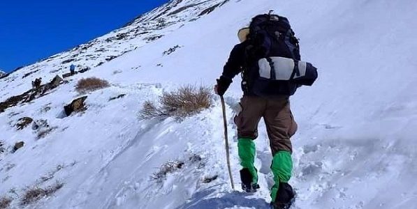
This is the only route in the state that will take you through snow all year round. The route follows the Kameng river and then the Tawang river to take you to Tawang district that borders China. You can see upto two high altitude Himalayan passes on this route. One of them is the Se la pass that needs to be crossed to reach Tawang. The other pass, Bum La, borders China and can be seen if the weather conditions and diplomatic relations are favourable and you are lucky.
Tezpur: is a city in Assam to the north of Brahmaputra river. It is the second biggest city on the northern bank after New Bongaigaon. All other major cities such as Guwahati, Jorhat, Dibrugarh and Tinsukia are on the southern bank of the river. Tezpur is at the confluence of Brahmaputra and Kameng rivers. It is the road head for a trip to Arunachal’s Tawang district. There is a road bridge across Brahmaputra from Tezpur, that takes you to the south bank town of Kaliabor. From Kaliabor, the Kaziranga national park, famous for its one-horned rhinos, is less than 50 km away.
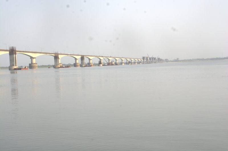
Brahmaputra river at Tezpur
Bhalukpong: is a town at the border of Assam and Arunachal on the Tezpur – Tawang route. The town is on the western bank of Kameng river. Your ILP will be checked at a checkpost in this town. The highway from Tezpur to Bhalukpong is flat. Beyond Bhalukpong, the highway starts ascending into the Arunachal Himalayas.
Bomdila: is the headquarters of West Kameng district. Bomdila is the biggest town on the way to Tawang. It has a monastery and a district-level playground. On the way back from Tawang, we used Bomdila as our halt for the two day motorbike ride from Tawang to Tezpur.
Dirang: is a town midway between Tezpur and Tawang. Dirang has a hill top monastery worth exploring. There is also a hot water spring near the Kameng river, which flows in a valley slightly lower than the town. We used Dirang as a halt for our two day ride from Tezpur to Tawang.
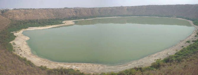
Se La pass: is a Himalayan mountain pass at an altitude of 13700 feet (4170 metres) at the border of West Kameng and Tawang districts. It has a lake that is frozen for half the year and has clear water reflecting the surrounding mountains in the other half. Se La has an army post. During bad weather, Se La becomes a bottleneck due to heavy snow or rain, either blocking or damaging the road, thus cutting off Tawang from the rest of India.
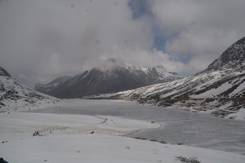
Frozen lake at Se La pass
Taxi drivers from Tezpur to Tawang and back usually ensure that they are at Se La pass before or by mid-day. No one wants to drive there during fading sunlight. When you are planning a trip to or from Tawang, you should also ensure a pre-noon pass through at Se La pass. So the best thing is to leave your source (either Tezpur or Tawang) very close to sunrise. In fact if you are using a motorbike, we suggest that you break your trip into two days: Tezpur – Dirang and Dirang – Tawang.
Jaswant Garh: is a war memorial in Tawang district. It is a memorial built for Garhwal rifles marksman Jaswant Singh Rawat, who singlehandedly kept the Chinese army at bay during the 1962 Indo-Chinese war. It is said that the spirit of Jaswant Singh still lives there.
Jang: is the first municipality on the way from Tezpur to Tawang. Near Jang town is a waterfall named Nuranang formed by the Tawang river.
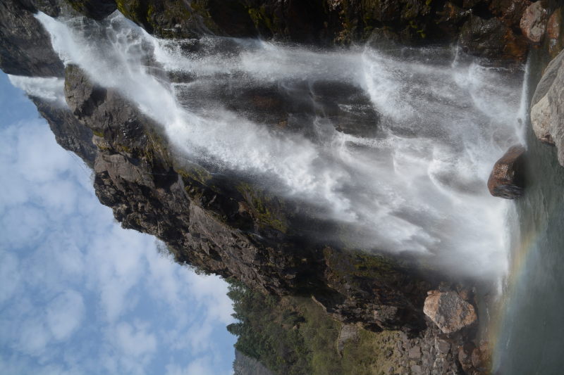
Nuranang waterfall at Jang
Tawang: is a town and the headquarters of the district of the same name. It is inhabited by the Buddhism-practising Monpa tribe, who speak the language of the same name. Tawang has a famous and ancient monastery. Other attractions around Tawang are Tawang war memorial, Panga Teng Tso lake, Sitting Buddha statue, Sangetsar lake, Takt Sang monastery (not the one in Bhutan) and Bum La pass.
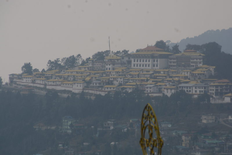
Tawang monastery
Here’s a video of our motorbike ride between Tezpur and Tawang.
Itanagar – Ziro – Daporijo – Aalo – Mechuka – Aalo
While Tawang is the most popular circuit among tourists, the Itanagar – Ziro circuit is gaining popularity as the roadways and transport are developing. This circuit starts from Assam’s Gohpur town and crosses the state border at Dhipu, where you need to show your permits at a checkpost. While most tourists head upto Ziro and return to Assam, we extended our route to cover Daporijo and proceeded to Aalo, from where one can visit Mechuka village. Aalo – Mechuka is a popular circuit among motorcycle groups and there is very little public transport in these areas. You cannot cover these places in a planned way through backpacking alone and public transport alone. You may get lucky enough to tag along with a group of motorcyclists or private village vehicles that happen to be going that side. I suggest that you take control of your itinerary by taking your own vehicle or a hired self-driven vehicle.
Itanagar: is the capital of Arunachal state. It does not belong to any district and comes directly under the rule of the state government. Interesting things to see at Itanagar are the hill top Ita fort and state museum that tells us about the culture of the various tribes of Arunachal. Itanagar is often combined as an urban conglomeration with nearby city Naharlagun, which is 5 km away in the district of Papum Pare. Similar to the way that New Delhi combines with Gurgaon, Faridabad and Noida to form NCR and Mumbai is often combined with Thane district to form MMRDA, Itanagar and Naharlagun are referred to as the Itanagar urban area. Due to space constraints, many of the state administrative offices are actually inside Naharlagun instead of Itanagar. Both Itanagar and Naharlagun have railway stations, the only major ones in Arunachal so far. There are frequent trains to Guwahati, New Bongaigaon and Siliguri. There is also an Arunachal Rajdhani that runs from New Delhi to Naharlagun twice a week.

Clock tower at Itanagar
Ziro: is the headquarters of Lower Subansiri district. The town is the most populated and the most commercially active town in the district that is named after the Subansiri river that flows through. Ziro is divided into Ziro town and old Ziro, with the old one having an air strip. Between the two is an ancient Shiva Linga. The Ziro music festival happens here every September.

Ziro town
Daporijo: is a town in Upper Subansiri district. It has fantastic views of the Subansiri river valley. If you are travelling from Ziro to Aalo, then it may be necessary to break your journey at Daporijo for a night. You can also look at Daporijo to fill up your petrol reserves, since there are no petrol pumps upto Aalo on one side and Ziro on the other.
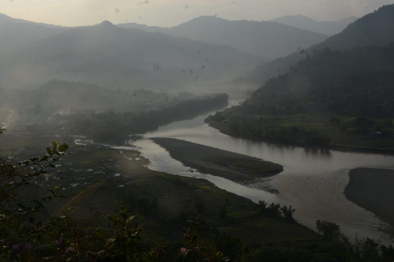
Subansiri river at Daporijo
Aalo: is a major town in West Siang district, with the name of the district coming from the river Siang, a major tributary of Brahmaputra river. Another name for Aalo is Along. Aalo is a three-way junction with one highway leading to Ziro and Itanagar, another one to Mechuka village and yet another one going to Yingkiong. Aalo is also a good place to fill up your petrol reserves if you are planning a trip to Mechuka, where there are NO petrol pumps yet.
Siko Dido waterfall: is a tall waterfall on the road between Aalo and Mechuka. The visible plunge of the waterfall from the road is 200 feet (60 metres). It is near the village of Tato.
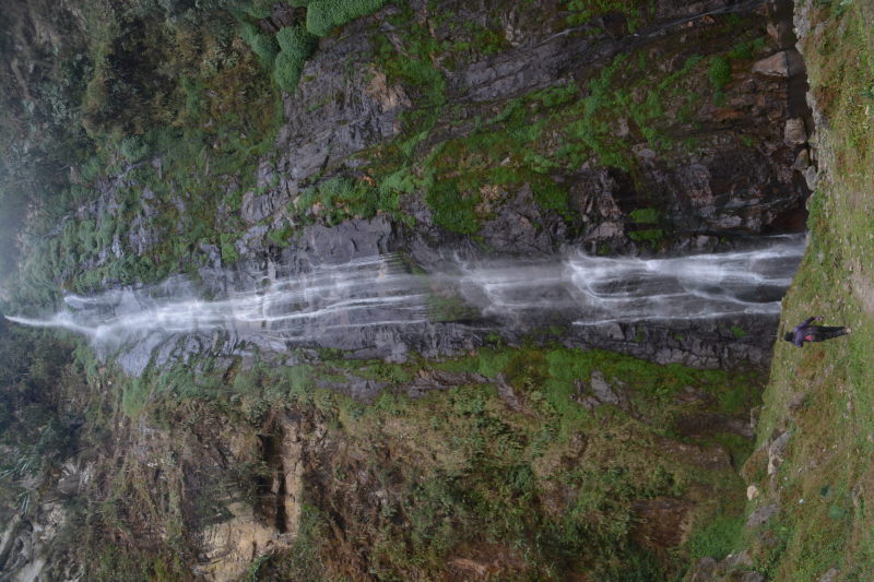
Siko Dido waterfall. Notice Priya standing near the waterfall. That’s how tall the waterfall is.
Mechuka: is a remote village close to the Chinese border. The name of the village means the ‘place with healing water’. The Siang river flows through Mechuka, while snow clad mountains stand tall far away. There are several green pastures with cows and horses grazing, making the village look straight out of Switzerland. Combine it with the colourful wooden houses and the cleanliness. The effect is complete. Mechuka has a history with close ties to Sikhism. It is said that Guru Nanak travelled to Arunachal Pradesh and Tibet to teach the virtues of compassion and sacrifice. Curiously, there is a monastery dedicated to ‘Nanak Lama’.
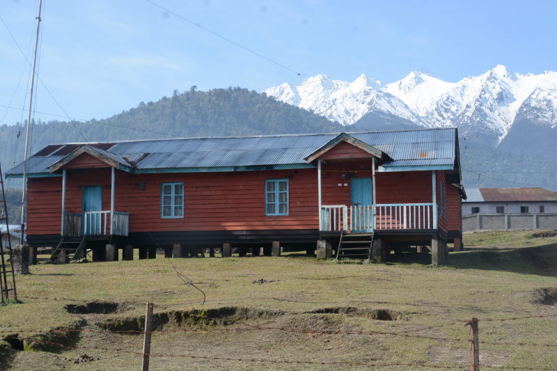
Mechuka village
Mechuka village
An Sikh regiment army major posted at Mechuka after independence noted that the locals heal ailments with medicinal water from the Siang river and prayers to Nanak Lama. Intrigued, he dug out history and found that this very land was graced by the man that Sikhs hold in highest reverence. Thus a Gurudwara was built in the army camp. This Gurudwara can be visited today, along with a river side temple where Guru Nanak is said to have parted stone to clear a path. Various regiments are posted to this army camp in rotation.
Please note that Mechuka is a dead-end. One must return to Aalo to be able to explore further circuits.
Aalo – Yingkiong – Tuting – Yingkiong
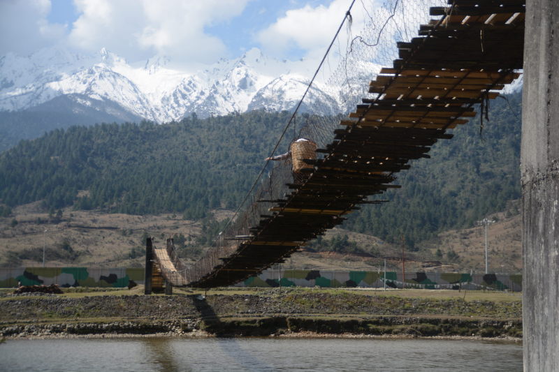
While Aalo – Mechuka road is beautiful and Mechuka village is hypnotising, the natural beauty on the Aalo – Yingkiong – Tuting circuit was at a different level, leaving both of us gaping our mouths and parking our bike for photos far too many times. The areas are so remote and so pristine that you will see hardly see anyone, locals or travellers. It also meant for us that the roads were in a terrible state of neglect. While the Aalo – Yingkiong road is in a fairly good condition, the road from Yingkiong to Tuting puts you under a level of test you’ll not often experience. But the stunning sight of the Siang river carving its way through the Himalayas bordering India and Tibet is so refreshing that the adverse effects of the driving test are soon forgotten.
While we want you to certainly take a trip to Yingkiong and Tuting, we would ask you to wait 2 or 3 years to wait for the roads to be repaired. If you haven’t ever ridden on low quality mountain roads before, then this trip is not for you. We do not recommend an SUV yet because the roads are too narrow to allow two SUVs to pass each other, should such an occasion arise. There are several large army trucks that use this route and your SUV will be found wanting for space to squeeze. Hatchbacks and sedans are definitely out of question due to their low ground clearance on such atrocious roads.
Jengging: A board outside Jengging claims that this is the most pollution free village of the country. We cannot confirm that. But certainly the village has excellent views to the Siang river flowing in the valley deep below the road.
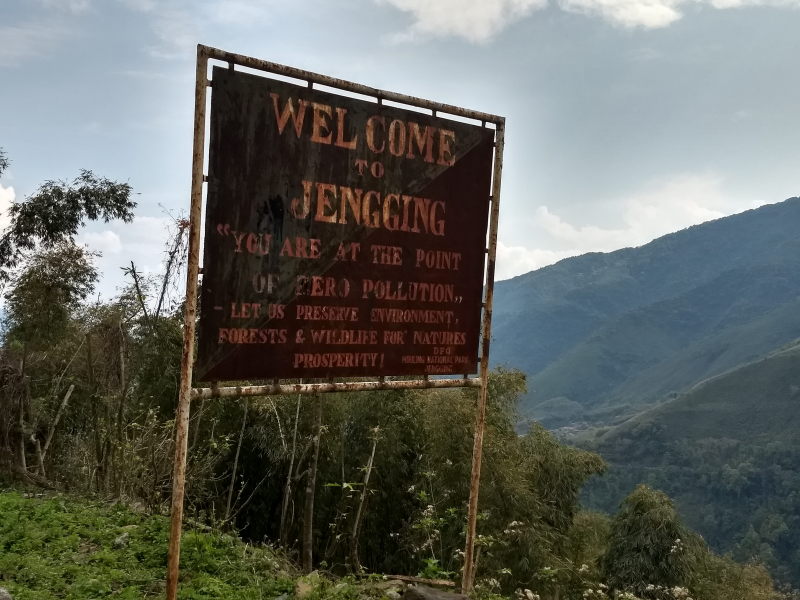
Zero pollution board at Jengging
Yingkiong: While the highway from Aalo to Tuting runs parallel to the west of Siang river, Yingkiong town is to the east of the river. It is the headquarters of Upper Siang district. The distance from Aalo to Tuting is way too much to cover in one stretch, due to time and fuel requirements. it makes sense to cross the river for the evening to rest and refuel at Yingkiong and then cross back to the highway in the morning. This was not possible before 2017. But then the government provided two brand new, sturdy road bridges with good quality roads on both sides, north and south, of Yingkiong town to access the highway on the west of the river. But even before these bridges made it possible for Yingkiong people to commute to Aalo, the town has always had a south-east bound highway to the town of Pasighat, that we will see in another circuit.
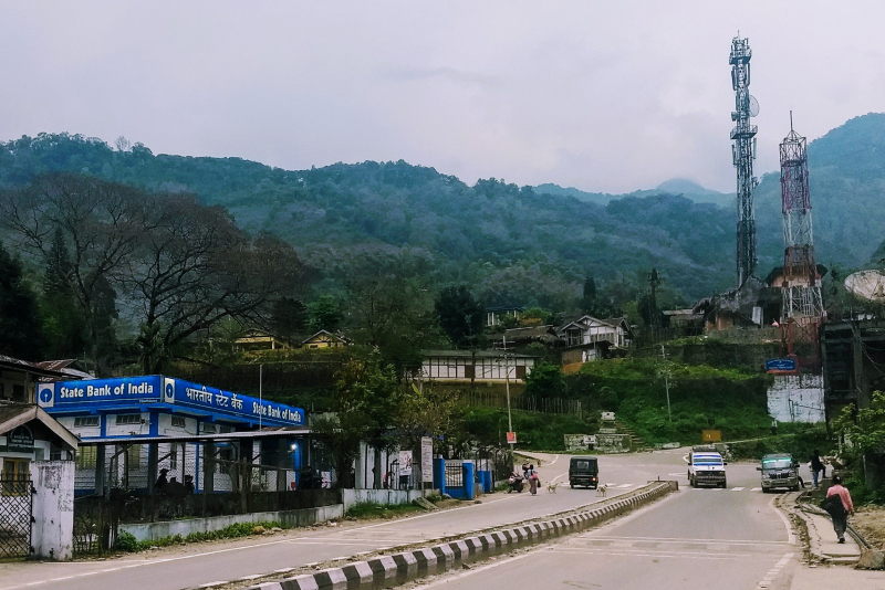
State Bank of India branch and BSNL phone towers at Yingkiong
There is nothing to see inside Yingkiong, but one thing stands out. The reassuring brand boards of Indian Oil, BSNL and State Bank of India stand tall in a town so remote from the creature comforts we are so used to, thus bringing fuel, connectivity and banking to remote corners of India. It puts the Shells, Vodafones and Standard Chartered Banks to shame.
Mingging: is a army outpost town on the way from Yingkiong to Tuting. We were lucky to be served food from army ration at the Mingging army camp, eating lunch with the soldiers. While we took photos, they politely asked us not to put photos on Internet, so we heed.
Tuting: is a remote village at one end of the state. It has beautiful views of the snow mountains bordering India and Tibet. Tourism has not caught upto this village and there are virtually no places to stay. There are no petrol pumps either and you need to buy petrol at higher than market rates from grocery shops. Tuting has a beautiful monastery with monk quarters. We wrote about our experience at Tuting in another post.
Yingkiong – Pasighat – Tezu – Parshuram Kund – Namsai
While most of Arunachal Pradesh is on the north of Brahmaputra river, a small region, namely Lohit, Namsai, Changlang and Tirap districts are to the south of the river. In Lohit district, the Lohit river joins the Siang river to form the Brahmaputra. This region of Arunachal is on the plains rather than the mountains.
Pasighat: is a bustling town by Siang river. It is the headquarters of East Siang district. To the south of Pasighat, the Siang river is joined by the Lohit river to form Brahmaputra.
Bhismaknagar: is the site of the ancient ruins of the Sutiya kingdom, who ruled the region around Brahmaputra between the 12th and 17th centuries.
Roing: is the headquarters of Lower Dibang district. It is home to Adi and Mishmi tribes.
Tezu: is the headquarters of Lohit district and is on the northern bank of the Lohit river. Tezu is home to Mishmi tribe.
Parshuram Kund: is a religious site that worships the site where Lord Parshuram bathed in Lohit river. Near Parshuram Kund, the highway crosses the river from the north bank to the south bank. At India 360, we used this fact as a logical seperation between exploring regions to the north of Brahmaputra (Arunachal, Tezpur, Bongaigaon, etc) and regions to the south (Guwahati, Majuli, Dibragarh, Digboi, Nagaland, etc).
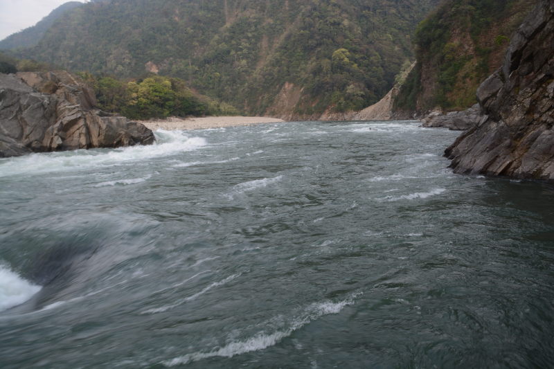
Lohit river at Parshuram Kund
Namsai: is a town at the border of Arunachal Pradesh and Assam. Near Namsai are a few Buddhist temples, such as Solungtoo Buddist temple of Lathao and a hill top Golden Pagoda. Namsai district has a Buddhism practising population as many are descendents of Burmese kingdoms such as Tai and Shan.
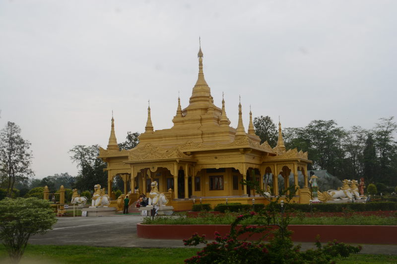
Golden Pagoda near Namsai
Places we did not cover
We did not cover the highway between Roing to Anini, a town near the international border with Tibet. We think that Anini would have been a pristine village similar to Mechuka and Tuting. But the thought of 300 km and back over the poor roads of Arunachal over 4 days discouraged us. We will return when the roads have been repaired.
We also skipped the road from Tezu to Walong for similar reasons. Walong is the first village in India over which the sun rises in the morning. The summer sunrise is as early as 3:45 am, whereas the winter sunrise is around 4:45 am. But the distance between Tezu and Walong is 200 km and the roads are bad. It would have taken 3 – 4 days too and fro. A future trip on good roads is eagerly awaited.
Conclusion
While a lot of states in India have multiple highways with several combinations of itineraries, the fact that the roads in Arunachal follow the rivers and wind around mountains, thus keeping the total number of roads inside the state to very few, it is very easy to plan a well-rounded itinerary to the state, especially if using your own transport. Use our route and plan your next trip to India’s land of rising sun.