While there are some really huge rivers in north India, such as Indus, Jhelum, Chenab and Beas, south India does not have perennial rivers or those with high volume of water all year long. Cauvery river is one such important river to both Karnataka and Tamil Nadu. Let’s take a tour of the river starting from its source at Tala Kaveri upto the point where it joins the sea — at two different places!
Tala Kaveri, Coorg, Karnataka
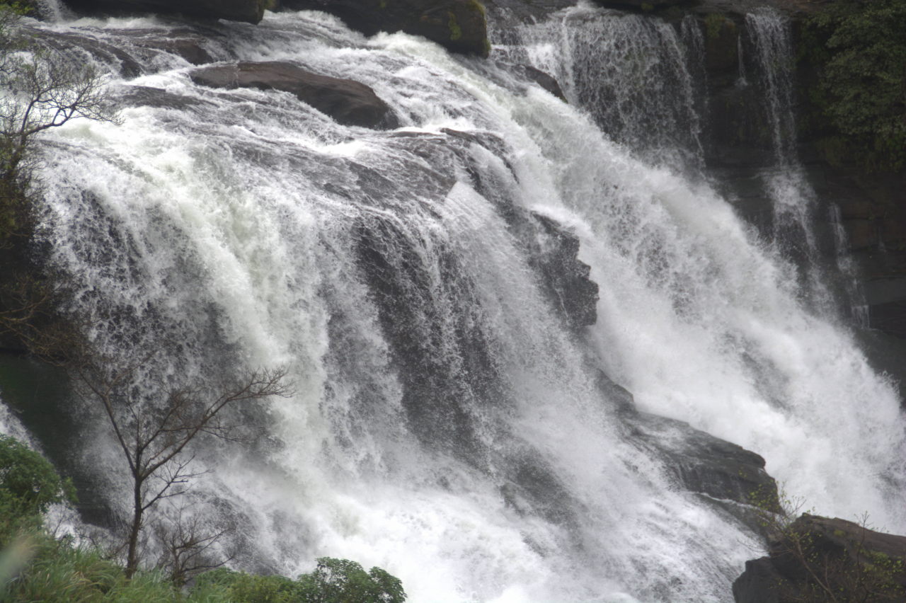
Stunning view of Mallalli waterfall, Coorg.

Chelavara waterfall, Coorg
Cauvery’s journey starts in the coffee district of Coorg in Karnataka. The monsoon brings heavy rain to the Western Ghats of Coorg. Several waterfalls such as Abbey, Mallalli and Chelavara can be found in the hills around Coorg’s headquarters Madikeri. All these waterfalls join forces to form the course of Cauvery river. Tala Kaveri is a Kshetra which is worshipped as the official source of river Cauvery as Kaveri Mata or Kaveri Devi.
Harangi dam, Coorg, Karnataka
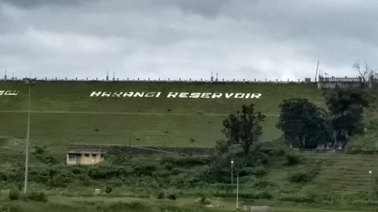
Harangi dam, Coorg
Cauvery’s length is not even 10 km long before it is obstructed by a dam. Harangi dam near Kushalanagara in Coorg district is the first dam of several on the course of Cauvery river’s 800 km run to the Bay of Bengal. While Harangi is the first dam by distance from the source of the river, it is not chronologically the first dam to be built on Cauvery. That credit goes to a ancient dam built 2000 years ago in Tamil Nadu, possibly India’s first ever dam. Nor is Harangi the most celebrated dam on Cauvery. We’ll travel to the outskirts of Mysuru to see such as dam.
Nisargadhama, Coorg, Karnataka
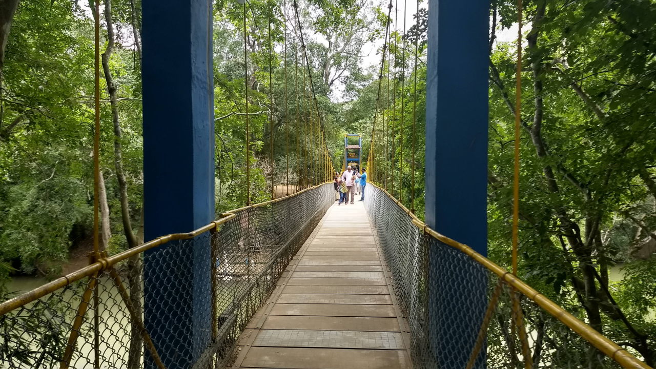
The rope bridge that crosses the Cauvery river and gets us to Nisargadhama nature park, Coorg.
On the southern bank of Cauvery, also near the town of Kushalanagara, is a nature park built by the government of Karnataka. This park is a green lung, nature trail, tourist centre, vacation stay (in cottages set up by Karnataka tourism), mini zoo and handicraft centre, all rolled into one. It is worth spending a day and a night in Nisargadhama.
Mysuru, Karnataka

A pelican sits at the top of a tree at Dr Salim Ali bird sanctuary, Ranganathittu near Mysuru
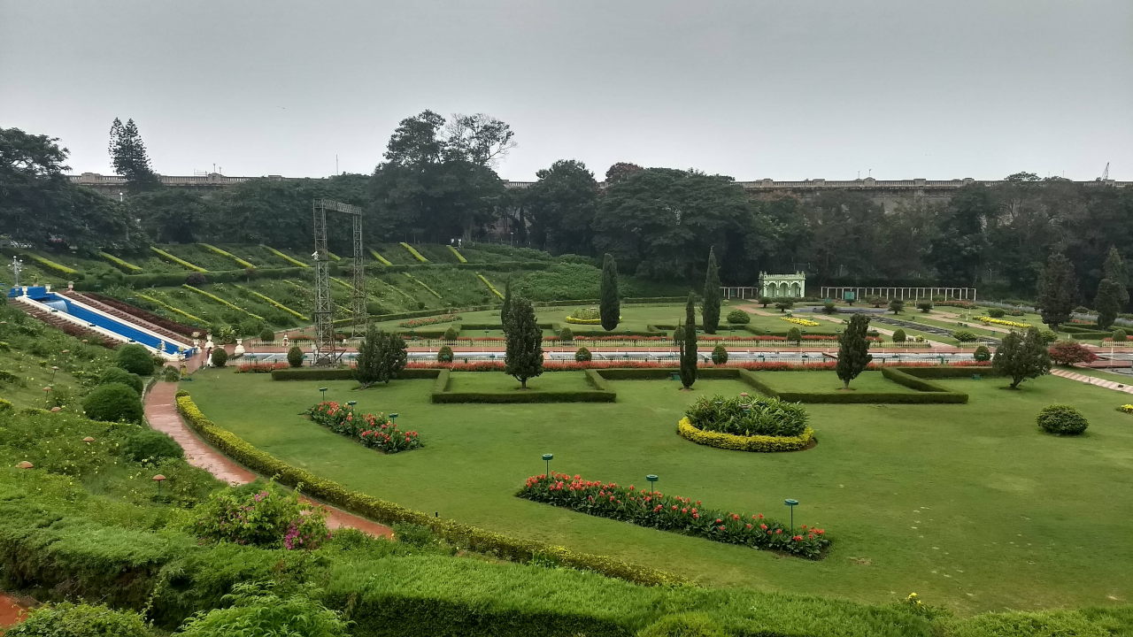
Brindavan gardens on the leeway of the Krishna Raja Sagara dam
While the river does not flow right by Mysuru city, it is just 16 km away. Two points of interest can be found at the location where the Cauvery river comes as close to Mysuru city as possible. The first one is a township built around one of India’s largest and most important dams called the Krishna Raja Sagara, which has been functional from 1938. It was commissioned by the ruling Wodeyar monarch Krishna Raja Wodeyar, one of the most progressive rulers Mysuru has ever seen. On the leeway of the dam is one of India’s first and most expansive botanical gardens famous throughout India as the Brindavan gardens.
About 10 km downstream from the dam is one of India’s first river-side bird sanctuaries. It is called Dr Salim Ali bird sanctuary and is in Ranganathittu village. In this sanctuary, one can take a boat ride to see various birds like cranes, cormorants, storks and even pelicans. Besides, you can see an occasional crocodile swimming in the river, so don’t stick your hand into the water.
You can read more about touring around Mysuru city in the post: City Focus: Mysuru, Karnataka.
Srirangapatana, Karnataka
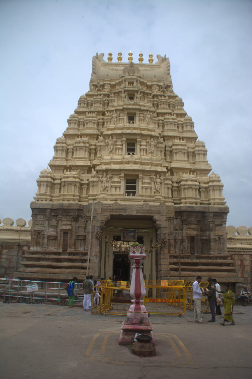
Sri Ranganatha Swamy temple at Srirangapatana
Outside Mysuru, the river on its west-to-east course splits around an island and then rejoins at the east of the island. This is not an unknown island. For several centuries, the island has been hosting an important temple for Vishnu devotees of south India. It also served as an Agrahara or a learning / publishing centre for Vaishnavite Hindu literature. The temple is home to Lord Ranganatha Swamy. The island is hence named Sri Ranga Patana or the ‘city of Sri Ranga’. For a brief period in history, between the middle and the end of the 18th century, the town lost its Vaishnavite identity. Muslim rulers Haider Ali and his son Tipu Sultan took over Srirangapatana and made it their capital. Along came a Jama Masjid, a palace complex, Mughal-style gardens and Muslim mausoleums. The Muslim supremacy ended with the death of Tipu Sultan in 1799 and the town was annexed by the British, who mispronounced it as Seringapatna. The combination of Mysuru and Srirangapatana became an important military advantage for the British to pick off and defeat all the princely states along the bank of Cauvery, all the way upto Thanjavur in Tamil Nadu.
A history of Srirangapatana during the rule of Tipu Sultan has been described in the post: Revisiting history: Tipu Sultan.
Somanathapura and Talakkad, Karnataka
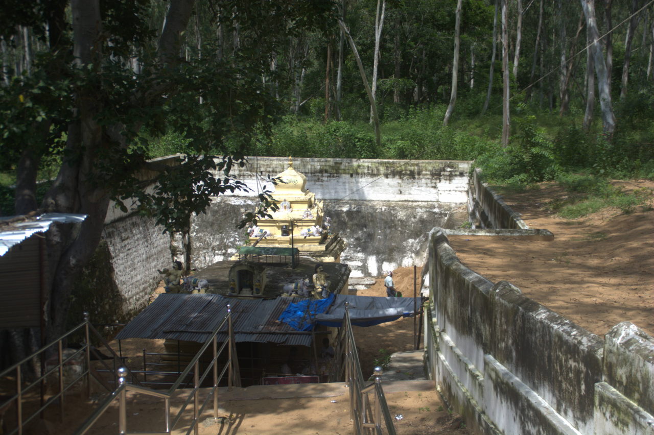
Pataleshwara temple at Talakad. This temple sunk under the silt deposited by the Cauvery river when it changed course and flooded. It was later excavated. The villagers believe that the sinking was due to a curse. Pataleshwara in Sanskirt means the ‘Lord of the world under the ground’.
These are two villages on the bank of Cauvery in Karnataka’s Mysuru district, where the different dynasties built temple complexes. While Somanathapura’s Chennakeshava temple is typical of Hoysalas, Talakkad has a unique story. Talakkad is said to have had 30 temples, but many of them were swallowed and buried by the Cauvery river when it changed course and caused floods. Archeologists are still excavating and discovering new temples in the area.
Shivanasamudra falls, Karnataka
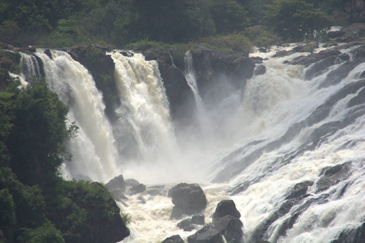
Bharachukki waterfall, Shivanasamudra
Gaganachukki waterfall, Shivanasamudra
If you want to see the equivalent of Niagara falls in India, then look no further than the Shivanasamudra group of falls halfway between Mysuru and Bengaluru. There are waterfalls at two locations and they are called Gaganachukki and Bharachukki. The Gaganachukki falls also drive a hydroelectric project that powers Bengaluru city. Beyond this point, the river turns to take a north-south flow instead of west-east.
Hogenakkal, Tamil Nadu

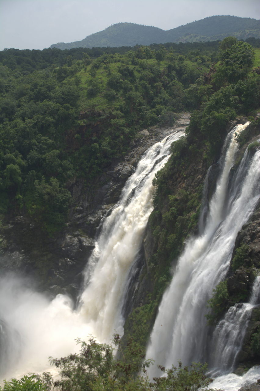
Cauvery river plunges into the gorge at Hogenakkal
Between Chamarajapuram district of Karnataka and Dharmapuri district of Tamil Nadu, the Cauvery river forms a natural border and flows calmly for a while before it plunges into a lengthy gorge from all sides. The gorge is in the village of Hogenakkal in Tamil Nadu. While the plunge is violent during monsoon, it softens during the winter and summer months, allowing you to take a coracle ride along the length of the gorge while the river streams in from all the sides.
Mettur, Tamil Nadu
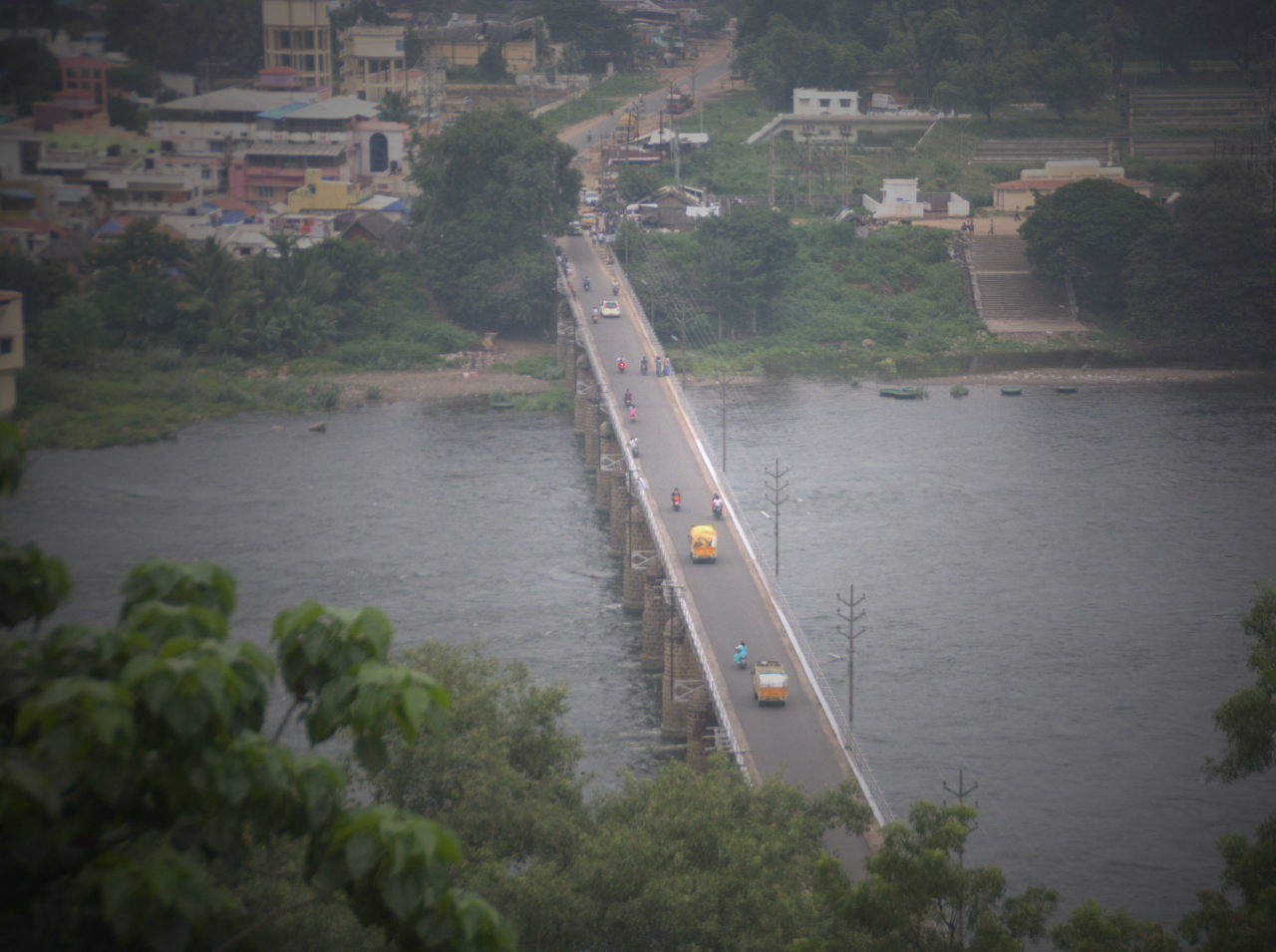
Bridge over Cauvery river at Mettur

A view of Mettur dam
South of Hogenakkal, in the district of Erode is the village of Mettur, where we see the third dam on Cauvery river. This dam is built at the area where the Cauvery river’s course broadens significantly after getting fed by the waters from the streams of the mountains bordering Karnataka and Tamil Nadu. These mountains belong to the eastern Ghats.
Erode, Tamil Nadu
Erode is an industrial town that has grown around the Cauvery river, with the urban area situated on the western bank of the river. In Erode district, there are several temples on the banks of the Cauvery river.
On the eastern bank of the river across Erode town is the Seshasayee Paper mill, a factory that has been a pioneer in the manufacture of paper & paper products since the 1930s. Due to the presence of Cauvery river and the abundance of wood, it was easy to set up a factory that processed paper right from pulp to finished products at the same location.
From Erode, the river once again takes a west-east flow, continuing in that direction upto the sea.
Tiruchirapally, aka Trichy, Tamil Nadu
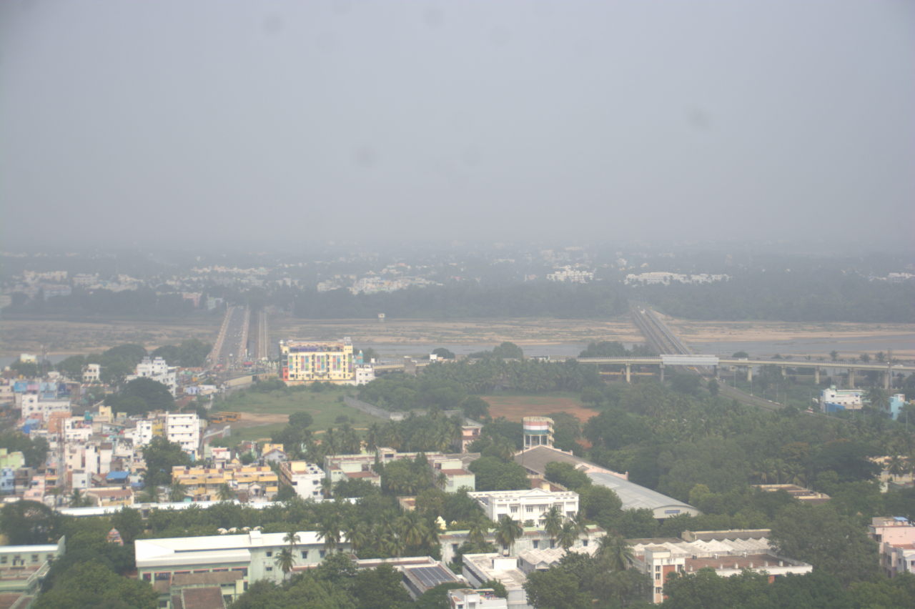
A view of Trichy from the top of Rock Fort. The two bridges are over the Cauvery river.
The capital of the Pallava dynasty has always had Cauvery river close to its heart. Trichy is spread towards the southern bank of the river. Near the bank is a small hill with a hill top fort. The hill fort is called Rock Fort. It has many historic temples all the way from the base to the peak. One can get a complete view of Trichy city and the Cauvery river from the top of Rock fort. The British used the geographical advantage of Trichy to set it up as an industrial and educational hub. Highways and railways were developed. Even today, companies like BHEL and institutions like NIT flourish in Trichy.
Srirangam, Tamil Nadu
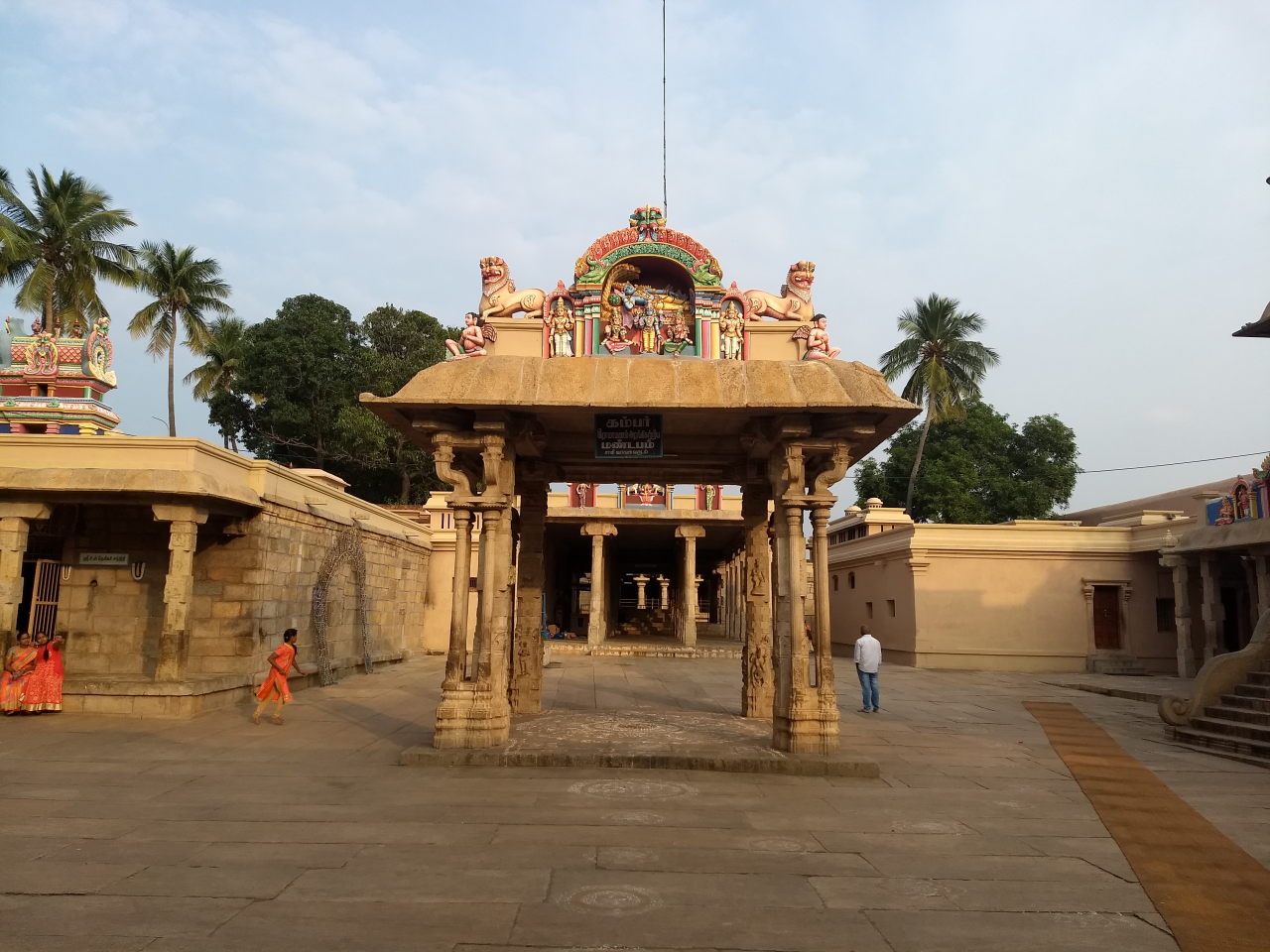
Inside Ranganathar temple, Srirangam
Very similar to Karnataka, the river splits around an island in Tamil Nadu too. The distributary to the north of the island receives a new name: Kollidam or Cooleron. Guess what! There is a famous Ranganathaswamy temple on the island. The temple is called the Sri Ranganathar temple and the island is named Srirangam. Deja vu! Just like Mysuru is a big city to the southern bank of the river across the island of Srirangapatana, Trichy is a big city to the southern bank of the river across the island of Srirangam. Double deja vu! Want more deja vu? Krishna Raja Sagara is a dam near the twin cities of Mysuru – Srirangapatana. Yes, there is a dam near the twin cities of Trichy – Srirangam too. But that’s where the similarities stop. KRS is a modern dam built by a 20th century ruler and with 20th century engineering. Not so for the dam near Trichy, which is 2000 years old. Read the next section to know more.
Kallanai / Grand Anicut, Tamil Nadu
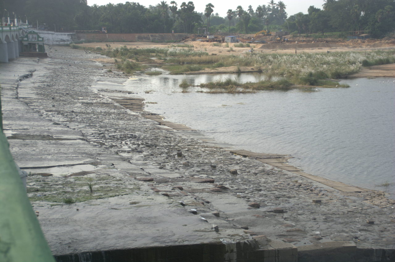
Grand Anicut, one of the world’s first dams.
The Cauvery river swerves around the island of Srirangam to rejoin into a single course. But 2000 years ago, a forward-thinking king from the region’s Chozha dynasty, Karikala Chozhan, wanted some of the water from the northern tributary, Kollidam, to maintain its original course for irrigating the fields to the north of the river. Using the power of elephants, a bank of stones with wide sluices was built to retain some of the water as a seperate river, while the rest of the water was allowed to rejoin Cauvery through narrow sluices. Kallanai was a state-of-the-art dam for the time. In the 19th century, the British noticed changes in the course of the river and some ineffectiveness in the original dam in channelling water to the Kollidam branch. The plan was updated and fresh dam gates were built on top of the original dam. The British made sure that they preserved the original 2000-year old dam in the process. Today you can seen the 2 millenia old bunds along with the modern dam from the road on top of the dam. The road connects the city of Trichy to the Chozha capital city of Thanjavur.
Thanjavur district, Tamil Nadu
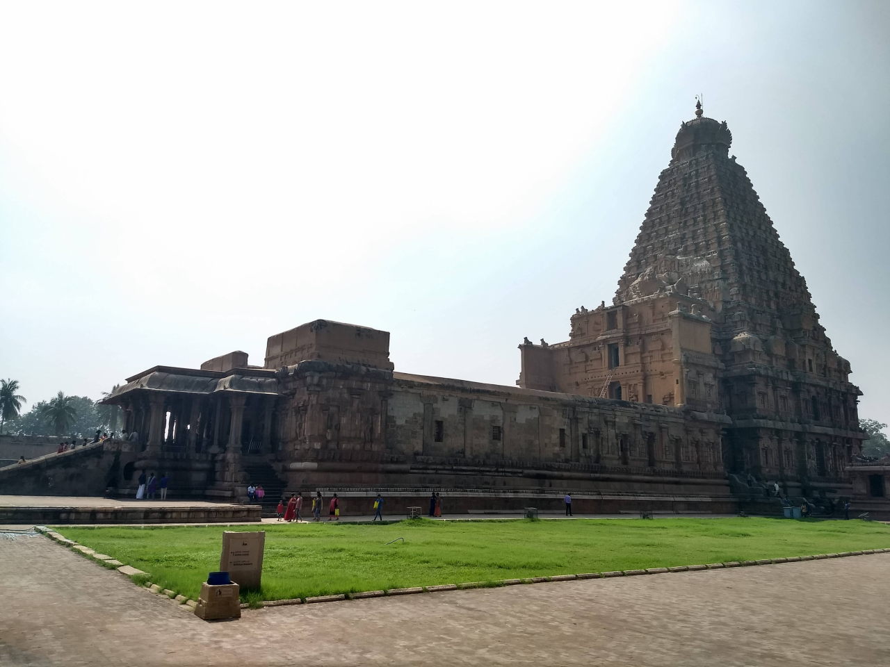
Brihadheeshwara temple, Thanjavur
Thanjavur city and some towns around Thanjavur flourished under the Chozha dynasty, especially Rajaraja Chozhan and Rajendra Chozhan. Thanjavur’s Brihadeeshwara temple, the temples of Kumbakkonam, Gangaikondachozhapuram, the Chidambaram Thillai Nataraja temple and the Thivarur temple were all built under the patronage of the Chozhas. Lesser known in the district is the village of Thiruvaiyar on the southern bank of the river, where Telugu composer Thyagaraja wrote most of his work and was also buried. The most famous Carnatic music singers assemble at Thiruvaiyar on his birthday and recite his works in a huge assembly hall.
Chidambaram, Tamil Nadu
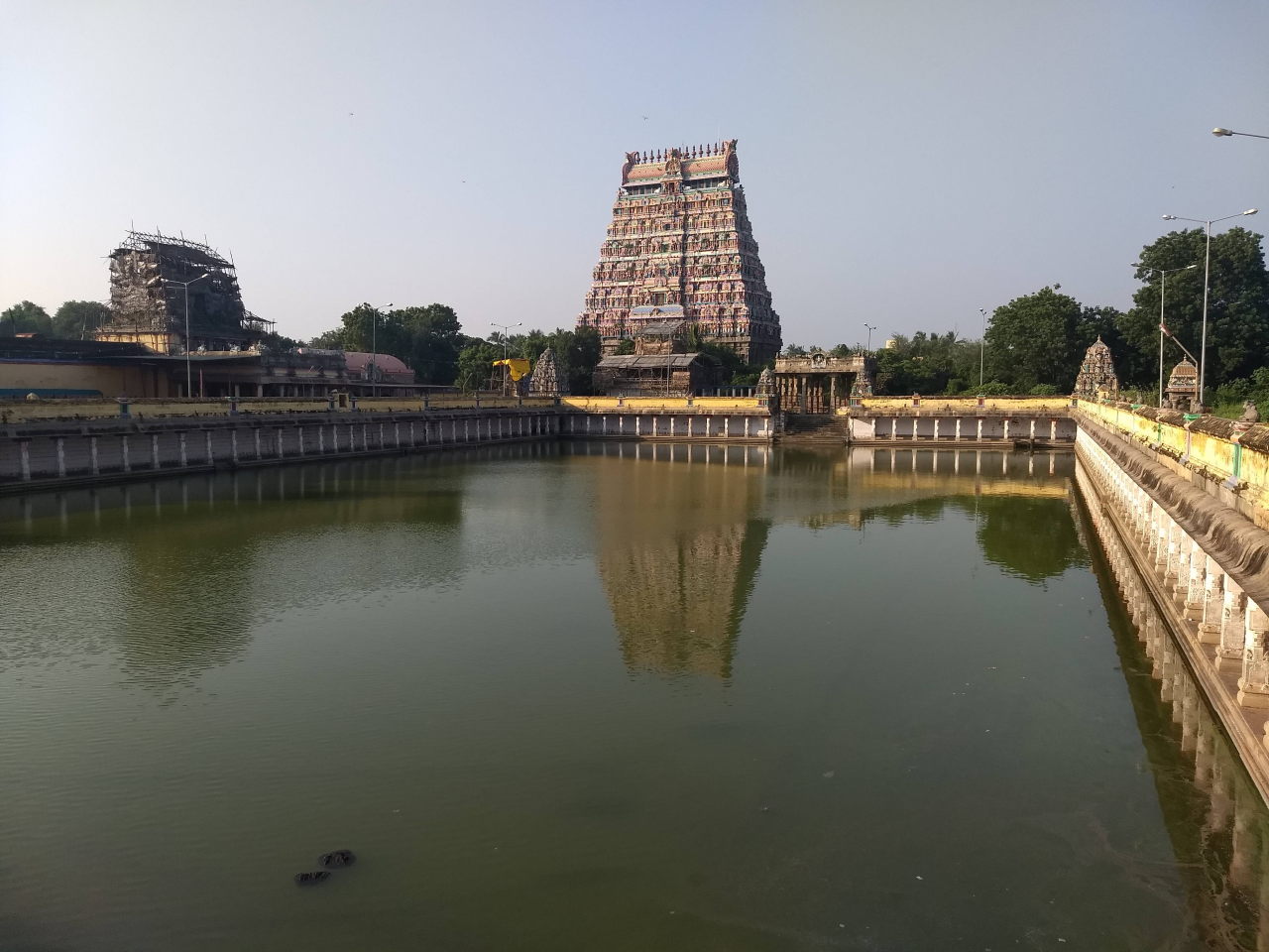
Chidambaram Nataraja temple campus
Chidambaram is not directly on the bank of the Kollidam river, but it isn’t very far. This town is the home of Lord Nataraja or Nata Raja, the king of dance. In the temple you can see the murals of the 108 steps of Shiva Tandava. The priests are this temple are a specific sect of Brahmins called the Dikshitars or Dixits.
Poompuhar, Tamil Nadu
The southern branch of the Cauvery river, still named the Cauvery, flows into the sea at the ancient port of Poompuhar. Poompuhar used to be the port for Chozha rulers, from where they sailed into south east Asia and established territory in Indonesia, Malaysia, Myanmar, Thailand and Cambodia. You can still see the old structures at Poompuhar. But the majority of the glorious port has been swallowed by the sea.
Pichavaram, Tamil Nadu
South-east of Chidambaram are the mangroves of Pichavaram. The Kollidam river splits into several distributaries, all seeking the sea. The deltas between the distributaries are home to several species of mangroves, bird life and marine life. One can take a boat around the islets of Pichavaram, seeking migratory birds and sholes of aquatic life. Beyond Pichavaram, the various distributaries and rivulets join the Bay of Bengal.
Conclusion
Any major river in the world creates an entire ecosystem and gives rise to civilisations wherever it flows. Cauvery is no different, creating an ecosystem and supporting several civilisations like the Kodavas, Pallavas and Chozhas. As with all major rivers, Cauvery has suffered at the hands of industrialisation and pathetic waste management. But following the river from the forests of Coorg to the mangroves of Pichavaram and parallely through the ancient commercial port of Poompuhar is a fascinating experience.