post

How we covered it: Nagaland

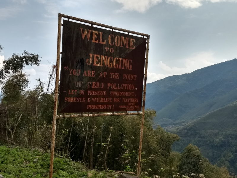
Very little is known about the north-east of India. Of particular obscurity are states like Nagaland and Arunachal Pradesh, where transport is limited, roads are substandard, tourism is yet to catch up and awareness is limited. Before our trip to Nagaland, we used to picture the state a set of tribals wearing attire made of skin, jewellery made of animal bones and tribesmen clashing with each other. The reality is quite different. The Nagaland we saw is a state of vibrant youngsters who prefer English rock music and study in convent schools. Nagas are some of the most stylishly dressed people in all of India.

Nagaland also has no single official language, although the people speak Nagamese among themselves. Nagamese is just Assamese attempted by the people of Nagaland using grammar and pronunciation deemed ‘faulty’, but still communicable by the people of Assam. Think of it as what a Britisher would feel when Indians speak English or what north Indians would feel when south Indians speak Hindi. Majority of Nagaland speaks fluent English, being a Christian state and as a result of sending their people to convent schools. 95% of the state is Christian. Hindi is spoken sparingly in cities like Kohima, Dimapur and Mokokchung. Most of the Hindi speakers are from Rajasthan, Bihar and Assam. The natives of Nagaland themselves struggle with the language.

We had the privilege of covering all of north-east and hence Nagaland on our motorbike. This allowed us to be nimble, ride through roads of questionable quality, reach and stop at places not usually covered by public transport, explore some unique villages and learn a lot about the culture of different tribes in Nagaland.

Route plan

Due to the condition of the roads in Nagaland, we had no choice but to enter the state and exit to Assam thrice. Roads were non-existent between certain districts. It was better to track back and use Assam’s highways to re-enter Nagaland in a different region. Here are the three phases we covered in Nagaland.

  1. Land of the Ao tribes
  2. Land of the Konyak tribes
  3. Urban Nagaland

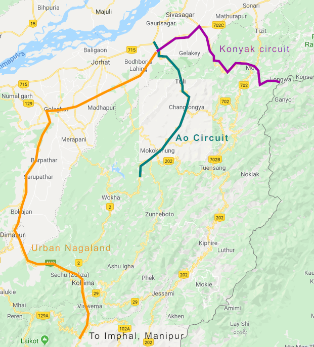
Our route plan around Nagaland

Let’s see each region one by one.

Land of the Ao

Among all the tribes in Nagaland, Ao tribes are the most educated, the most forward thinking and the friendliest to people from outside Nagaland. Aos are usually convent-educated and spend their youth in boarding schools. Most Aos are fluent in English, and moderately conversant in Hindi. Their native language is Ao, the same as the name of the tribe, and is classified under the Sino Tibetan family of languages. Just like Romio – Juliet and Heer – Ranjha, Ao tribes have their own sad-ending love story in the form of Etiben and Jina. Ao tribes reside in the district of Mokokchung.

Here are some interesting places to see in Mokokchung district.

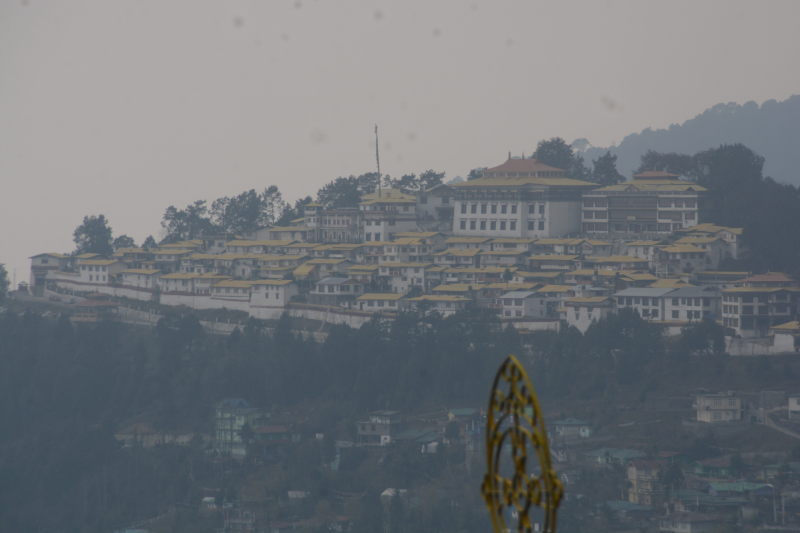
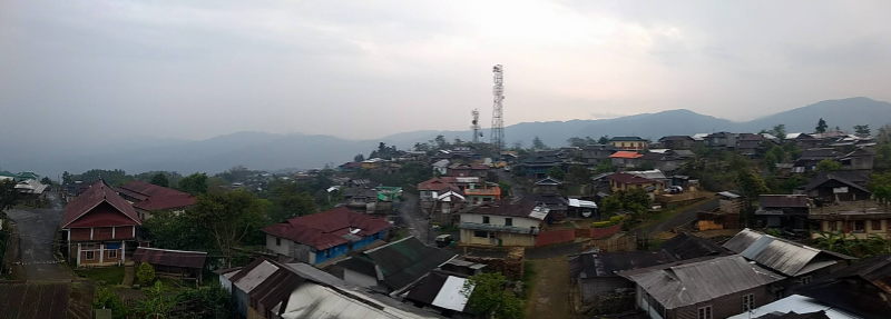
Mokokchung town: Mokokchung town is the headquarters of the district. There is nothing particularly touristy in Mokokchung. But one can take long walks on the city’s streets and check out the local markets. The best view of the city is from the slope with Hotel Metsuben, which is at the highest point of the town. Unlike Mon district and places like Kohima, it is rare to find tourists, foreign or Indian, in Mokokchung district. So Mokokchung is a good place to rest at night, refuel your vehicle and stock up on supplies when you are in Ao tribe territory.
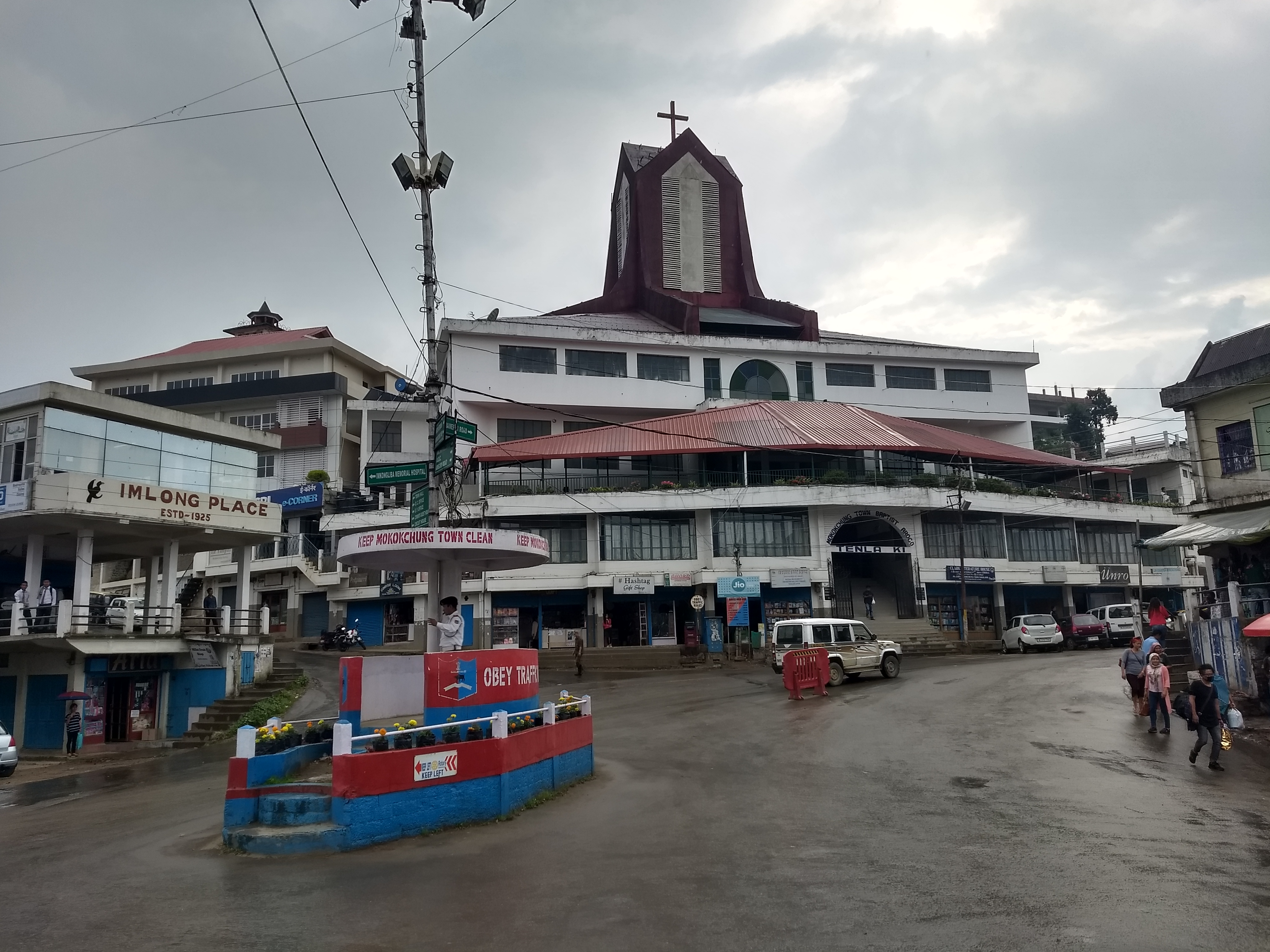
Mokokchung town

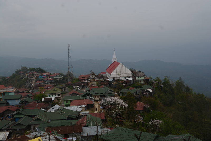
Mopungchuket: Mopungchuket is a little village slightly north of Mokokchung. It is one of the best villages to check out the life of Ao tribes. At Mopungchuket, we were guided around the village by Ronsengla, a primary school teacher and a choir singer at the local church. There are two towers in the village, that give a beautiful view of the hills in Mokokchung district. One of the towers is called Jina tower and the other Etiben tower, named after the two legendary lovers in the area. Also in the village, one can check the Ao tradition museum, which also doubles up as a guest house.

Sungkotenem park, Mopungchuket

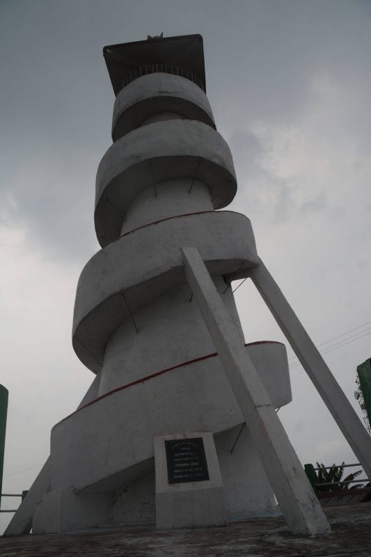
Etiben tower, Mopungchuket

View of Mopungchuket village from Jina tower

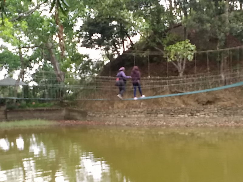
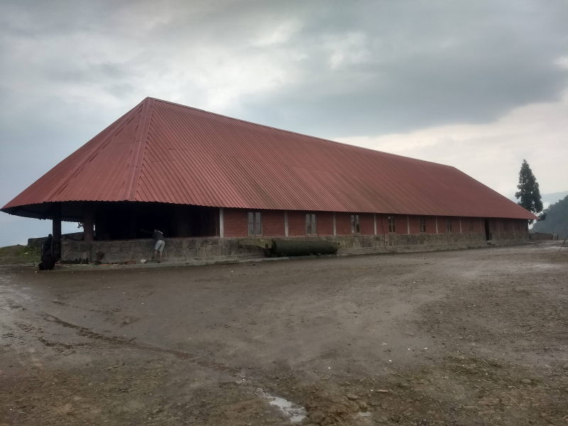
Sungkotenem park is a small park with a lake just on the outskirts of the village. A small trail in the park goes across the lake via a walkway and ends at a podium, where one can see sculptures from the legendary stories of Ao tribes. Finally, one can see architectural examples like a Morung, which is a form of a tribal hostel, a long drum and several other artefacts which have been preserved around the village for the benefit of tourists.

Longkhum: Longkhum is the village where according to the legends, the two lovers Etiben and Jina hung out during their clandestine time together. It is here that Jina used to play the traditional Ao instrument, Kota-Kongki, while Etiben would enjoy the music in bliss. At Longkhum, you can ask one of the local vilagers to show you around.

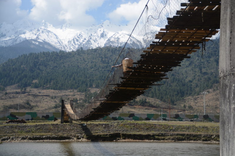
You will be shown a staircase frequented by Etiben and Jina. The staircase ends at a cliff, from where one can see a beautiful view of Doyang river. Along the way, there is a Naga version of a root bridge (made famous by Meghalaya) and a small caving experience in a narrow, but beautiful cave (caving is also famous in Meghalaya).

Longkhum village

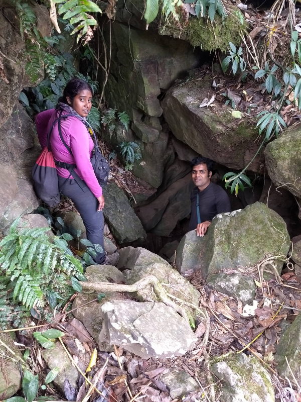
Mini caving experience at Longkhum

Land of the Konyak

Konyaks are one of the oldest tribes in Nagaland and had frequent skirmishes with the tribals from Burma. This led to head-hunting culture as we’ll see in the paragraph about Longwa. Konyaks inhabit the Mon district. The district shares a border with Sagaing state of Myanmar. Here are some interesting places to see in Mon district.

Mon town: Just like Mokokchung, Mon town on its own does not have much to offer. But it is a great place to run into people who are visiting or have visited Longwa. What’s special about Longwa? We’ll see in the next paragraph. Mon is a town with facilities such as lodges, restaurants and fuel stations. If you are bound for Longwa, Mon is a good place to stay for the night and use the next day to travel to Longwa.

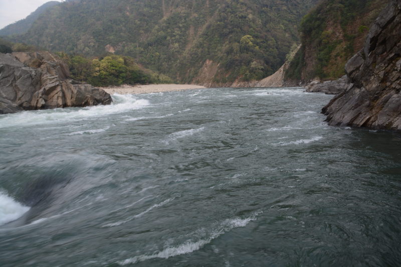
Longwa: Longwa is a unique village in Nagaland that is right on the border of India and Myanmar. The house of the chief of the village, known as the Angkh, is partly inside India and partly inside Myanmar. One can stay for the night at one of the rooms inside the Angkh’s house. From here, one can go for a small trek to a landmark stone which is also on the border. One side of the stone has the name of India written in Devnagari, while the other side has the name Myanmar written in their local script.

The Angkh’s house is partly in India and partly in Myanmar

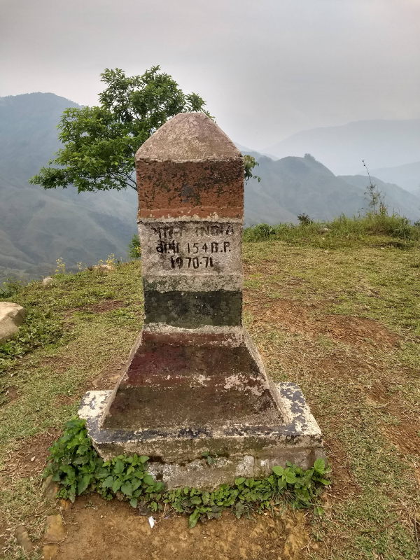
Landmark stone pointing towards India.

Also unique to Longwa are the tribal marksmen who have hunted the heads of rival tribals. The head hunters are now very old, mostly in their 80s and 90s. They wear a chain around their necks with pendants that look like human heads. The hunters wear as many pendants as the number of heads they have hunted. Head hunting is now outlawed and the entire region is peaceful with the introduction of education and conversion to Christianity.

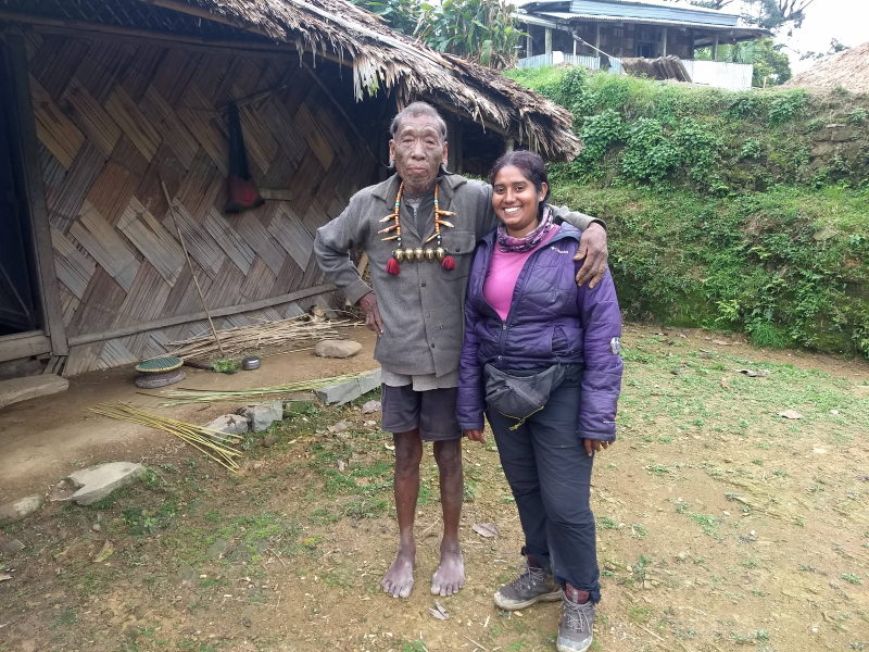
A Konyak headhunter. Note that he has felled 5 heads, thus the 5 pendants on the chain around his neck.

While growing of drugs like opium is banned in India, the Myanmarese side of the village grows and sells opium. Opium addicts flock the Myanmarese side of the Angkh’s house to consume the drug legally!
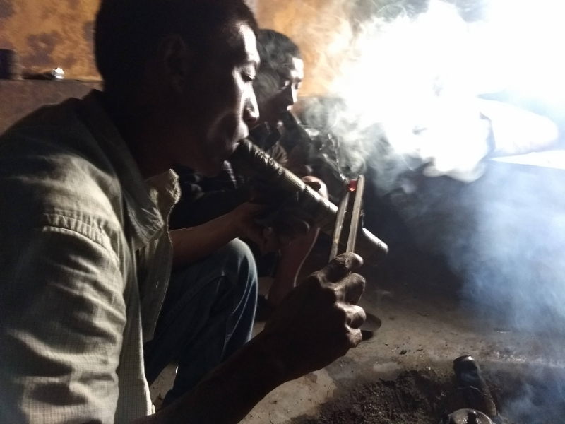
Opium smoking

Urban Nagaland

From villages with love stories and villages with head hunters, let’s go to urban Nagaland, where two of the state’s largest cities lie 60 km from each other.

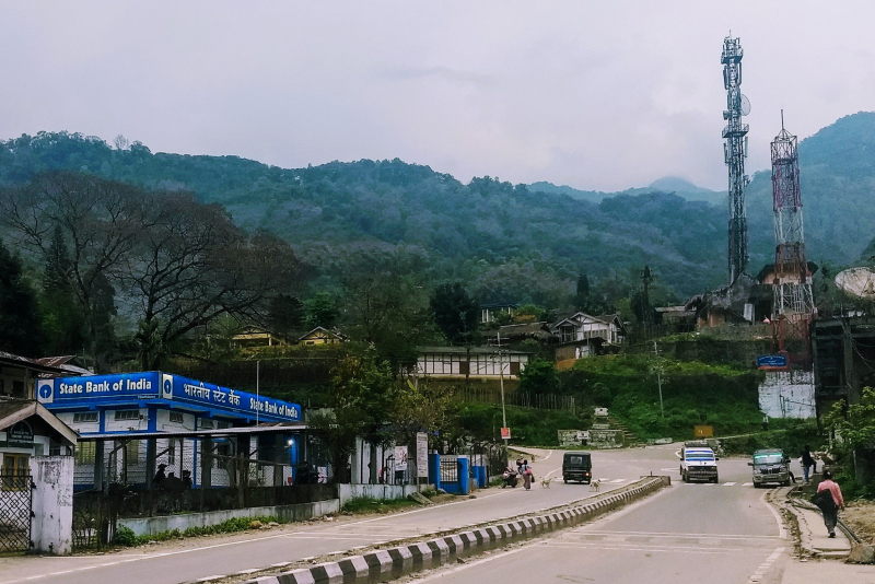
Dimapur: Dimapur is the largest city in Nagaland and the only one in the plains. Due to its location in the plains, Dimapur is the only city in Nagaland to have a railway station and an airport. Dimapur is the gateway to Nagaland since it is right on the border of Assam and Nagaland. The main language of Dimapur is Kachari, but other languages like Nagamese, Assamese, English, Hindi and Bengali are also spoken here. Something unique in Dimapur that we saw was a shop selling utensils, buckets and other material made of old rubber tyres.

At Dimapur with our friend Wapang. Wapang is from the Ao tribe (see the section ‘Land of the Ao’ above)

Kohima: Kohima is the capital of Nagaland. It is a city with Angami Naga tribe. The city is quite pleasing with several wall paintings, foot over-bridges which are painted on and places where graffiti is made using natural contours of the background.

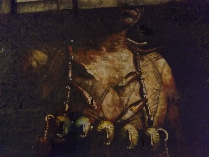
Wall painting of a head hunter at Kohima

Kohima has some good places to see, one of them being the Nagaland state museum, where most of the Naga tribes, their culture, sports and food have been described over several galleries. The war cemetary has a good path to stroll on. Kohima also has a good street market, where you will see some wierd things being sold as food items, e.g. frogs!

Khonoma: Khonoma is a village near Kohima which is termed as the Nagaland Heritage Village. It is here that every December, the Hornbill festival takes place. The festival is a congregation of all the tribes from Nagaland. It features dances, handicrafts, local food, natural products and many other things hosted on stages and in stalls.

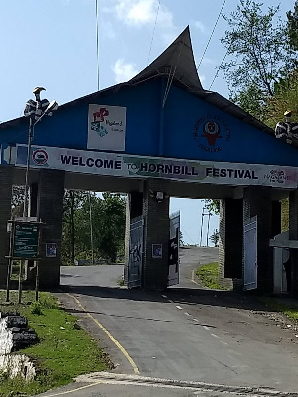
Entrance to Hornbill festival, Khonoma

Dzukou valley: Dzukou valley is a trek on the border of Nagaland and Manipur. On the highway between Kohima and Imphal, a trail starts near Jakhama village towards the ascent and ends on a pasture of land overlooking rolling slopes. At the top of the trek is a basic rest house with a dormitory and a few private rooms. If you have your own tent you can camp. A basic entrance fee (₹ 50) is to be paid for a trek to Dzukou.

Conclusion

Nagaland is a state of several territories, none of which you can call similar to each other. The state has more than 30 local languages and several dialects, most of which can be understood more by the Myanmarese and less by most Indians. It has its own love stories, head hunters and some beautiful vistas overlooking mountains and plains with plenty of greenery. The best time to visit the state is around November – December to make your trip coincide with the Hornbill festival. So plan your trip for the upcoming winter.

post

District Focus: Ratnagiri, Maharashtra

What if I tell you that you can see all of the following things in a single district inside India: the birthplace of a famous freedom fighter, pristine beaches, Olive Ridley turtles, alphonso mangoes, cashewnut plantations, gorgeous mountain ghat roads and sea-side temples. The district’s name translates to a ‘mountain of jewels’. That would be Ratnagiri district of Maharashtra, a district that lies between the sea and the mountains and has some of the richest people in the country, courtesy the export of Alphonso mangoes. Continue reading

post

Natural wonders: Rann of Kutch, Gujarat

You are standing in the middle of an area from where all you can see is white colour. The ground is covered in a powdery white substance that looks crystalline on closer inspection. There aren’t many people around. There isn’t any vegetation around. Nothing grows here because the soil is covered and perhaps its nutrients compromised by the white substance. In your mind, you may conclude that this white substance is snow and that you are standing in the Himalayas.

Here are some problems with that assumption. You are at sea level. You needn’t wear any thermal underwear, gloves or scarves. Sure, at night and early in the morning, this place is cold, but you won’t get a frostbite if you leave your skin exposed. You can pick up the white crystalline substance with your hands and it doesn’t feel freezing. Come afternoon and the heat is sweltering here. You are actually in the middle of a desert covered in salt. You are standing at the Great White desert of Kutch, also known as the Rann of Kutch.

What is Rann of Kutch?

Salt crystals covering the ground at Rann of Kutch. This is what makes the entire desert appear white in colour. Only insects can survive such a desolate surrounding with no vegetation.

In Kutchi language, the word Rann, with its pronunciation matching the English word ‘run’, means a desert. Rann of Kutch covers an area of 7500 sq km in Gujarat state, bordering Sind region of Pakistan. The area under Rann of Kutch was initally abundant in water. The Indus river used to flow into the Arabian sea in this area. Due to an earthquake in the 19th century, the river changed its course. The saline water formed by the creek at the river mouth was left behind. The extreme heat in the region, coupled by no more fresh water supply caused all the water to evaporate and leave behind crystals of salt. As a result, we see a vast area covered by white crystals of salt. Since the salt has compromised the nutrients in the soil, no vegetation grows here. No water, no vegetation. Hence the region is classified as a desert that is white in colour. This is a natural occurence unique to Gujarat and Sind.

Where is Rann of Kutch?

Rann of Kutch is in the north-western corner of Gujarat. It is inside Kutch or Kachchh district. The international border with Pakistan runs west to east across the Rann and splits it into two parts. 1/3rd of the Rann to the north of the border belongs to Pakistan while 2/3rds to the south of the border belongs to India.

Map of Gujarat and Rann of Kutch

To the west of the Rann is the Narayan Sarovar wildlife sanctuary, centred around Narayan Sarovar lake. To the east of the Rann is a huge saline lake, which is a part of the creek still in the process of evaporation. This is the Rann of Kutch lake. To the south of the lake are the rural and urban areas that form the plains of Kutch district. Bhuj, the headquarters of Kutch district, is 80 km to the south of Rann.

To the east of the Rann of Kutch lake, there is another white desert called the Little Rann of Kutch. This place is less touristy, but also looks less spectacular compared to the Great Rann.

If you want to visit all of Gujarat state, including Kutch district’s Gandhidham, Bhuj and Mandvi beach, then you can read the post, How we covered it: Gujarat

What to see at Rann of Kutch

Concrete square at Rann view point.

Rann view tower

The entrance to Rann of Kutch is near a village named Dhordo. This is the only entry for civilians. The highway from Bhuj to Rann ends at a gate guarded by the Indian Army. After this gate, the road proceeds two kilometres to a dead-end that ends with the whiteness of the desert. To get past this gate, the army requires that you furnish your Aadhar number (Indians) or passport number (foreign nationals).

The road beyond the gate ends at a concrete square known as the Rann viewpoint. At the Rann viewpoint, there is a stilted tower that climbs 3 storeys to give you a spectacular view of the desert.

One can walk upto 500 metres away from the concrete square into the desert. No one would stop you if you were to go further, but common sense says that you’d get lost. The desert is a monotonous stretch of white with no vegetation, hills, man-made or geographical features. Everything looks the same. An expanse of white that stretches upto the horizon. So don’t try to be a superhero, believing that you have exceptional navigation and survival skills.

Sunrise and sunset

First rays of the sun at Rann of Kutch

It is best to time your visit to the Rann during sunrise or sunset. The golden hues of the sun blend well with the white canvas of the desert. We would recommend watching the sunrise rather than the sunset. Since the authorities need to close the gate before it gets very dark, you won’t be allowed to stay for very long once the sun goes down. It isn’t safe either. But at sunrise, you are under no such pressure since it is only going to get brighter. You can linger in the desert for a bit longer until the heat forces you out of the area.

Sun up and running at Rann of Kutch. We have wandered a safe distance from the view tower for this photo, mainly to avoid too many people.

Rann of Kutch festival

Between November and January, a cultural festival happens at the entrance of the Rann at Dhordo. Several local folk music artistes are invited to perform at a stage set up in the area. The performances happen even late at night. During this time, Dhordo village sets up tents for tourists and vendors. You can book an accommodation in one of the tents. Around the residential tents are commercial tents for food vendors and the like.

A promo board for Kutch festival

Be warned that the tented accommodation is exorbitant, given the facilities provided. If you are budget-conscious backpackers / road-trippers like we are, then such accommodation makes no sense monetarily. We didn’t carry our tent during our Gujarat trip, so we do not know if pitching your own tent is allowed in this area. Our view is that Rann of Kutch is too close to Indo-Pak border and has had issues with refugees in the past. Authorities may not take kindly to you setting up camp in such sensitive areas. We found it more economical to stay in or around Bhuj. Since we took our own car to Gujarat, it was easy for us to set off for Rann as early as we could. If you are relying on public transport and want to be around Rann for sunrise / sunset, then staying in Dhordo’s tented accommodation is your best option.

Best season to visit

Rann of Kutch is incredibly hot during summers, which starts in March and continues upto September. Monsoon, which turns the mountains and the fertile plains of the rest of the country lush green, has no effect in Kutch district. Interior Gujarat is dry throughout the year. Day time temperatures can soar to 50 degrees celsius. Even in winters, the dryness of the air can make the day temperature more difficult to tolerate than in humid regions.

We visited Rann of Kutch in January and would recommend that you visit between November to February. Also, try not to be inside the desert after 10 am. The best timings are in the mornings between 5 am – 8 am and evenings between 4 pm to 7 pm. Winter sunset time is around 7 pm and summer sunset can be as late as 8 pm.

Getting there

By air

The closest airport is at Bhuj, the headquarters of Kutch district. Another important airport is at Gandhidham, the commercial hub of the district. However, there are frequent flights to the two cities only from Mumbai. If you are travelling from any other city, then Ahmedabad and Rajkot are better options. From Ahmedabad or Rajkot, you can take buses to Bhuj and then a taxi to Rann.

By rail

Bhuj’s railway station is New Bhuj Jn. It comes under Western Railway and lies on the Ahmedabad – Viramgam – Gandhidham – New Bhuj route. Direct trains to New Bhuj run from Mumbai (3 trains), Pune, Kolkata and Bareilly. Most of them pass through Ahmedabad. If you cannot get a ticket for a direct train to Bhuj, you can book a train to Ahmedabad or Rajkot and then take a bus.

By road public transport

Gujarat state buses run from Ahmedabad, Rajkot, Gandhidham, Palanpur and Jamnagar. From Bhuj, you can hire a taxi to Dhordo.

By driving yourself

To drive to Bhuj, you should first join the NH-8 Mumbai – Surat – Vadodara – Ahmedabad – Udaipur – Jaipur – New Delhi highway. If you are driving from the south of India (e.g. Bengaluru or Chennai), you can join the NH-8 by driving to Pune and then taking the Pune – Lonavla – Navi Mumbai (satellite city to Mumbai) – Thane (also a satellite city) – Vasai bypass. With this, you will skip all of Mumbai city’s traffic. You should exit the higway and enter Ahmedabad city. If you are driving from central India (e.g. Bhopal, Nagpur or Indore), there is a direct highway from Indore to Ahmedabad without using NH-8.

Once at Ahmedabad, you should take the Ahmedabad – Viramgam – Bhachau – Bhuj highway. At the entrance of Bhuj, you will be welcomed by a traffic island with an optical illusion exhibit. A faucet seems to hang in the air and spew water from no visible source. Thereafter, a north-bound highway from Bhuj, in excellent condition, allows you to drive the 80 km from Bhuj to Rann in one hour. At a highway junction at Bhirandiara village, turning left takes you to Rann, while keeping straight takes you to an army check post about 60 km from the Indo-Pak border.

Conclusion

India has plenty of places where nature has played a magical hand in shaping jaw-dropping wonders. Rann of Kutch is one such wonder, where it is amazing to see vast stretches of a salt desert all the way to the horizon. Rann of Kutch is one of a kind.

How we covered it: Arunachal Pradesh

Arunachal Pradesh is one of the most beautiful and least travelled states in India. We had the fortune of getting to travel across the state on our motorbike and I would suggest you to do the same if wish to cover the state fully. The state’s public transport does not get you to every corner, nor is it possible for you to take your car to some of the narrow roads in the remote areas of India’s eastern-most state. A road trip across Arunachal Pradesh can leave you spell-bound as you will see plenty of rivers, valleys, rugged mountains, snow, green pastures, picturesque villages and wonderful people.

On the map of India, Arunachal Pradesh looks tiny. But trust us, the state is big. Barring Assam, Arunachal is the largest among the states termed as the seven sisters. Despite using the most nimble form of transport, i.e. our motorbike, we could not cover the entire state. This is because, the distances between towns are really high. Arunachal Pradesh occupies more than 300 km on the northern bank of Brahmaputra river. There are days you will need to cover 150 – 200 km on a single day on winding mountain roads which are in a state of disrepair, thus taking you 6 – 8 hours to cover what seems like a fleeting distance on roads like Mumbai – Pune expressway, Delhi – Agra Yamuna expressway or Tamil Nadu’s Grand Southern Trunk (GST) highway. We had to take hard decisions about having to drop certain plans simply because the roads were not ready for us yet. Hopefully, the current government has considered the matter and they are supporting BRO (Border Roads Organisation) to prioritise the completion of important roads in the state.

In this post, we will replay the road route we took to cover as much of the state as we could and the places that are interesting along the way. This should hopefully help you plan an exciting, jaw-dropping trip to the state named the ‘the province of the crimson veil’, a name that arises out of the fact that the state is the first to see sunrise in India.

Our route plan

Our Arunachal Pradesh route plan

We covered the following 4 routes in Arunachal Pradesh

  1. Tezpur – Tawang
  2. Itanagar – Ziro – Daporijo – Aalo – Mechuka – Aalo
  3. Aalo – Yingkiong – Tuting – Yingkiong
  4. Yingkiong – Pasighat – Tezu – Parshuram Kund – Namsai

Inner Line Permits

Please note that you need an Inner Line Permit (ILP) to visit Arunachal Pradesh. On the permit, you need to mark all the districts that you wish to visit. At all the checkposts between Assam and Arunachal Pradesh and at intermediate checkposts between districts, your inner line permits will be checked. An inner line permit can be obtained online from Arunachal ILP website.

Tezpur – Tawang

This is the only route in the state that will take you through snow all year round. The route follows the Kameng river and then the Tawang river to take you to Tawang district that borders China. You can see upto two high altitude Himalayan passes on this route. One of them is the Se la pass that needs to be crossed to reach Tawang. The other pass, Bum La, borders China and can be seen if the weather conditions and diplomatic relations are favourable and you are lucky.

Tezpur: is a city in Assam to the north of Brahmaputra river. It is the second biggest city on the northern bank after New Bongaigaon. All other major cities such as Guwahati, Jorhat, Dibrugarh and Tinsukia are on the southern bank of the river. Tezpur is at the confluence of Brahmaputra and Kameng rivers. It is the road head for a trip to Arunachal’s Tawang district. There is a road bridge across Brahmaputra from Tezpur, that takes you to the south bank town of Kaliabor. From Kaliabor, the Kaziranga national park, famous for its one-horned rhinos, is less than 50 km away.

Brahmaputra river at Tezpur

Bhalukpong: is a town at the border of Assam and Arunachal on the Tezpur – Tawang route. The town is on the western bank of Kameng river. Your ILP will be checked at a checkpost in this town. The highway from Tezpur to Bhalukpong is flat. Beyond Bhalukpong, the highway starts ascending into the Arunachal Himalayas.

Bomdila: is the headquarters of West Kameng district. Bomdila is the biggest town on the way to Tawang. It has a monastery and a district-level playground. On the way back from Tawang, we used Bomdila as our halt for the two day motorbike ride from Tawang to Tezpur.

Dirang: is a town midway between Tezpur and Tawang. Dirang has a hill top monastery worth exploring. There is also a hot water spring near the Kameng river, which flows in a valley slightly lower than the town. We used Dirang as a halt for our two day ride from Tezpur to Tawang.

Se La pass: is a Himalayan mountain pass at an altitude of 13700 feet (4170 metres) at the border of West Kameng and Tawang districts. It has a lake that is frozen for half the year and has clear water reflecting the surrounding mountains in the other half. Se La has an army post. During bad weather, Se La becomes a bottleneck due to heavy snow or rain, either blocking or damaging the road, thus cutting off Tawang from the rest of India.

Frozen lake at Se La pass

Taxi drivers from Tezpur to Tawang and back usually ensure that they are at Se La pass before or by mid-day. No one wants to drive there during fading sunlight. When you are planning a trip to or from Tawang, you should also ensure a pre-noon pass through at Se La pass. So the best thing is to leave your source (either Tezpur or Tawang) very close to sunrise. In fact if you are using a motorbike, we suggest that you break your trip into two days: Tezpur – Dirang and Dirang – Tawang.

Jaswant Garh: is a war memorial in Tawang district. It is a memorial built for Garhwal rifles marksman Jaswant Singh Rawat, who singlehandedly kept the Chinese army at bay during the 1962 Indo-Chinese war. It is said that the spirit of Jaswant Singh still lives there.

Jang: is the first municipality on the way from Tezpur to Tawang. Near Jang town is a waterfall named Nuranang formed by the Tawang river.

Nuranang waterfall at Jang

Tawang: is a town and the headquarters of the district of the same name. It is inhabited by the Buddhism-practising Monpa tribe, who speak the language of the same name. Tawang has a famous and ancient monastery. Other attractions around Tawang are Tawang war memorial, Panga Teng Tso lake, Sitting Buddha statue, Sangetsar lake, Takt Sang monastery (not the one in Bhutan) and Bum La pass.

Tawang monastery

Here’s a video of our motorbike ride between Tezpur and Tawang.

Itanagar – Ziro – Daporijo – Aalo – Mechuka – Aalo

While Tawang is the most popular circuit among tourists, the Itanagar – Ziro circuit is gaining popularity as the roadways and transport are developing. This circuit starts from Assam’s Gohpur town and crosses the state border at Dhipu, where you need to show your permits at a checkpost. While most tourists head upto Ziro and return to Assam, we extended our route to cover Daporijo and proceeded to Aalo, from where one can visit Mechuka village. Aalo – Mechuka is a popular circuit among motorcycle groups and there is very little public transport in these areas. You cannot cover these places in a planned way through backpacking alone and public transport alone. You may get lucky enough to tag along with a group of motorcyclists or private village vehicles that happen to be going that side. I suggest that you take control of your itinerary by taking your own vehicle or a hired self-driven vehicle.

Itanagar: is the capital of Arunachal state. It does not belong to any district and comes directly under the rule of the state government. Interesting things to see at Itanagar are the hill top Ita fort and state museum that tells us about the culture of the various tribes of Arunachal. Itanagar is often combined as an urban conglomeration with nearby city Naharlagun, which is 5 km away in the district of Papum Pare. Similar to the way that New Delhi combines with Gurgaon, Faridabad and Noida to form NCR and Mumbai is often combined with Thane district to form MMRDA, Itanagar and Naharlagun are referred to as the Itanagar urban area. Due to space constraints, many of the state administrative offices are actually inside Naharlagun instead of Itanagar. Both Itanagar and Naharlagun have railway stations, the only major ones in Arunachal so far. There are frequent trains to Guwahati, New Bongaigaon and Siliguri. There is also an Arunachal Rajdhani that runs from New Delhi to Naharlagun twice a week.

Clock tower at Itanagar

Ziro: is the headquarters of Lower Subansiri district. The town is the most populated and the most commercially active town in the district that is named after the Subansiri river that flows through. Ziro is divided into Ziro town and old Ziro, with the old one having an air strip. Between the two is an ancient Shiva Linga. The Ziro music festival happens here every September.

Ziro town

Daporijo: is a town in Upper Subansiri district. It has fantastic views of the Subansiri river valley. If you are travelling from Ziro to Aalo, then it may be necessary to break your journey at Daporijo for a night. You can also look at Daporijo to fill up your petrol reserves, since there are no petrol pumps upto Aalo on one side and Ziro on the other.

Subansiri river at Daporijo

Aalo: is a major town in West Siang district, with the name of the district coming from the river Siang, a major tributary of Brahmaputra river. Another name for Aalo is Along. Aalo is a three-way junction with one highway leading to Ziro and Itanagar, another one to Mechuka village and yet another one going to Yingkiong. Aalo is also a good place to fill up your petrol reserves if you are planning a trip to Mechuka, where there are NO petrol pumps yet.

Siko Dido waterfall: is a tall waterfall on the road between Aalo and Mechuka. The visible plunge of the waterfall from the road is 200 feet (60 metres). It is near the village of Tato.

Siko Dido waterfall. Notice Priya standing near the waterfall. That’s how tall the waterfall is.

Mechuka: is a remote village close to the Chinese border. The name of the village means the ‘place with healing water’. The Siang river flows through Mechuka, while snow clad mountains stand tall far away. There are several green pastures with cows and horses grazing, making the village look straight out of Switzerland. Combine it with the colourful wooden houses and the cleanliness. The effect is complete. Mechuka has a history with close ties to Sikhism. It is said that Guru Nanak travelled to Arunachal Pradesh and Tibet to teach the virtues of compassion and sacrifice. Curiously, there is a monastery dedicated to ‘Nanak Lama’.

Mechuka village

Mechuka village

An Sikh regiment army major posted at Mechuka after independence noted that the locals heal ailments with medicinal water from the Siang river and prayers to Nanak Lama. Intrigued, he dug out history and found that this very land was graced by the man that Sikhs hold in highest reverence. Thus a Gurudwara was built in the army camp. This Gurudwara can be visited today, along with a river side temple where Guru Nanak is said to have parted stone to clear a path. Various regiments are posted to this army camp in rotation.

Please note that Mechuka is a dead-end. One must return to Aalo to be able to explore further circuits.

Aalo – Yingkiong – Tuting – Yingkiong

While Aalo – Mechuka road is beautiful and Mechuka village is hypnotising, the natural beauty on the Aalo – Yingkiong – Tuting circuit was at a different level, leaving both of us gaping our mouths and parking our bike for photos far too many times. The areas are so remote and so pristine that you will see hardly see anyone, locals or travellers. It also meant for us that the roads were in a terrible state of neglect. While the Aalo – Yingkiong road is in a fairly good condition, the road from Yingkiong to Tuting puts you under a level of test you’ll not often experience. But the stunning sight of the Siang river carving its way through the Himalayas bordering India and Tibet is so refreshing that the adverse effects of the driving test are soon forgotten.

While we want you to certainly take a trip to Yingkiong and Tuting, we would ask you to wait 2 or 3 years to wait for the roads to be repaired. If you haven’t ever ridden on low quality mountain roads before, then this trip is not for you. We do not recommend an SUV yet because the roads are too narrow to allow two SUVs to pass each other, should such an occasion arise. There are several large army trucks that use this route and your SUV will be found wanting for space to squeeze. Hatchbacks and sedans are definitely out of question due to their low ground clearance on such atrocious roads.

Jengging: A board outside Jengging claims that this is the most pollution free village of the country. We cannot confirm that. But certainly the village has excellent views to the Siang river flowing in the valley deep below the road.

Zero pollution board at Jengging

Yingkiong: While the highway from Aalo to Tuting runs parallel to the west of Siang river, Yingkiong town is to the east of the river. It is the headquarters of Upper Siang district. The distance from Aalo to Tuting is way too much to cover in one stretch, due to time and fuel requirements. it makes sense to cross the river for the evening to rest and refuel at Yingkiong and then cross back to the highway in the morning. This was not possible before 2017. But then the government provided two brand new, sturdy road bridges with good quality roads on both sides, north and south, of Yingkiong town to access the highway on the west of the river. But even before these bridges made it possible for Yingkiong people to commute to Aalo, the town has always had a south-east bound highway to the town of Pasighat, that we will see in another circuit.

State Bank of India branch and BSNL phone towers at Yingkiong

There is nothing to see inside Yingkiong, but one thing stands out. The reassuring brand boards of Indian Oil, BSNL and State Bank of India stand tall in a town so remote from the creature comforts we are so used to, thus bringing fuel, connectivity and banking to remote corners of India. It puts the Shells, Vodafones and Standard Chartered Banks to shame.

Mingging: is a army outpost town on the way from Yingkiong to Tuting. We were lucky to be served food from army ration at the Mingging army camp, eating lunch with the soldiers. While we took photos, they politely asked us not to put photos on Internet, so we heed.

Tuting: is a remote village at one end of the state. It has beautiful views of the snow mountains bordering India and Tibet. Tourism has not caught upto this village and there are virtually no places to stay. There are no petrol pumps either and you need to buy petrol at higher than market rates from grocery shops. Tuting has a beautiful monastery with monk quarters. We wrote about our experience at Tuting in another post.

Yingkiong – Pasighat – Tezu – Parshuram Kund – Namsai

While most of Arunachal Pradesh is on the north of Brahmaputra river, a small region, namely Lohit, Namsai, Changlang and Tirap districts are to the south of the river. In Lohit district, the Lohit river joins the Siang river to form the Brahmaputra. This region of Arunachal is on the plains rather than the mountains.

Pasighat: is a bustling town by Siang river. It is the headquarters of East Siang district. To the south of Pasighat, the Siang river is joined by the Lohit river to form Brahmaputra.

Bhismaknagar: is the site of the ancient ruins of the Sutiya kingdom, who ruled the region around Brahmaputra between the 12th and 17th centuries.

Roing: is the headquarters of Lower Dibang district. It is home to Adi and Mishmi tribes.

Tezu: is the headquarters of Lohit district and is on the northern bank of the Lohit river. Tezu is home to Mishmi tribe.

Parshuram Kund: is a religious site that worships the site where Lord Parshuram bathed in Lohit river. Near Parshuram Kund, the highway crosses the river from the north bank to the south bank. At India 360, we used this fact as a logical seperation between exploring regions to the north of Brahmaputra (Arunachal, Tezpur, Bongaigaon, etc) and regions to the south (Guwahati, Majuli, Dibragarh, Digboi, Nagaland, etc).

Lohit river at Parshuram Kund

Namsai: is a town at the border of Arunachal Pradesh and Assam. Near Namsai are a few Buddhist temples, such as Solungtoo Buddist temple of Lathao and a hill top Golden Pagoda. Namsai district has a Buddhism practising population as many are descendents of Burmese kingdoms such as Tai and Shan.

Golden Pagoda near Namsai

Places we did not cover

We did not cover the highway between Roing to Anini, a town near the international border with Tibet. We think that Anini would have been a pristine village similar to Mechuka and Tuting. But the thought of 300 km and back over the poor roads of Arunachal over 4 days discouraged us. We will return when the roads have been repaired.

We also skipped the road from Tezu to Walong for similar reasons. Walong is the first village in India over which the sun rises in the morning. The summer sunrise is as early as 3:45 am, whereas the winter sunrise is around 4:45 am. But the distance between Tezu and Walong is 200 km and the roads are bad. It would have taken 3 – 4 days too and fro. A future trip on good roads is eagerly awaited.

Conclusion

While a lot of states in India have multiple highways with several combinations of itineraries, the fact that the roads in Arunachal follow the rivers and wind around mountains, thus keeping the total number of roads inside the state to very few, it is very easy to plan a well-rounded itinerary to the state, especially if using your own transport. Use our route and plan your next trip to India’s land of rising sun.


post

City Focus: Rishikesh, Uttarakhand

Ganga river has a lot of cities on its banks. The first city that Ganga flows through after descending the HImalayas is Rishikesh. Rishikesh is in Tehri Garhwal district and is surrounded by the mountains of the Garhwal range of Himalayas. The city is quite unique in the sense that there is something here for everyone. Whether you want to visit temples and watch Ganga Ghat Aarti, or if you want to learn yoga, or if you want to get your adrenaline pumping with white water rafting and bungee jumping. Continue reading

post

Travel Tips: Start from home

“We would like to travel just like you, but we don’t even know where to start!”
“It must be awesome, but we can’t dedicate ONE YEAR like you did.”
“Gosh, Himalayas are too far away. Goa’s beaches are too far away. it’s such a large country, everything takes time to travel from where I live.”
“Where do I start and when do I start? I am so confused.”

Well, in this post, I am putting all the above questions, confusions and excuses to immediate rest. In this post, I suggest that you explore your own home like a traveller would. Get comfortable with your home and get to know it better. You’ll be surprised how much you didn’t know. If you have never travelled for weeks together before, then this will be your perfect first long-term getaway. Forget about going around the country. Forget about Himalayas and Goa’s beaches. Just be a tourist in your home zone. Continue reading

post

Travel tips: Stay fit for travel, stay fit while travelling

We started India 360 during April 2017 and drew the curtain down during May 2017, despite not having seen every inch of the country. It was a time-bound experiment to see how much of the country we could travel in a year and our trip already overran by a full month. One thing that fuelled us and aided us to keep going was a very important factor which never flagged throughout the trip despite some moments of discouragement. Our supreme FITNESS. Continue reading

post

District Focus: Uttara Kannada, Karnataka

Uttara Kannada is a district to the north-west corner of Karnataka. It is just to the south of Goa. Typical of all the regions to the west of the Indian peninsula, Uttara Kannada district is bordered by the Arabian sea to the west and by the Western Ghat mountains to the east. Such geographical diversity makes Uttara Kannada rich in places to explore, be it sandy beaches, waterfalls, rivers, rock formations or mountains with tropical forests.

Continue reading

History revisited: The Ahom dynasty of Sibsagar, Assam

Assam is a state rich in history, mainly due to its multi-ethnic nature. While the Hindu Assamese are a major part of the state, there are several tribes and communities that live along the plains of Brahmaputra and also the hills of the state. One such community, the Ahoms, ruled Assam for 600 years and were influential towards the culture of the state. In fact, the name ‘Assam’ comes from the word ‘Asam’, which is a Sanskritisation of the word, ‘Aham’ or ‘Ahom’. We will explore the Ahom history through their capital city Sibsagar.

Continue reading

post

Man-made wonders: Nilgiri Mountain Railway

Nilgiri Mountain Rail, also known as the ‘Ooty Toy train’, is one of the most exciting ways to explore the beautiful Nilgiri Hills. It is one of the steepest mountain railways in Asia and is steeper than its Himalayan counterparts (e.g. Shimla, Darjeeling). The terrain of Nilgiris is very demanding and it took the British 45 years to complete the Niligiri Mountain Railways. This may not sound like much until you are told that Darjeeling Hill Railway, which was the first Hill railway in India and built before Niligiri, was built in under 3 years.

Unlike the other three famous mountain railways of India (Shimla, Darjeeling and Matheran), which use narrow gauge, Nilgiri Mountain Rail runs on standard metre gauge tracks with adaptation for the mountains. Nilgiri Mountain Rail has rightly been declared as a ‘World heritage site’ by UNESCO in 2005.

A Brief History of the Nilgiri Mountain Railway

In the 18th century when Udhagamandalam or Ootacamund was a favoured hill station for the British posted in Madras, Mysore & Travancore presidencies, access to the town was primarily through horseback or on ‘dollies’ (palanquins) carried by workers. The British commissioned the Swiss Inventor Riggenbach to build a railway line. Work commenced in 1899. The initial route ran up to Coonoor, but was later extended to Fern Hill and further to Ooty in the 1900’s. The locomotives used here have impressive strength and life span. The youngest locomotive of this train is about 50 years old and the oldest is about 80 years and still going strong.

The Train’s Unique Engineering

A unique thing about the Ooty toy train is that it ascends from an altitude of 1069 Feet to 7228 feet, i,e an impressive 6159 feet within just 45 kilometres, making it the steepest rail route in Asia. The excellent engineering capabilities that made this possible is very interesting and unique called Alternate Biting system or ABT, also known as rack and pinion system. It mimics the way a person climbs a ladder.

Rack rail between regular rails

Between the metre gauge rails is a pair to two closely placed rails that look like teeth. The teeth on the two rails are not matched, but out of step with each other. The third rail pair is called a rack. On the underside of the train is a wheel with teeth. The teeth on this wheel behave like human feet. They place themselves on the teeth on the rack and use them as the steps of a ladder, thus propelling the train upward. This teeth-bearing wheel is called a pinion. Regular metre gauge rails (without rack rail) run for 4 km from the origin station, Mettuppalayam to the next station Kallar. 200 metres after the train leaves Kallar, the train’s pinions grab onto the rack rail to start a steep ascent.

The train is powered by a steam locomotive between Mettuppalayam and Coonoor. On the way up, the steam locomotive is at the rear of the train to push it from behind. On the way down, the locomotive is on the front of the train, but is attached with its hood facing the train. This means that the downhill-bound train is still being pushed uphill! With the train hurtling down purely due to gravity, the engine regulates the train’s speed by pushing it in the opposite direction to prevent any collision or derailing.

A Nilgiri Mountain Railway train at a platform at Coonoor.

These days, the section between Coonoor and Ooty is powered by diesel locomotives. These locomotives were running on the Southern Railway’s metre gauge route between Chennai and Madurai. But with that route converted to broad gauge, the locomotives were shipped to Nilgiri Mountain Rail. Pinions were added to the underside of the diesel locomotives to use the rack rails.

The Rail Route of the Ooty Toy Train

Important railway stations on the route are:

  1. Mettuppalayam, where the train starts.
  2. Coonoor
  3. Wellington
  4. Lovedale
  5. Ooty

There are other stations such as Kallar, where the rack rail begins, Hill Grove, where the train stops for the steam locomotive to refill water to produce steam, Aravankadu and Ketti.

Nilgiri train taking a halt outside a tunnel

The railway line between Mettupalayam and Ooty is 46 Km long and takes 5 hours. Starting from the foothills at Mettupalayam, on the banks of Bhavani river, the train passes through the plains for 4 kilometres. In the next 12 km stretch, it quickly climbs an impressive 4363 feet, and passes through nine tunnels. The entire stretch between Kallar and Ooty contains 16 tunnels with different curvatures and lengths, all in excellent condition.  The stretch also has 250 bridges large and small. It is a delight to cruise through this picturesque route in a cute little toy train, which travels at a maximum permissible speed of 13 kmph over the 42 km rack rail section and at a maximum of 30 kmph on the 4 km section with no rack.

The steam locomotive of the Nilgiri Mountain train hisses out plenty of steam at Hill Grove railway station as it prepares to leave.

Though there is no scheduled downtime for monsoon unlike the Matheran Hill Railway in Maharashtra, the Nilgiri mountains receive very heavy rainfall from both the south-west and northeast monsoon winds. The train service is often temporarily suspended due to landslide or related hazards.

A heritage semaphore signal on the Nilgiri Mountain route. An arm parallel to the ground is the equivalent of a red ‘stop’ signal and the arm drooping down towards the ground is the equivalent of the green ‘go’ signal. At night, the arms are nearly invisible. The red and blue film glow in the dark. The radiant films are vertically lined up when the arm is parallel to the ground, and appear diagonal when the arm is down.

Traveller Tips

  1. Grab the left side of the coach on the way up and right side on the way down to get more views of the valley. On the other side you will mostly see mountain walls adjacent to the train.
  2. The best views can be seen from the early morning and early evening trains with several photo opportunities.
  3. Mettupalayam – Coonor section doesn’t just have the best views. This part of the journey is powered by the Swiss-made X Class steam locomotive, which is one of the oldest steam locomotives still running.
  4. Only one of the coaches is available for reservation in advance, e.g. through a website like IRCTC. The tickets for the other coaches must be bought at the station where you board. The tickets are sold on a first-come-first-serve basis. To get the tickets at the station, please be available at least 30 minutes to an hour before the departure of the train.
  5. Ooty railway station is officially called Udhagamandalam, the city’s Tamil name. The British habitually failed to learn the correct pronunciation of Indian places. They pronounced and spelt the name as Ootacamund. It was shortened to Ooty and the name stuck. You will also see the shortened Tamil name Udhagai on shop boards and Tamil Nadu state transport buses.

Full Video

Here is a full video of our ride in the Nilgiri Mountain Rail toy train from Mettuppalayam to Coonoor.

Conclusion

Railways are a wonderful way to explore India, but mountain railways like the one in Nilgiri are especially spectacular. Along with enabling the tribes of India to access the facilities in the cities of the plains, they are an engineering marvel, a work of beauty and a tribute to the wonder that India is.