post

Natural Wonders: Pangong Tso lake, Ladakh Union Territory

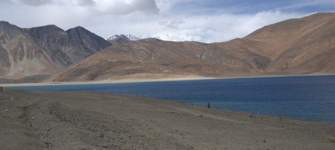
From the Bollywood Hindi movie Three Idiots, do you remember the scene where Phuntshuk Wangdu (played by Aamir Khan) is re-discovered by his best friends from college? Do you remember the lake in front of which they talk? Have you wondered where the lake is? It is Pangong Tso in the Ladakh region, part of Jammu & Kashmir when we visited, but now a union territory ruled directly by the central government. While the lake was made famous by the movie and has since received increased tourism, it has been considered sacred for centuries by both Ladakh and Tibet. Continue reading

post

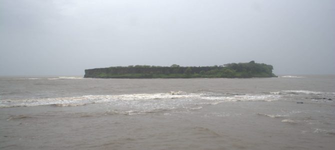
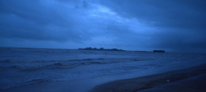
Thematic trips: Sea forts in Maharashtra

Between the late 17th century to the early 19th century, the Maratha empire had a formidable navy. Started by Chhatrapati Shivaji Maharaj as a way of countering invastion by foreign forces from the west coast of India, the navy flourished under the Peshwas with the able commandership of admiral Kanhoji Angre. Maharashtra’s coastline was particularly strong because of the presence of some strong forts along the coastline. While not all of them were built by the Marathas, several of them were captured by them and held for more than a century. Most forts fell to the hands of the British when the Marathas were defeated in 1818.

Here is a glimpse of the most important sea forts in Maharashtra.

Continue reading

post

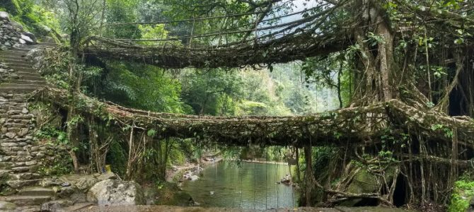
How we covered it: Meghalaya

Meghalaya translates to the ‘abode of the clouds’ (Megha Aalaya in Sanskrit). The state is home to green mountains, forests, man-made tree root bridges, spice gardens and natural caves. We covered parts of Meghalaya that are usually not covered by tourism packages. Because we covered the state on motorbike. But also, we went there during the north-east monsoon season. So a lot of interesting spots such as deep cave exploration and hidden waterfalls were closed due to flooded paths. Still, in this post we cover our path through Meghalaya and what important points we covered. We will also list some of the places we couldn’t cover and from where you can get there.

Geography of Meghalaya

Meghalaya is a mostly mountainous state, with the only low-lying area at Dawki near the border of India and Bangladesh to the south of the state. The state is divided into three north-south regions based on the tribal communities. The west-most region, which is the least touristy, is known as Garo district. The middle region, which contains the most populated and touristy destinations such as Shillong, Sohra (Cherrapunji) and Dawki are part of Khasi district. The east most region is named Jaintia and has some of the most interesting treks and cave exploration. Jowai is the most important town in Jaintia region.
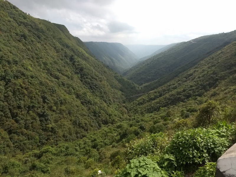
Meghalaya receives rainfall for 8 to 9 months every year. Mawsynram village in Khasi region is the rainiest place in the world, with an annual rainfall of 10,000 to 11,000 mm (i.e. 393 to 433 inches). The state receives rain from both the north-east and south-west monsoon winds. It can rain practically any time all over Meghalaya. There is a dense cloud cover for most of the year, with cloud build-up happening several times per day, leading to rains, thus earning the state its name.

Our route through Meghalaya

In our trip, we did not cover Garo hills, i.e. the western region. We were told by other motorbiking groups that while the region was beautiful, it was hard to get by with English or Hindi in the region or to find accommodation. Garo region is not yet open to tourism and there is still work to do.

Meghalaya was the last state in India 360 that we covered. We entered Meghalaya through Assam. Since we were travelling from Tezpur, which is to the east of Meghalaya, we took the west-bound highway to Guwahati via Nagaon and took the south-bound exit to Meghalaya at Jagiroad town. If you are driving from Kolkata or Guwahati, you will reach Jagiroad from its west and take the same exit.

After staying in Shillong for a couple of nights, we covered Sohra (previously called Cherrapunji) district. From Sohra, we drove to Mawlynnong, the village rated as the cleanest village (frankly, reason not convincing enough for us). From Mawlynnong, we drove to the river-side town of Dawki. From Dawki, we started driving towards Assam to complete our trip India 360. But instead of driving all the way back to Shillong on the same route, we used the Jaintia region to drive via Jowai and Nartiang before exiting Meghalaya at Khanduli.
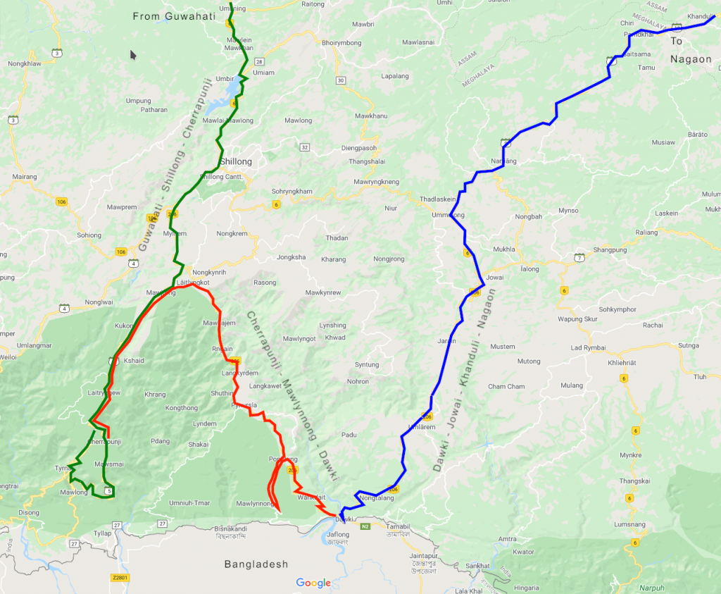
Our route through Meghalaya. Click to enlarge.

Here are the places we saw along the route.

Khasi Hills: Guwahati – Shillong – Sohra

Umiam lake: Umiam lake is a lake on the entry to Shillong. It was formed in the 1960s after building a dam over the Umiam river. It is the main catchment area for Shillong city for water supply. You will not miss Umiam lake if you are driving to Shillong from Jagiroad. It is right on the way.
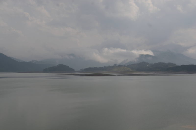
Umiam lake is the main catchment area for Shillong city.

There is a road near Umiam lake that goes straight to Shillong airport without passing through Shillong city. It is called Shillong bypass road. Going beyond from Shillong airport, this road leads to Jowai in Jaintia Hills. After showing tourists around Meghalaya upto Dawki, some tourist taxis prefer to drive to Jowai and then drop tourists off either at the airport or back to Shillong city.

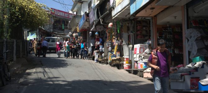
Shillong city: Shillong is the capital of Meghalaya. It is commercially the most important city among the hilly states in north-eastern Himalayas. The main language spoken in Shillong is Khasi, since the city is in the Khasi Hills. Shillong itself has several places of interest, which we will list in the points to follow.

City centre point, Shillong: The city centre point is a commercial hub inside Shillong city that has five roads meeting at one junction. One of the roads is a walk-only promenade with several street side shops, restaurants, cafes and hotels.
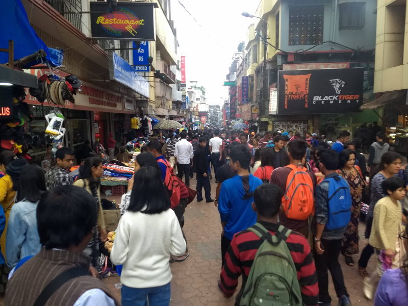
Pedestrian-only promenade at Centre point.

Ward’s lake: This is a lake in downtime Shillong. The lake has a walkway surrounding it. There is even a small wooden bridge as a walkway crossing the lake. The lake has pedal boats. Outside the lake are several eateries where you can eat common snacks such as momos and frankies. The lake area is a good place for relaxing and for photography.
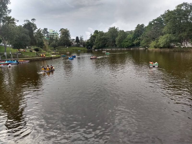
Ward’s lake is a nice place to spend a relaxed evening on the day that you arrive at Shillong.

Shillong peak (Laitkor): Shillong peak is a hill just outside Shillong city. Most of it belongs to the Indian Army as a place to watch over Shillong and the surrounding area. Visitors are allowed on certain days upto a watch tower inside the campus. The rest of the campus is off-limits for civilians.
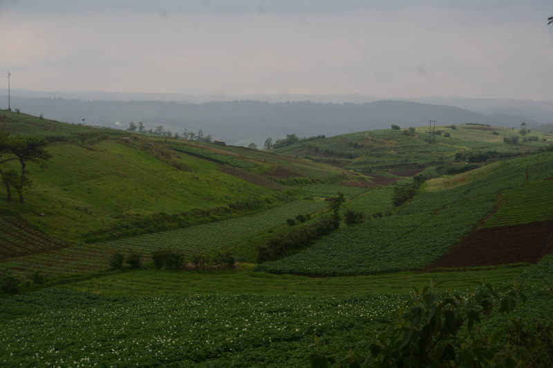
On top of Shillong (Laitkor) peak. Photos are not allowed inside the military area of the peak, so we took one where we could.

Captain Williamson Sangma museum: Named after the late Lok Sabha speaker, the Sangma museum is a place where you can look at the history of Meghalaya state and get a glimpse of its culture.
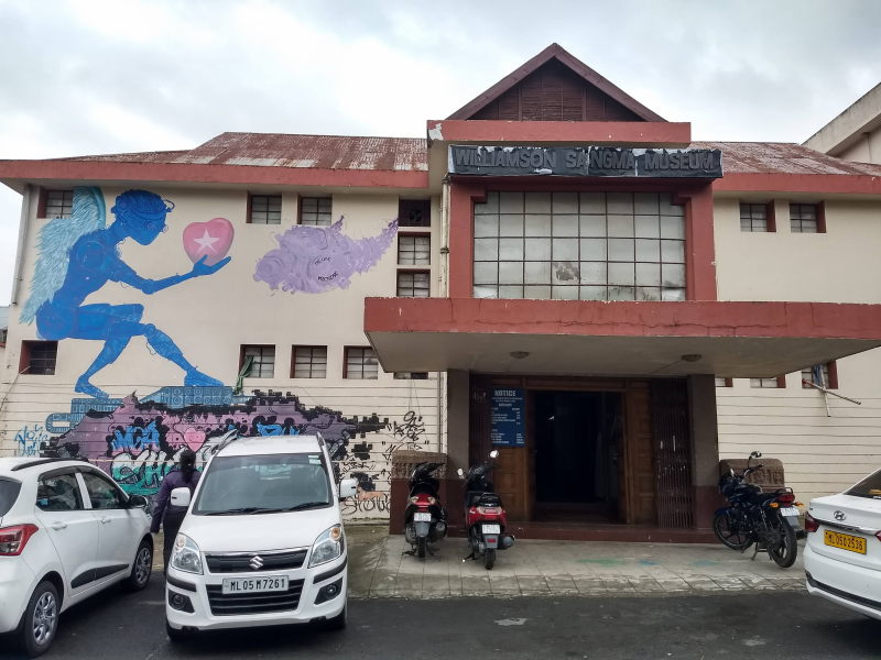
Captain Williamson Sangma museum shows a glimpse of Meghalaya culture in all three regions.

Don Bosco museum: Don Bosco museum is in a quiet suburb of the city with less crowd and traffic. The museum is a seven-storey edifice with glimpses into all the 8 states in north-east Himalayas (Arunachal, Assam, Manipur, Meghalaya, Mizoram, Nagaland, Sikkim, Tripura). On the terrace is a view point with a view of the entire city of Shillong surrounded by Khasi Hills.
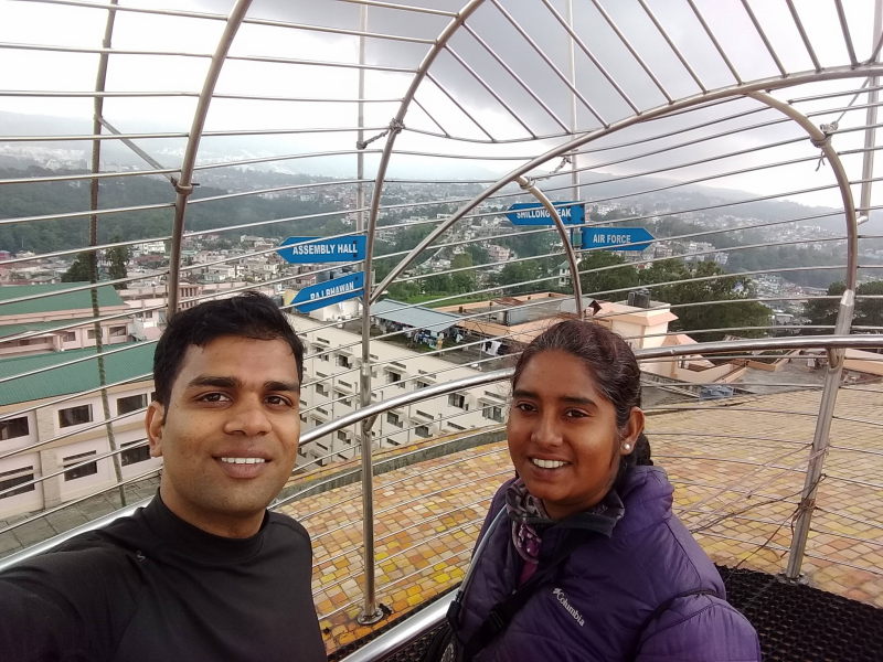
Terrace of Don Bosco museum

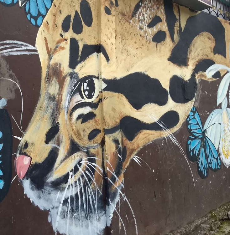
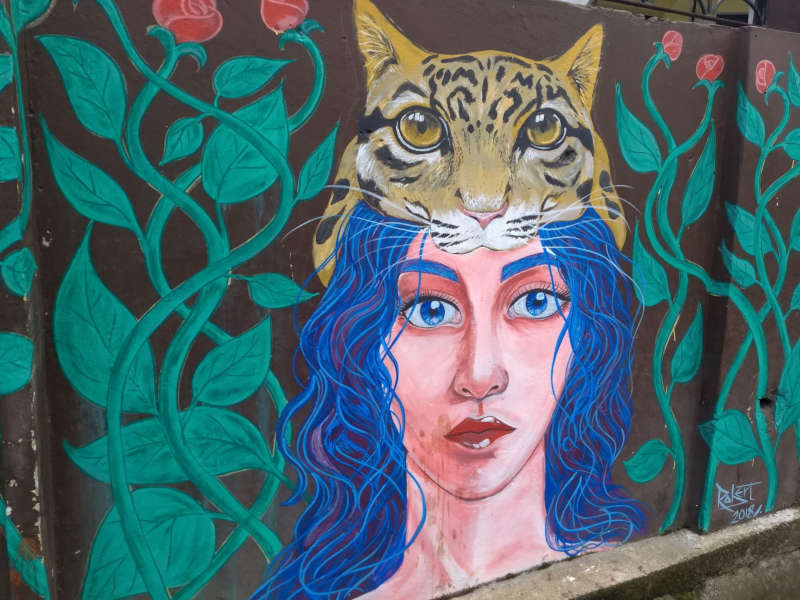
Lachumiere wall paintings: In Lachumiere neighbourhood in the centre of the city, some of the government buildings facades and compound walls have beautiful paintings. I will let the photos do the talking.
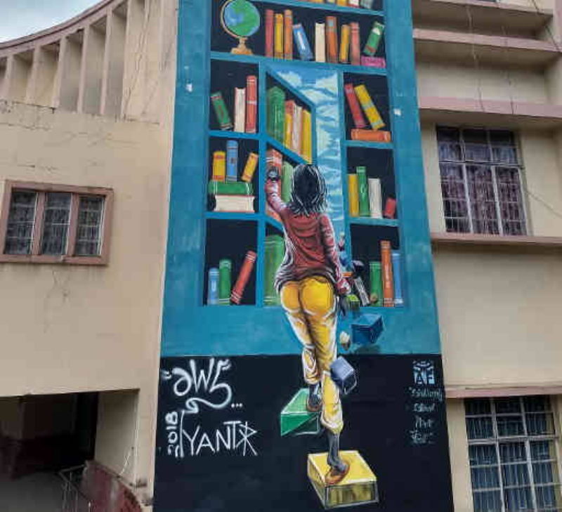
Wall paintings at Lachumiere
Laitumkrah cathedral: This beautifully constructed cathedral is the chief cathedral for the entire state of Meghalaya. People from all over the state gather here for important Christian festivals.

Elephant waterfall: On the highway between Shillong and Sohra, you will come across the entrance to the trail that leads to the Elephant falls. No one really knows with certainty why the falls are named that way. You will hear quite a few stories about it. While you can visit the falls when you are in Shillong, there is nothing extremely beautiful about it and there are better falls around Sohra.
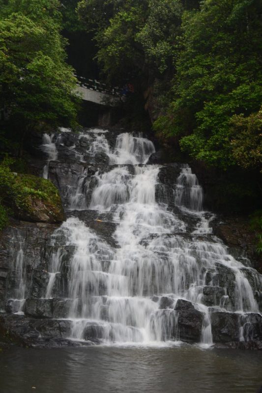
Elephant falls are near Shillong, but are hardly eye-catching compared to really beautiful ones like Nohkalikai or Krang Suri.

Sohra: The town was famous by the name Cherrapunji until a few years ago and used to be the wettest place in the world. The record has been taken over by Mawsynram, also in Khasi Hills. But over the last two years, Agumbe in Karnataka and Mahabaleshwar in Maharashtra have received more rains that Khasi Hills, which has faced a couple of drier monsoons. Sohra is a town where you can stick around for a day or two to explore the nearby destinations, some of which are legendary.

Nohkalikai falls: These falls are near Sohra and can be seen from a viewpoint. The falls plunge from a height and form a clear blue pool at the bottom. There is a way to trek down to the base of the falls, but you’d need a local guide for that.
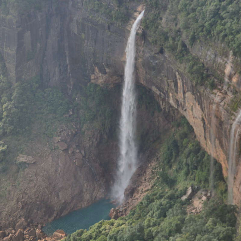
Nohkalikai waterfall near Sohra.

Mawsmai caves: These caves are a teaser for caving in Meghalaya. While it is too short and too touristy, it can serve as a good starting point if you wish to explore more secluded caves in Meghalaya.
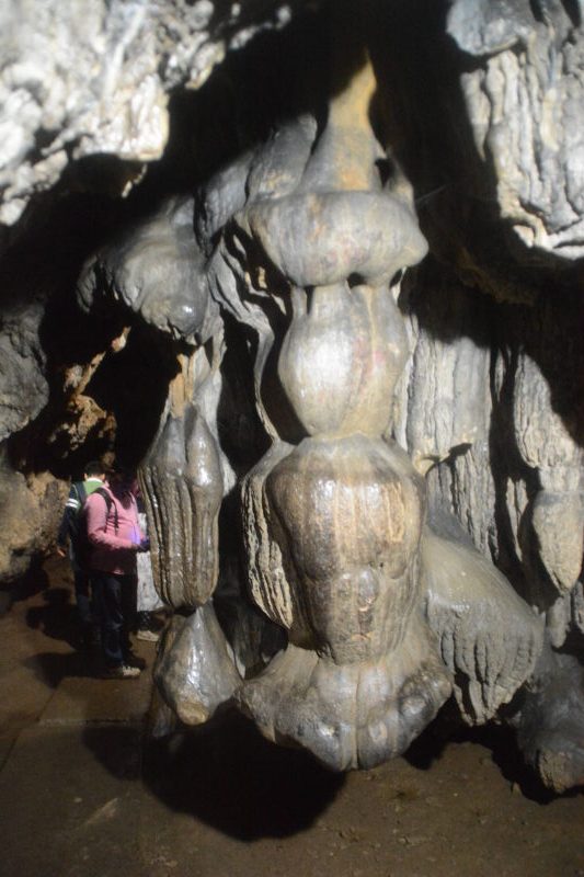
Stalactites inside Mawsmai caves, Sohra.

Nongkriat living root bridges (single and double): In the village of Nongkriat, a trail goes down to the depths of the forest where you can witness something unique to Meghalaya. The roots of trees have been used to build bridges to cross a river. Meghalaya’s most famous landmark is the double-root bridge, where the roots of two trees across the river have been used to build a double-decker bridge, with one bridge slightly above another. We could not cover another destination on the same trail, i.e. Rainbow falls. When we went to Nongkriat, it was raining once every 10 minutes and all the hidden trails were flooded.
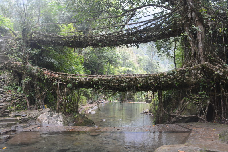
The legendary double decker root bridge of Nongkriat

Kutmadan: Kutmadan is a small village in Sohra district, from where one can literally see the plains of Bangladesh, while standing on a hill top. In fact, if you search for mobile networks on your phone, you will be shown Bangladeshi phone networks, whose towers seem to beam more power to this village. Only certain areas in the village, e.g. the kitchen of a resort where we pitched our tent, are capable of receiving Indian mobile provider signals.
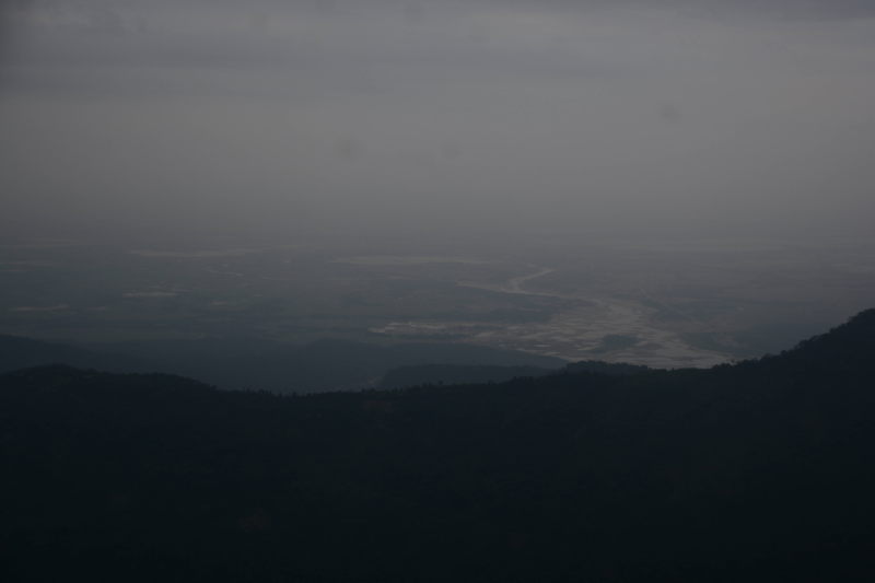
View of the plains of Bangladesh from Kutmadan.

Khasi Hills: Mawlynnong – Dawki

From Sohra, it makes good sense to point your vehicle towards Mawlynnong and then further to Dawki. Here is what we saw along the route.

Mawlynnong: This village is supposedly the cleanest village in Asia. While we definitely saw people working hard to keep the village clean and also teaching their children how to, we definitely cannot be convinced that this is the ONLY clean village in India or even the north-east. We have seen several places which are equally clean despite being more populated. Another disappointing thing is the exorbitantly jacked up prices of the guest houses around the village, which are a result of the ‘clean tag’ and the resulting curious tourism. Many people also find Mawlynnong less crowded than nearby Sohra, especially tourists from abroad, who prefer to use Mawlynnong as a quieter place to stay and use from further travel.
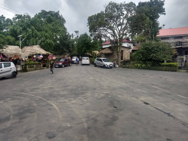
Main village square at Mawlynnong.

That said, Mawlynnong has its own activities such as canopy walk, its own living root bridge and a balancing rock, which is a large rock sitting on a smaller rock with immaculate balance.

Mawshun caves: Mawshun caves were discovered and opened for tourism quite recently (2017). It is in Mawshun village on the highway from Shillong to Dawki. But unlike Maswmai (Sohra), Mawshun attracts few tourists. This is because it takes a nimble body to explore these caves. While Mawsmai has only one narrow passage, Mawshun has a series of narrow passages, where one needs to duck, squeeze and wiggle. The walk inside the cave is conducted by a bunch of Khasi kids who look like secondary school students from lower middle class families. But they speak impeccable English and are experts around the caves. You are given torches, special shoes and helmet to explore the caves, along with one guide.
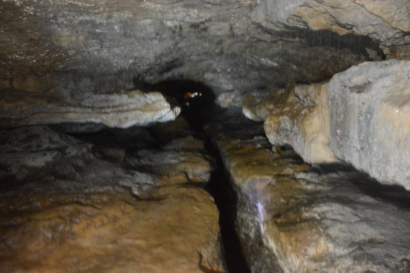
More advanced than the simple Mawsmai caves, the Mawshun caves have tigher crawling, ducking and wiggle spaces! Thankfully, we had our GoPro ready to shoot instead of having to fidget inside our bags while wiggling!

Dawki: Dawki town is on the western bank of Dawki river where it is joined by Goyain river. To the south of the confluence is Bangladesh’s Jaflong town. At Dawki, the river water is so clear that you can see through to the bottom and the boats appear to be floating in the air. There are several lodges in Dawki, but the best way to stay here is river-side camping either with your own tent or through a camping company.
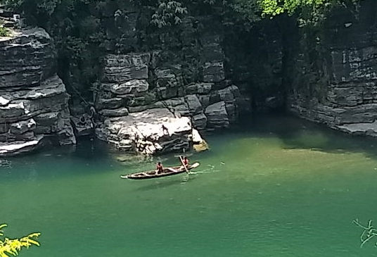
Since the shadow of the boat can be seen so clearly in the water, the boat seems to be floating in the air.

Jaintia Hills: Dawki – Jowai – Khanduli

To the east of Dawki river, the Khasi region ends and Jaintia region starts. The highway crosses from west to the east of the river thus putting you in Jaintia region. But not before passing near Tamabil checkpost. This checkpost is on the border of India and Bangladesh. Trucks carrying goods between India and Bangladesh need to get through customs at this checkpost. As a result, you will see a humungous row of trucks waiting for their turn on the lane of the highway that leads to the checkpoint. The lane that leads towards Jowai is virtually empty. It is amusing to see hundreds of trucks stretching into a line several kilometres long. From the length of the line, we estimated that the last ones would take two days to reach the checkpost!
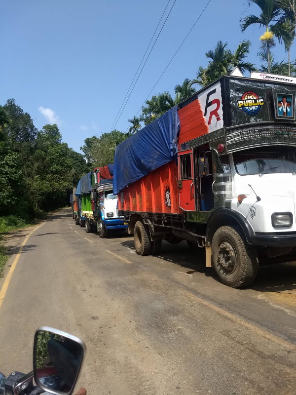
A line of trucks that is kilometres long. Watch our for people who use our lane to overtake the trucks.

Be careful while you drive along this road. Really careful. Since the trucks take up one side of the two-lane road for days together, the traffic bound from Jowai to Dawki can do nothing but stray towards the lane that is used by the Jowai-bound vehicles. Be really careful to avoid head on collisions, especially with local motorbikes who zip along in the wrong direction at really high speeds. There are no dividers on this highway and for once, I have to say that it is with good reason. Otherwise, cars and motorbikes would have to stay behind the trucks for days. But honk away at every blind turn and drive reaaaaallly slow, not exceeding 20 kmph, until you see the last of the trucks. No ego or thrill necessary here. It is your safety at stake.

Jowai: is the principal city of Jaintia Hills. From here a highway goes westward to Shillong airport (the same Shillong bypass road that passes Umiam lake), while we remained on the north-east path towards Nartiang. Jowai is a road-head for several caving and rarely used trekking trails in Jaintia Hills, which are yet to receive the kind of attention they deserve.

Waterfalls, caves and treks: None of which we could cover ( 🙂 ) since all the trekking trails and cave paths were inundated in knee deep water. We were practically laughed at when we asked for trekking information at Jowai town. It felt like asking to see snow in July. We phoned a friend who had visited Meghalaya recently, but he responded that he had seen only Khasi and hadn’t visited Jaintia region at all.

But here are some things you can see if you visit at the right time of the year (October – March): Krang Suri falls, Phe Phe falls, Umlawang caves (the longest mountain caves at 31 kilometres!), Mookhuri falls, Moopun falls, Tipka falls, Kremlabit caves (also 20+ km)….. and many more that are still being discovered!

Nartiang menhirs: This place has a stone-henge like feel to it. Inside a park, we can see several stone menhirs stacked in several shapes. The menhirs are also called ‘monoliths’, since each one is carved out of a single rock. The monoliths are said to be carved by the Hindu rulers of Jaintiapur. Jaintiapur city is now in the plains of Bangladesh, but the region, as you know, is still named Jaintia Hills.
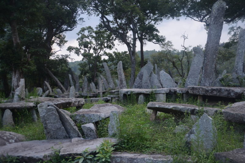
Nartiang menhirs / monoliths, created by the Jaintia rulers.

Conclusion

While we drove through a lot of regularly visited sites in Meghalaya and even some of the not-so driven paths, we couldn’t do justice to the really beautiful state, because we visited in May when monsoon is at one of its fiercest in the state. We would really love to head back here during the last quarter of some year soon. But using this post, you can plan a trip as beautiful as or even better than ours 🙂
post

Travel tips: Driving around India

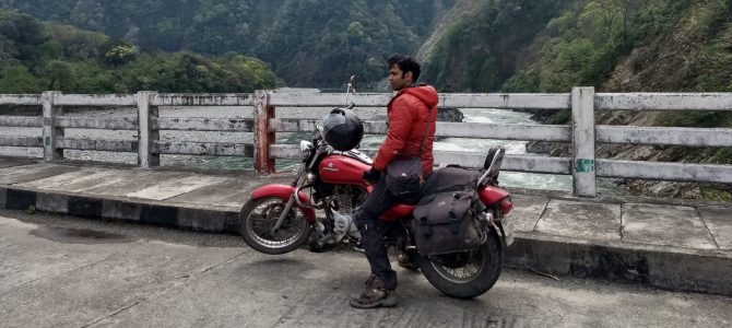
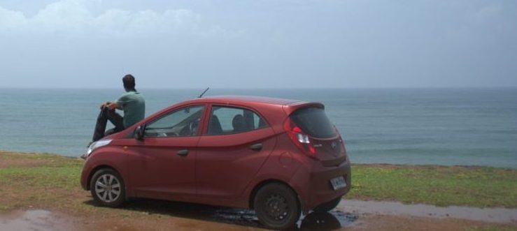
India 360 was a unique trip in terms of modes of transport used. We had three phases in the trip based on the vehicle used. During the first part of the trip, i.e. north Indian Himalayas between April to July 2017, we used public transport. Phase 2 and 3, were covered by car and motorbike respectively. We used our Hyundai EON Magna while driving around peninsular India, i.e. the west coast from Gujarat to Kerala and the east coast from Tamil Nadu to Andhra Pradesh and the Deccan plateau in between. For the phase of our trip that covered eastern and north eastern India, we used our newly purchased second-hand Bajaj Avenger motorcyle. We drove or rode over more than 30,000 km of the country’s roads. So, in this post, we wish to share some things you may already know about driving in India, and some things we learnt by good fortune and from mistakes. We are covering the post in the form of Q&A.

Is it safe to drive / ride around India?

It is never fully safe to ride or drive anywhere in the world. Even Sweden or Denmark aren’t free of road accidents. If you start living your life by avoiding risks, you will end up limiting your options and having less fun. It is reasonably safe to drive around India if you follow safe driving rules, even if the others around you are driving like they have left their brains at home. The fact that we are back from the trip and writing this blog is testimony for our statement. The thousands of motorbike tours and car convoys that have driven around the country will vouch for it and echo our statement too. There are few who haven’t lived to tell the tale, but that is true for road-trippers in every country in the world. We will cover some safe driving tips and tricks in a question in this post.

Which vehicle is the best to drive around the country?

Hari: My favourite is a sturdy motorbike (minimum 150cc). The mileage should be good too. At least 40 kilometres per litre, so that the fear of running out of fuel will not worry you. The wider the tyres, the better. Carrying a two-man tent and a 60 – 70 litre rucksack should suffice for two persons. Royal Enfield purists swear that theirs is the only motorbike capable of travelling comfortably over long distances. But I have made no such observation. Any 150cc+ motorbike does the job pretty well as I have observed for ourselves and for many motorbike travellers we saw along the way. Travelling by motorbike makes you prone to backaches and hence limits how much you can ride per day.

For a more comfortable journey, my favourite would be a compact car of 800 – 1000 cc. Would a car like that tackle the Himalayan roads? Even a 600 cc Tata Nano can ascend the steep slopes with ease on the better roads of Himayalas. That said, any hatchback or sedan with low ground clearance is unsuitable for those HImalayan roads which have atrocious conditions. While, SUV advertisements pitch themselves to be the best for the Himalayas, I have often seen that with their bigger size they keep ducking to the side of the narrow roads while allowing trucks and army vehicles to pass. For Himayalan roads, I feel that motorbikes are a better fit.

Our hatchback, Hyundai EON Magna, is comfortable for long drives, but cannot handle the part of Himalayas with bad roads.

What documents do I need to carry?

The following documents are mandatory and must be available immediately if any traffic cop asks you.

1. Your driving license. Make sure that only a person with a valid driving license is driving the vehicle. A driving license expires every 20 years and must be renewed on expiry. India accepts foreign driving licenses, as long as they are printed in English. If a license is printed in a language other than English, you need to procure an International Driving Permit, which translates the contents of your license into 18 languages, from the transport office that issued your license.
2. Registration book: is a smart card / booklet that assigns an all-India unique number to your vehicle. The number is matched to your vehicle chassis number on an all-India database. The registration number must also be visible on your vehicle on a white-coloured board with black lettering if you are driving your own vehicle. If your vehicle is rented, then it must display yellow letters on a black coloured board. Registration expires every 15 years.
3. Insurance: An insurance policy that covers damage to people and property other than your vehicle and yourself is compulsory and must be renewed every year. This is referred to as a third-party damage insurance. In addition, you can get a comprehensive insurance that also covers damages to your vehicle and medical treatments for you.
4. Pollution Under Control certificate: is a small paper certificate issued by a pollution testing centre to validate that your vehicle’s emissions are within the norms mandated by the transport department. A certificate is valid for only six months and must be renewed twice every year.

How much should one ride everyday?

The first point we lead with is NEVER to ride after 5 pm. By 5 pm, you should be inside a hotel room or at your destination, such as a friend’s or relative’s home. We made exceptions to that rule in familiar cities, but never in places we had no idea about. Driving after dusk throws up a completely new set of probabilities for accidents. Vehicles from the opposite direction drive with beams fully powered, blinding your eyes. People get drunk and return home from bars. Roads are poorly lit and you cannot see much to your front. Rain at night wreaks havoc with visibility and balance. And so on.

On a motorbike, the practical distance to cover each day was between 150 – 200 km for us. Your fitness may give you a different experience. With a car, we even drove 500 km on a single day. Most often, you will not need to cover such distances because you will already be in next town with sight-seeing features and hence, worthy of looking for a lodge. Our average distance driven per day didn’t exceed 100 km. It dropped to a mere 30 km in Goa. Andhra Pradesh and Arunachal Pradesh needed us to drive 200 km every day for multiple days in a row.

How should we schedule fuel stops?

The answer to this question varies by region. In the Indian plains, you are practically assured of a fuel (petrol and diesel ONLY) pump every 25 km. 50 km is the farthest you will travel without finding a pump. It is not a valid assumption if you are driving in the mountainous regions of India, such as the Himayalas, Sahyadris, Niligiris or Araku valley. In those cases, fill up your tank in the most major town in the area before you leave for the mountains. If you are driving a low mileage vehicle such as an Enfield, you may even need to carry a couple of cans of petrol with you.

Fuel types other than petrol and diesel are NOT ready for an all India driving trip yet. There aren’t enough natural gas pumps in India to cover you for a country-wide trip. Taking an electric vehicle for an all India tour is still a dream an some automobile engineer’s drawing board.

How often should we service the vehicle?

Make it a point to service your vehicle as soon as you reach a tier 1 or tier 2 city, e.g. Mumbai, New Delhi, Bengaluru, Chennai, etc. The good points about these cities is that even if you vehicle needs to stay at the service station for a day, the cities have enough alternative transport to let you explore the sight-seeing places. If you have taken your vehicle for a bumpy road over the Himalayas, then take your vehicle in for a service as soon as you reach the nearest town with a service station. If you hear strange sounds in your vehicle, then stop over at the first habitation where you find a mechanic, hoping that they know what they are doing.

What are some safe driving tips throughout India?

1. Only persons with valid driving licenses and sufficient driving experience must drive during the entire trip. An all-India road trip is not the best stage for driving lessons or practice. That should be restricted to the area around your home or in a driving school.
2. Do not ride after dusk. Under no situation.
3. Always slow down at a junction, even if the traffic light shows green for your side. You never know when a ‘smart person’ suddenly decides that he can successfully jump the signal and get away before you have the time to react.
4. Never exceed 80 kmph even on national highways. The thrill isn’t worth the risk.
5. Never exceed 40 kmph on a mountain road.
6. Always switch your headlights on as soon as dusk sets in. Try not to use your headlights on high beam since that hurts others’s eyes. But if the road is poorly lit, then you have no choice.
7. Always make sure that your tyres are at the right pressure. Lower pressure leads to punctures and higher may lead to a burst.
8. Do not drive when your tyre treads are worn out. Get a new tyre or at least a second-hand tyre with treads intact.
9. Do not continue riding your motorbike in heavy rain or snow. You may have to stop for the day at the next habitation if the rain is really heavy and showing no signs of stopping.
10. On a snowed out day, wait for the army to clear the snow and give the go-ahead. In fact, allow a few more experienced motorists to drive ahead of you and follow them. You may need to return and stay put at your hotel while the army clears the snow. There is no point waiting right where the army is clearing the road. It may impede their progress.
11. During heavy rain, close the windows of your car and switch the air conditioner on even if at a low cooling setting. This will prevent your front windshield from fogging your breath and forming patches through which you can’t see. Do not drive your car in snow.
12. Always assume that the person driving in front of you can take a turn across your path without signalling to you. Anticipate it, slow down and keep your distance.
13. Due to point 12, before you attempt to overtake a vehicle, pause for at least three seconds and drive at the same speed as the vehicle at least 10 metres behind it to check if that vehicle won’t do something you don’t expect it to, e.g. a sudden stop, a sudden turn across your path, a sudden change of lane, etc. If something were to happen even if technically it’s their fault, your vehicle and you will also suffer damage and injury.
14. Always be wary of rickshaw drivers, poorly driving two wheelers and poorly riding bicyclists. If your instinct tells you that one of them is about to do something unexpected, then your instinct is usually spot on.
15. Crossing cattle is a nightmare in India. It deserves it own question.

How do I deal with cattle crossing the road?

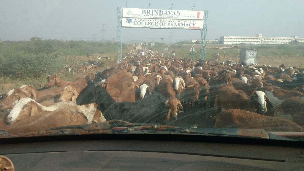
A huge herd of goats blocked us on the way to Kurnool, Andhra Pradesh. We had to switch our car off and wait for 10 minutes to let them clear.

Here’s how different types of cattle behave. These are our observations throughout India and not empirically proven facts. I hope to give you a heads up based on our experience.

#1. Bovines (Cows & buffaloes): Never attempt to cross a bovine in front of it. Bovines stop and start moving several times while crossing. You cannot predict their speed or forward movement reliably. A good thing about bovines is that they never walk backwards or retrace their paths. If a bovine is in the middle of the road with enough space for you to drive around it, that’s what you should do. But behind the animal, not in front of it. A sitting bovine ignores all the vehicles without a care in the world. A reasonable assumption is that it won’t get up for your vehicle and will continue to hog the road. You can safely drive around it in any direction.
#2. Dogs, cats, roosters: The problem with these three creatures is that they appear to cross the road confidently, but panic on seeing your vehicle and retrace their path. You will be thoroughly confused about which way to swerve to avoid hitting them. It’s best to slow down a few metres in front of their path, even come to a stop, so that they cross without panic.
#3. Goat and sheep: Goat and sheep have a strange panic habit. On seeing you, they run in the same direction as your vehicle, trying to outrun your horsepower to get away from you. Like category #2, it is best to slow down or stop to let them ease off the road.
#4. Wild life! I am talking about big cats and even elephants. Yes, it does happen in India. Wild felines and elephants routinely cross national highways and surprise motorists. Call us lucky not to have encountered such a thing. Or perhaps unlucky not to enjoy such a sighting. This tip comes from forest rangers and trackers. On a four-wheeler you should roll up all your windows and start reversing slowly, carefully not to rev your engine so hard that it sounds like a growling threat to the animal. On a motorbike, kill the engine and don’t move if the animal hasn’t spotted you or doesn’t care about your existence. A revving engine might imitate growling, so better not to engage the animal. I have no tips to offer you if the animal spots you and doesn’t seem pleased. Just pray!

What if my vehicle breaks down?

On many national highways in India, the various numbers for road assistance are printed on highway signs. Your vehicle manufacturer’s manual mentions their highway assistance number too. In remote places like the north-east, the local truck drivers are nice enough to give your motorbike and you a ride to the nearest garage. In remote places like mountains, you many need to wait endlessly and patiently for help to arrive. Your best bet is to prevent a breakdown by servicing your vehicle regularly.

Would you recommend travelling in groups of vehicles?

It depends on your preference. Riding with groups is safer and problems can be handled together. But the slowest member of the group dictates the speed of the trip. This is something you will have to get used to. Also, it is easier to assemble groups for dedicated routes like Manali – Leh over a short duration such as a week to three weeks. It’s unlikely that anyone would take kindly to a year-long plan for driving all around India, since that requires a lot of decision making over career, finance and time spent.

Conclusion

Driving around India sounds thrilling and intimidating at the same time. Some doubts are common and hopefully we have addressed them in today’s post. Whatever your inhibitions, do not back out of a road trip around India due to doubt and uncertainty, since that decision may come back to haunt you on an opportunity missed.

post

City Focus: Majuli, Assam

The title of this post is misleading when it says, ‘City Focus’. Instead, we are going to focus on a unique village that has settled on the largest river island in the world.  We will also see the unique Satra culture of Majuli’s settlement and why Majuli is perfect getaway for a day or two. Majuli holds a special place in our hearts, because we celebrated 3 years of our marriage on this island. Continue reading

post

Listicle: 7 cultural festivals we enjoyed around India

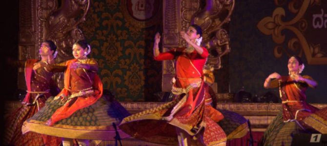
India is a large country and each region has its own culture, mostly manifesting in the form of stories, songs, dance, food and art. As Indians, it is impossible for us to know about the culture of each state or even every district in the country. Cultural festivals that happen at different places in the country give us a glimpse into the culture, either from different regions in the country (e.g. Kala Ghoda, Mumbai) or just what is local to the region (Margazhi Utsavam, Chennai). Thousands of festivals happen in India. But we managed to catch some interesting festivals around the country, some of them in places we’d never heard of before. Here are the ones we attended along with the time of the year, so that you too can plan to attend them someday. Continue reading

post

City Focus: Mussourie, Uttarakhand

While Uttarakhand, especially Garhwal region, is known for its holy destinations, such as river-side temples, river origin temples and Kshetras dedicated to Lord Shiva (hence referred to as Dev Bhoomi or Shivalik), there is one town which exhibits lot of British character. That’s because it indeed was built and inhabited by the British. In fact, an author of famous childrens’ books, who was born in India but is of British descent, Ruskin Bond, lives at this charming hill station. We are talking about Mussoorie in Dehradun district. Continue reading

post

How we covered it: Konkan, Maharashtra

When imagining holidays, it is common to put yourself on a shack on a quiet beach. At nearly 700 km, Maharashtra state has one of the longest coastlines in the entire country. The coastline is dotted with several beaches, both popular and secluded. But that’s not all. Maharashtra is probably one of the few states in India which has several forts, many belonging to Marathas, but some built by other rulers such as Bahamanis, Siddhis and Portuguese. Coastal Maharashtra (or Konkan as it’s called locally) is not plain. It is a series of flat beach strips interspersed by hill ranges. There are many vistas where you will see the sea waves crashing into the base of hills. To complete your enjoyment, Konkani food is extremely delicious. In this post, we will tell you about how we covered Konkan region, its beaches and its many sights worth visiting. Continue reading

post

Travel tips: Being really present in your trip

Travel is all about exploring new places and meeting new people. It is also a way to discover yourself. You will often come across a form of yourself that you have never been able to meet in your day-to-day routine. To be fully attuned to yourself and to the places and people around you, you need to fully mindful in your travel. You should be truly present in every place and with everyone. Your physical presence at a place, but with your mind elsewhere is one of the worst ways to experience travel. If you travel for a long time, you will occasionally come across problems that will make your mind drift. But otherwise, you should be ready to receive every new experience with full attention. Sleepwalking through travel is the worst thing you can do to yourself. You deserve a good trip and a great experience, one to remember and feel in your veins forever. This post tells you simple tips to cultivate presence and mindfulness in your trip. Continue reading

post

District Focus: Coorg, Karnataka

Filter coffee is a favourite beverage in two states in India. Tamil Nadu is the highest consumer of coffee. But the consumption is not matched by the production. Another state, Karnataka, produces far more coffee beans than Tamil Nadu does. The hilly and forested district of Coorg produces more coffee than any other region in India. Apart from coffee plantations, Coorg has so many things to see. In this post, we will see what makes Coorg a great destination for your next travel.

Geography of Coorg

The name Coorg is British. The original name of the district is Kodagu. The headquarters of the district is at Madikeri or Mercara. Coorg is a land-locked district and is bordered on three sides by districts of Karnataka. The Dakshina Kannada district is to the north of Coorg. Mysuru district is to both the east and the south. To the west, Coorg is bordered by the Kasaragod and Kannur districts of Kerala.

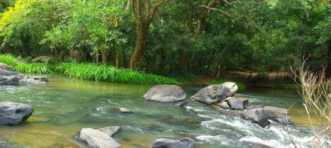
Cauvery river that flows through south Karnataka and central Tamil Nadu starts at Tala Kaveri in Coorg district. The river is a major part of Coorg and features several eco-parks and other landmarks along the river side. There are also several waterfalls that form smaller rivers joining Cauvery.

Other than urban areas like Madikeri and Somawarapeta, the rest of Coorg is covered in evergreen forests of the western Ghats. This makes for a great wildlife preservation opportunity. Promptly, the Karnataka government has a tiger reserve at Nagarahole, a reserved forest at the border of Coorg and Kerala.

People of Coorg

The natives of Coorg are classified as tribals and speak Kodava language. Nearly all of them are fluent in the state language Kannada, while a handful of them have also learnt the language of Dakshina Kannada, i.e. Tulu. Malayalam and Tamil are also spoken by the people in the southern part of the district. Hindi is spoken sparingly, mostly by the people related to the tourism industry.

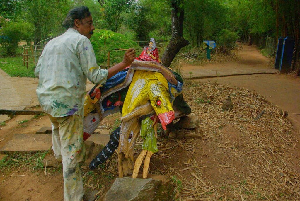
A Kodava (native of Coorg) using the contours of a tree stump to turn it into a work of art.

The people of Coorg are mostly farmers, with coffee being the most commonly grown crop. Industries related to agriculture makes up the majority of occupations in Coorg. Tourism is also a big industry in Coorg. While the district was a getaway for the people from Mangaluru, Bengaluru and Mysuru in the past, these days people from around India have discovered the charms of Coorg and have made it a must-see destination.

Here are the most interesting things to see in Coorg district

Nisargadhama eco park

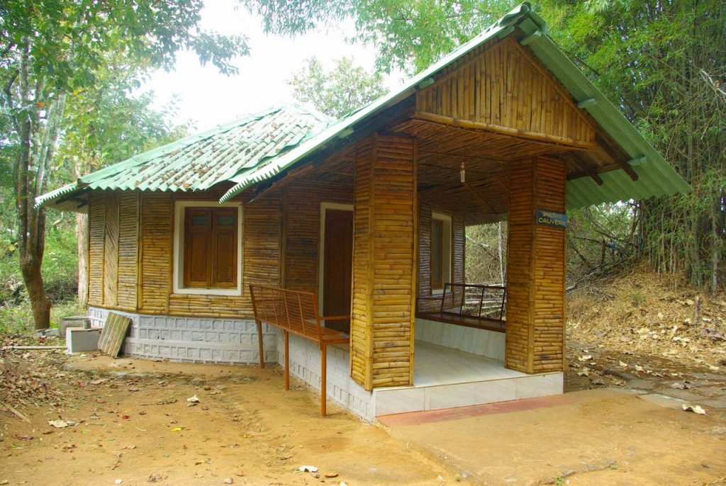
Forest cottage at Nisargadhama

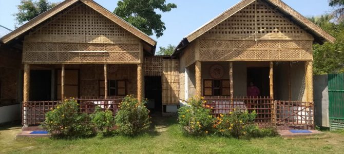
Driving from the Mysuru-side, Nisargadhama is one of the first places you’ll reach. Nisargadhama is an eco park on the bank of Cauvery river. It features bamboo plantations, walking trails, elephant ride, tree houses and cottages that can be booked for overnight stay. It is relaxing to walk along one of the trails that are parallel to the river. The town nearest to Nisargadhama is Kushalanagara.

Tala Kaveri

Tala Kaveri is worshipped as the source of Cauvery river. There is a temple dedicated to Goddess Kaveri. Tala Kaveri can be reached from Coorg’s headquarters Madikeri.

Harangi dam

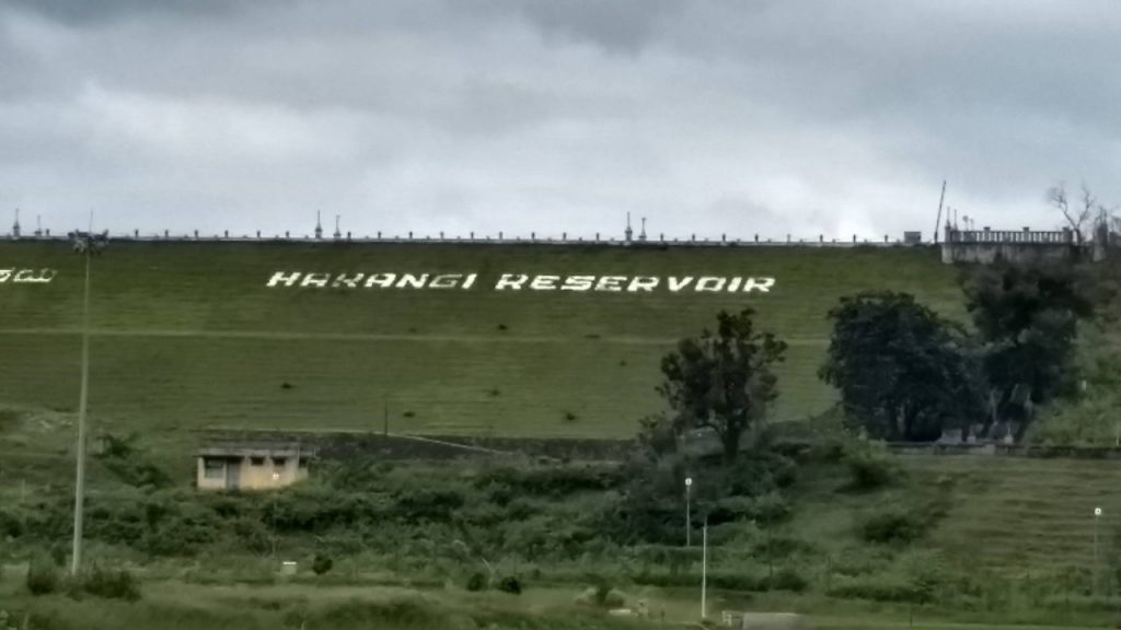
Harangi dam is the first dam along the course of the Cauvery river.

Harangi is the first dam along Cauvery river’s path. It is to the east of Tala Kaveri. The dam features an eco-park and a few walking trails. Harangi can be easily reached from Kushalanagara.

Dubare elephant camp

Also near Kushalanagara, Dubare elephant camp is an elephant training camp by the riverside. The camp also features a resort where one can stay overnight. Activities in the area include watching trainers work with the elephants and taking coracle rides in the river. The elephants at Dubare get to enjoy one special occasion every year, which is to take part in the Navratri procession in Mysuru.

Namdroling monastery

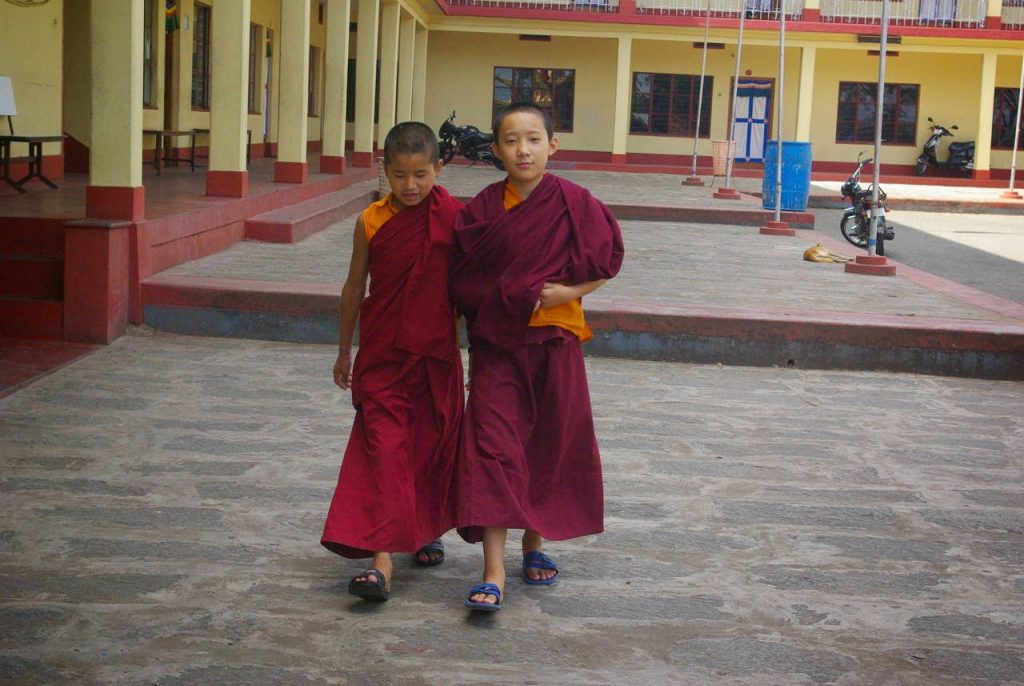
Young monks at Namdroling monastery, Bylakuppe.

In the village of Bylakuppe near Kushalanagara, we can visit the Buddhist monastery Namdroling. It is one of the biggest Buddist teaching centres in India, with 5000 lamas (male and female), living in the monastery. The monastery was started by those on exile from Tibet, as the government of India gave them a various parcels of land for their refuge, one of them being in the forests near Cauvery river.

Waterfalls

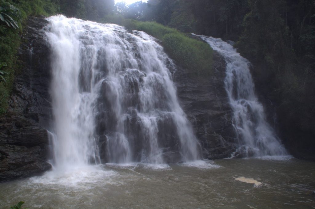
Abbe falls, Coorg

There are four waterfalls worth enjoying in Coorg district. Abbey waterfalls is very close to Madikeri town. This is also the most popular and crowded waterfall. The Abbey falls are enclosed inside an eco-park with entrance fees and can be reached by taking a staircase. The falls can be seen from a viewing platform.

Chelavara waterfall, Coorg

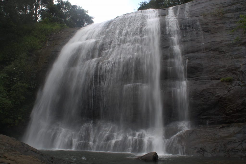
The second waterfall, Chelavara, is on the Ghat road descending from Madikeri towards Mangaluru. This waterfall is quite obscure and you won’t find many visitors here. In fact, people who drive from Bengaluru and Mysuru completely miss this beautiful spot. Only those who drive from Mangaluru or Udupi get to see this fall since it is on their way. In contrast to Abbey, you won’t find any complex with entrance fees, staircase or viewing platforms. You need to park your vehicle on the shoulder of the highway and tip toe your way through a very short forest trail to reach the fall.

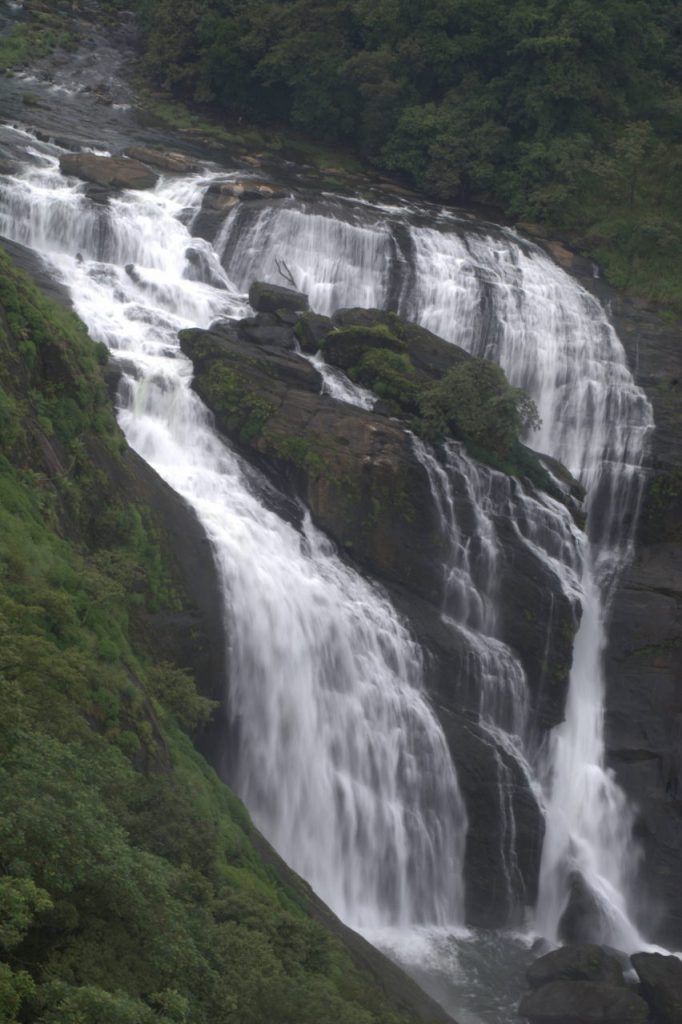
Stunning view of Mallalli waterfall, Coorg.

The most spectacular waterfall is Mallalli. This waterfall is on the highway that goes from Madikeri to Hassan and is at the northern end of Coorg district. There are two views for the waterfall. The first is from the entry to the hiking trail. From here you can see the falls from a point above it. It takes a small hike downhill to reach the base of the waterfall, which is another way to view the fall.

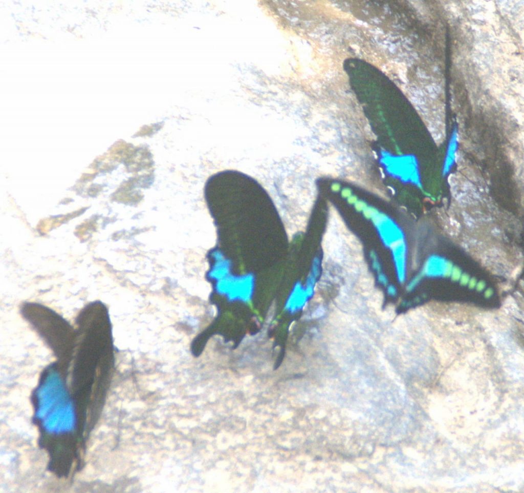
There are several of these butterflies, known as Blue flutter, near Irpu waterfall.

Irpu waterfall is on the border of Karnataka and Kerala. It is part of the Brahmagiri / Aralam forest reserve. Irpu waterfall can be reached by taking the Madikeri – Nagarahole road. Irpu waterfall area is known for its colourful butterflies.

Nagarahole forest reserve

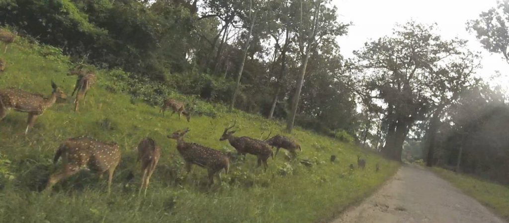
Spotted deer while driving through Nagarahole reserve forest.

There are two ways to enjoy the Nagarahole reserve. The first way is to take a canter / jeep safari for a fee early in the morning. The canter / jeep rides will take you through forest trails inside the forest where your own vehicle cannot reach. This is usually a good way to spot animals that are deeper in the wild, e.g. tigers, wild elephants, gaurs, etc. One more way to explore Nagarahole is to simply use the tar road inside the reserve to travel from here to Hunsur in Mysuru district. Of course, this drive is free of cost, only requiring that you enter your name and vehicle registration number at the forest gate near Kutta village. You cannot use your vehicle to go into forest trails. But even from the tar road, you have guaranteed sighting of spotted deer, langurs, wild goats, boars and a variety of birds.

Raja’s seat

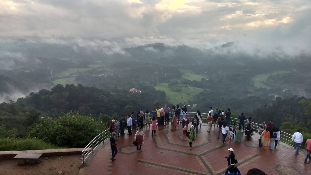
Sunset viewpoint at Raja’s seat park

Raja’s seat is a park built by Raja Doddaveerarajendra of Kodagu. The park is so named because of a special seating chamber that he prepared for himself. The seating chamber overlooks the beautiful view of the Ghats of Coorg that ascend from Dakshina Kannada side. There is a better place to enjoy this view though. At one end of the park is a railing that gives you a clear view of the afore-mentioned view. The view is especially spectacular during monsoon.

Apart from the view, the Raja’s seat park has flower beds, lawns, walking paths and fountains.

Madikeri fort

While it served as a fortress for the rulers of Coorg, the Madikeri fort today is a museum that exhibits some artefacts from around Coorg. Of special importance is a chamber dedicated to two army heroes, both of whom are from Coorg district: General Thimayya and Field Marshal Cariappa. Both of them were instrumental in monumental moments for the Indian Army. Field Marshal Cariappa formed the structure of the Indian Army after India received independence. The unification of several princely states, especially the defying Hyderabad, between 1947 – 1950 was effective due to Cariappa. He can be attributed as the one who made the slogan ‘Jai Hind’ official for the Indian Army. General Thimayya was instrumental in India winning the 1962 Indo-China war and the Indo-Pak wars in 1965 and 1971.

Gaddige / Raja’s tomb

The citadel of Madikeri fort, now a museum

Gadige monument is at the northern end of Madikeri town. It features two twin Hindu memorials built partly in Muslim style, especially the dome. The memorials belong to Raja Doddaveerarajendra and Lingarajendra, There is a smaller tomb for the royal priest Rudrappa.

Coffee estate home stay

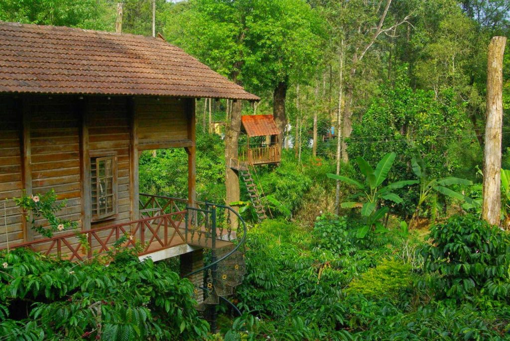
Home stay in Coorg

Staying in a coffee estate home stay is a unique experience in Coorg. There are several estates. The ones near Madikeri are usually booked quite soon. You should look for estates near Kushala Nagara or Suntikoppa. These areas are less crowded and may offer deals on their estate homestays. Homestay hunting in Coorg is unorganised. Many of the best homestays are in secluded villages with little public transport and you may have to walk / drive a lot to find the best ones. If it is your first time to Coorg or you don’t have time to explore homestays on your own, then you can use a tour operator to book a stay. Alternatively, you can check sites like Make My Trip or Clear Trip for deals online. Not many homestays have a listing online, but you can still find some really good ones. From the Internet, we found a great stay called Forest Flower on a village road forking off the main highway between Suntikoppa and Madikeri. There was no traffic on this road and the ambience at the estate was very peaceful.

What to eat

Home made chocolates: In Coorg, you will find several shops with home-made white, brown and dark chocolates. There are even chocolates with mixed flavours such as pista, orange, apricot and fig. Indulging in good quality home made chocolate is a fun experience in Coorg.

Oranges: Like Nagpur, Coorg has its own variety of oranges that are easy to peel, aromatic and tangy. The oranges are very seasonal and are available after November.

Filter coffee: Coorg is the home of filter coffee and you should give in to your caffeine cravings while you are here. In fact, Amalgamations group, the company that owns Cafe Coffee Day, sources all of its coffee beans from a variety of plantations in Coorg district. They own some plantations, while at the same time they also have contracts with others’s plantations.

What to buy

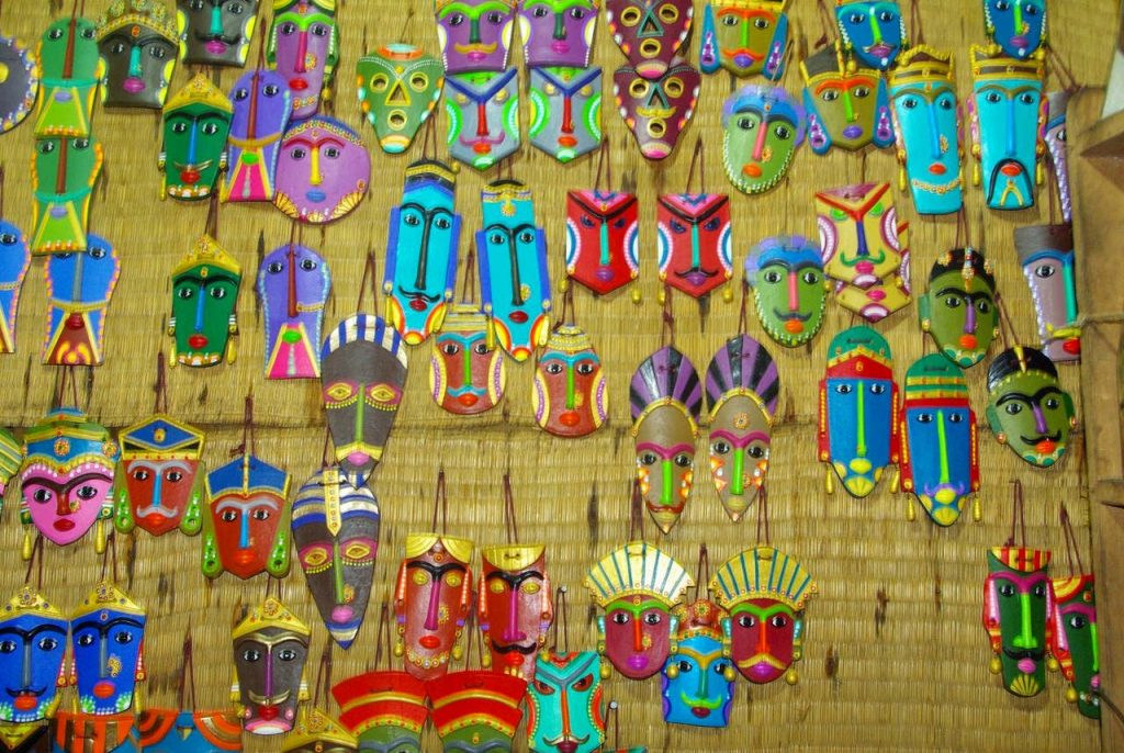
Coorg clay masks

Coffee: The most obvious choice is coffee beans or roasted coffee powder. While at it, you can also purchase a decoction filter vessel or a French press, which are necessary to make concentrated coffee decoction from roasted beans or powder.

Home-made chocolate: We have already spoken about this from the last paragraph.

Spices and essential oils: These two product categories are common and abundant in good quality across all the hill stations in the Western Ghats of south India, be it in Karnataka, Kerala or Tamil Nadu.

Honey: Coorg is home to several apiaries and you can get different types of honey drawn by different breeds of bees from different forest flowers.

Fruit wine: There are no grapes in Coorg, but the locals use different fruits to make wines. We tried a wine made of passion fruit.

Clay handicrafts: There are several types of tiny handicrafts made of baked clay. Coorg masks are quite popular.

Getting to Coorg

Coorg is not connected by air or rail. You need to disembark at nearby cities and continue in road transport, which is the only form of transport available in the district.

Here are the options.

Air: The nearest airports are Mysuru and Mangaluru. From both cities, you can take a Karnataka Saarige (Karnataka State Transport Bus) to Madikeri or Kushala Nagara.

Rail: The nearest railway stations are Mysuru, Hassan and Mangaluru. Madikere or Kushala Nagara can be reached through Karnataka Saarige.

Road public transport: Bengaluru – Coorg buses use the highway Bengaluru – Madduru – Mysuru – Hunsur – Kushala Nagara – Madikeri. So you can take a state bus from Bengaluru / Mysuru. From coastal Karnataka, buses are available from Mangaluru and Udupi. If you are travelling from interior Karnataka, e.g. from Chikkamagaluru or Shivamogga, then there are buses available from those cities and they take the highway via Hassan.

Self-drive: Following highways lead to Coorg district.
Bengaluru – Madduru – Mysuru – Hunsur – Kushala Nagara – Suntikoppa – Madikeri. This highway is the best if you are travelling from Tamil Nadu, Andhra Pradesh, Telangana, interior Maharashtra and also the rest of India. This is most commonly used route to reach Coorg. You will need to drive on this highway anyway if you intend to cover Nisargadhama, Harangi dam, Dubare elephant camp or Namdroling monastery.
Shivamogga – Bhadravati – Chikkamagaluru – Belur – Hassan – Gorur – Arakalagudu – Shanivarasanthe – Somawarapete – Madikeri. This route is the best if you are driving from Belgaum, Bijapur, Davanagere, Shivamogga or Chikkamagaluru. Mallalli waterfall is situated on this route.
Kasargod –  Subramanya – Sampaje – Madikeri or Kannur – Taliparamba – Iritty – Kunnoth – Virajapete – Madikeri are two routes you can use if you are driving from Kerala. The second route is close to Nagarahole and Irpu waterfall.
Mangaluru – Putturu – Subramanya – Sampaje – Madikeri is a route you should follow if you are driving from coastal Maharashtra, Goa or coastal Karnataka. This route in our opinion is the most beautiful since it involves ascending a Ghat from sea level to about 3800 feet and involves many beautiful waterfalls, valley views and hairpin bends along the way. The Chelavara waterfall is on this route.

Getting around Coorg

Your personal vehicle is the best option around the remote places in Coorg. Buses only cover the main highways, i.e. to Mysuru, Hassan and Mangaluru. Places like Dubare camp and Namdroling monastery are tucked away in little hamlets off the highway. So are places like Mallalli fall. If you were to use mass transport, you can only cover Nisargadhama and Abbey fall.

Taxis and auto rickshaws are available within the towns and villages of Coorg, but you will realise that your expenses shoot up very fast if you intend a comprehensive coverage of the district like ours.

Conclusion

Nestled in the Western Ghats and caressed by Cauvery river, Coorg is a district that is worth a visit and stay of at least 2 nights. You can stretch your trip for upto a week, keeping 3 days for sight-seeing and another 3 just to laze in a coffee estate homestay. You will come away from Coorg’s forests and streams completely recharged.