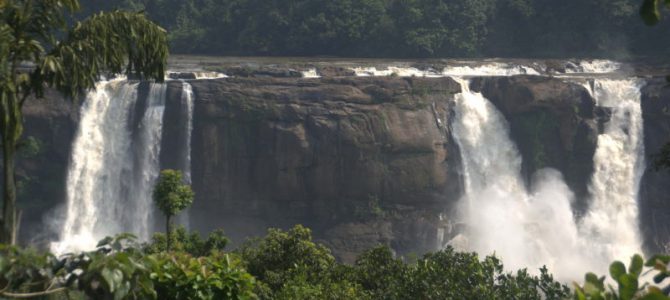
The Sholayar river is not very heard of. It is just a river confined to a very small region that forms the border of Tamil Nadu and Kerala. The river doesn’t even called by the same name in the two states. It is Sholayar in Tamil Nadu and Chalakudy in Kerala. The route that this river follows is not as forgettable as the river itself. From the lake that forms the source of the river all the way upto the place where it flowly calmly into the plains of Kerala, it has so many wonders to see. You can follow the flow of this river as you start from Valparai, a non-touristy hill station in the Western Ghats to Tamil Nadu, to Chalakudy, the town in Thrissur district, where the Western Ghats end and the plains of Kerala start.
Upper Sholayar dam
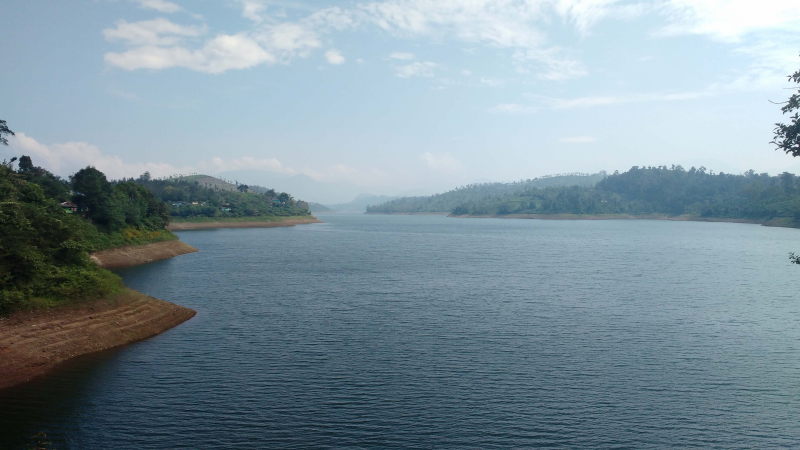
Upper Sholayar near Valparai, Tamil Nadu
After exiting Valparai in Tamil Nadu, we reach the Upper Sholayar dam. This is where the Sholayar river starts. The dam is surrounded by the hills of the Western Ghats. Unlike a lot of other dams, this one does not have any look out points, vendors selling food or any tourist information. We just drive by the lake of the dam on our way to Kerala. The village at the bank of the lake is small & residential, with no attempt to turn this place into a tourist hub. It is just the village and its people living with nature.
Malakkappara check point
At the place, where we cross the border from Tamil Nadu to Kerala, there is a forest checkpost where we need pay a small fee and enter the details of our vehicle. Beyond this point, we can see a visible change in the thickness of the forest. Malakkappara is an excellent place to spot rare birds. We have some photos from friends who have even spotted hornbills here.
Lower Sholayar dam
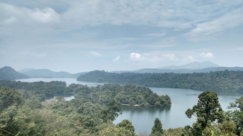
Lower Sholayar dam near Malakkapara
While Upper Sholayar dam is near the main road and with a village on its bank, the Lower Sholayar dam is in the middle of the forest, with the main road passing at a distance from it and at a higher ground. We need to take a detour on an obscure and narrow road to read the shore of the lake. That road is mostly used by the staff who work at the dam. There are no villages around the lake, so there aren’t any locals either. The view to the lake from the main road is very beautiful. It is not officially a viewpoint, but because the tree line clears for a while, you get a view of the valley.
Peringalkuthu dam
The flow of the river upto Peringalkuthu is rapid as the Western Ghats have a steep descent. But beyond the Peringalkuthu dam, there are sheer cliffs off which the river has to drop. This leads to a series of waterfalls all the way to the plains of Kerala. The lake formed by the Peringalkuthu dam can also be seen from the highway, which now passes through a series of tight curves and hairpin bends.
Vazhachal waterfall
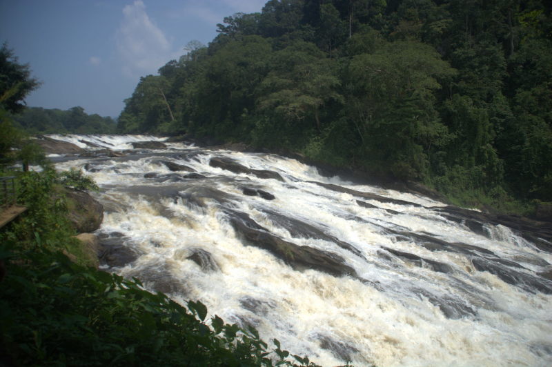
Vazhachal waterfall is more like a very thick stream
This is the first of the three waterfalls that come in quick succession as we descend the Western Ghats and hit the plains of Thrissur district. Vazhachal is one of the two waterfalls that have a park with entry fees. Thankfully, you can purchase a single ticket to access both the parks. People from Tamil Nadu side will usually buy a ticket a Vazhachal, whereas those from Kerala would usually reach the other falls first and buy a ticket there. Vazhachal is more like a really thick stream than a waterfall. There is no dramatic plunge, but rather a place where the slope is at a 45-degree angle and the water flows with a lot of rapids.
Charpa waterfall
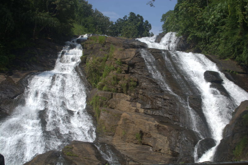
Charpa waterfall
After leaving the Vazhachal park complex and heading downhill, you will see a waterfall right on the side of the highway. This is the Charpa waterfall. The waterfall has two streams coming from the top of a hill and falling parallely into a pool by the side of the highway. A duct passes underneath the highway and channels the water into the river, without flooding the highway.
Athirapally waterfall
In this entire route, Athirapally waterfall is the stand-out destination. While we see secluded destinations at the Tamil Nadu end of the route, Athirapally is where there is a thick rush of tourists. Finding a parking spot is difficult as the highway is narrow and you may need to drive quite a distance to find a spot. There is no official parking spot in the park itself, because the entire terrain is sloping.
Why is Athirapally so popular? Because the waterfall is spectacular. A wide cascade of water 100 metres in width (333 feet) drops 50 metres (166 feet) into the valley below. The volume of water is so much and the impact on the ground below so hard that there is always a misty spray of water towards the view point at the base of the waterfall.
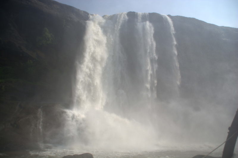
Athirapally waterfall
So spectacular is the waterfall that it has caught the fancy of film industries in the south and also Bollywood. Kamal Hassan starrer Punngai Mannan shows the waterfall at the start and also at the end of the move. Raavan, which was shot and dubbed in multiple languages, and has Vikram / Abhishek Bacchan with Aishwarya Rai also features the fall.
In the park adjoining Athirapally fall, with luck, one can find Malabar species like the bushy Malabar squirrel, civet and macaques.
Plains of Thrissur district
After the ferocity of Athirapally fall, the river calms down as it flows through the plains. The road runs parallel to the river upto Chalakudy town. From here this road joins the Bengaluru – Dharmapuri – Erode – Coimbatore – Palghat – Thrissur – Kochi national highway at Pudukkad, 13 km from Thrissur city.
Conclusion
Self-driven road trips in India are in themselves as much a joy as being at fabulous destinations. But if that route is not frequented by too many tourists, then the joy is more since all the views are pristine. The route between Valparai and Thrissur is one such pristine route where urban development is sparse, people are few and time seems to stand still as you can listen to sounds from nature.

