Maharashtra is not a particularly appealing destination during summer. But during the other two seasons, travellers have abundant options in all corners of the state. The effects of monsoon and winter on Maharashtra are worlds apart. Between June to September, the monsoon magic casts its spell on the state, but the best effects are towards the west. The cool and pleasant winters are great for visiting interior Maharashtra districts like Aurangabad, Solapur, Nagpur and Chandrapur. it is also the best time to stick to the coast for all the secluded and gorgeous beaches.
Our plan around Maharashtra
Our coverage of Maharashtra was in three parts.
- A monsoon phase in July 2017, when we drove across each of the Ghat roads between Konkan and Deccan (we’ll see what they are soon).
- Konkan coast in September 2017
- Marathwada and Vidarbha, covering Mumbai – Aurangabad – Nagpur in February 2018.
We covered our route map around Kerala in a single post, but that is not possible for a gigantic state like Maharashtra. We will cover just one, our route around the Ghats, in this post. We promise that there will be two follow-up posts later to cover Konkan, Marathwada and Vidarbha in the coming months.
Geography of Maharashtra’s Ghats
Western Maharashtra is divided into 3 distinct regions: Konkan coast, Sahyadri hills and Deccan plateau.
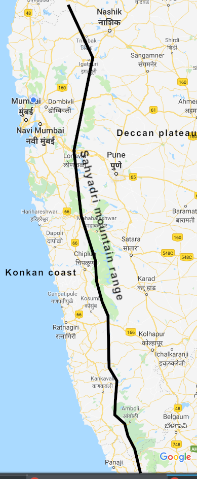
Geography of western Maharashtra
Adjoining the Arabian sea is the 720 km coastline of Maharashtra. Beaches, cities, forts and sea temples are plentiful in number to be explored along the coastline. There are six district in the Konkan region: Palghar, Thane, Mumbai, Raigad, Ratnagiri and Sindhudurg. We will cover the Konkan coast in more detail later. To the west of the Konkan coast is the vast expanse of the Arabian sea, the next landmass directly in the Gulf.
Standing tall to the east of Konkan is a range of mountains called the Sahyadri. The Sahyadris are part of the Western Ghat range that starts in Dang district of Gujarat and continues all the way to Anaimudi peak in Kerala. Throughout the western coast of India, the western Ghats flank the coastal plains between 75 – 100 km inland.
To the east of Sahyadris is a flat expanse of land elevated above the Konkan coast in altitude but lower than the mountains themselves. This flat plateau covers all of peninsular India and is known by different names in different cities. It is called Deccan in both Maharashtra and Telangana, while the name Rayalaseema is used in Andhra Pradesh. India’s top non-coastal peninsular cities lie on the Deccan plateau. In Maharashtra, the important Deccan cities are Pune, Nashik, Kolhapur, Ahmednagar and Solapur. Other important Deccan cities are Hyderabad, Bengaluru, Mysuru and Coimbatore.
How you can use this geography
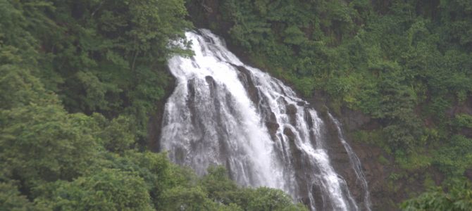
A series of highways lace across the Sahyadri mountains connecting Konkan to Deccan. These are called Ghats or passes. The Ghats are their very best during the 4-month monsoon, because they get bathed in between 3000 to 5000 mm of rain over 120 days. The Ghats are spread all the way from the border of Gujarat to the southern border with Goa and Karnataka. The rains make the landscape extremely beautiful with greenery, waterfalls and streams everywhere. Lakes and rivers swell, small or non-existent streams turn to thick waterfalls, and vegetation gathers colour. Since the Ghats are only 100 – 120 km from the nearest coastal city, you can experience the thrill of a rapidly dramatic change in landscape and weather as you go from beach to a 4000-feet peak in 2 hours.

Our used route between Kasara Ghat and Varandha Ghat
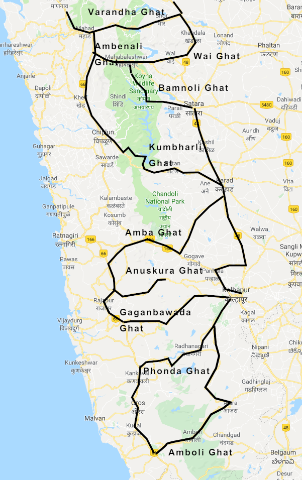
Our used routes between Varandha Ghat and Amboli Ghat
There are 15 Ghats criss-crossing Konkan and Deccan via the Sahyadris. One of your itineraries in the state should be to explore by driving along each of the Ghat roads, and using the chance to see viewpoints, trek to forts, see historic cities and enjoy local food.
The Ghats between Konkan and Deccan
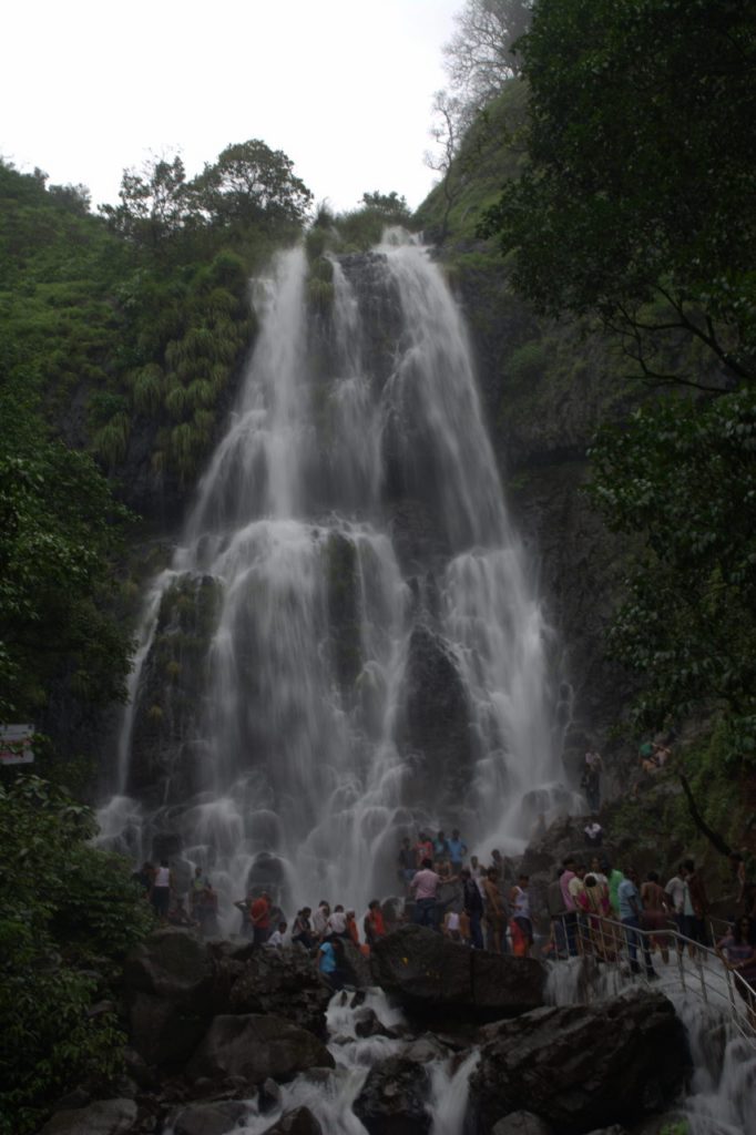
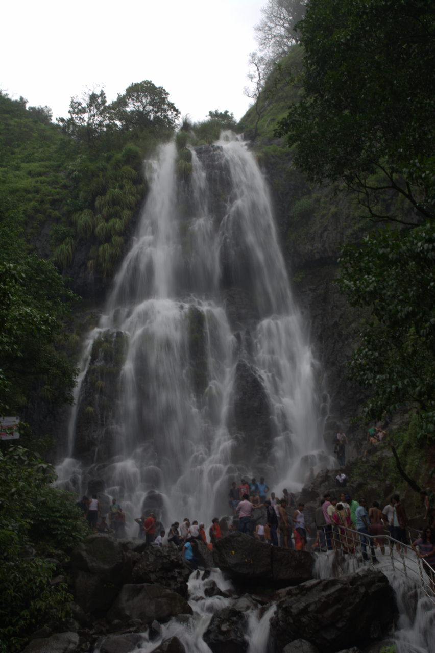
- Kasara / Thal Ghat (Thane district to Nashik district): This Ghat is part of the National Highway 3 connecting Mumbai – Shahapur – Nashik – Bhopal – Gwalior – Agra – New Delhi. Locally, it is called the Mumbai – Nashik highway. At 120 km from Mumbai is the small village of Kasara, part of Thane district. The road ascends from Kasara and reaches peak at the town of Igatpuri.
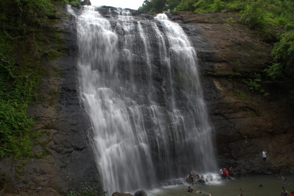
Ashoka waterfalls at Vihigaon near Thal Ghat
Here are some of the best destinations you can explore on the Thal Ghat:
- Mahuli fort at Shahapur (80 km from Mumbai)
- Tansa lake near Shahapur
- Bhatsa lake near Shahapur
- Ashoka waterfall on a spur road between Kasara and Igatpuri. It is in the village named Vihigaon.
- Dhammagiri Vipassana centre at Igatpuri
- Several viewpoints where you can see the parallel Kasara – Igatpuri rail route run with the road and cross chasms over bridges.
- Malshej Ghat (Thane district to Pune district): My favourite of the lot, Malshej Ghat is a beautiful mountain road on NH222: Mumbai – Ahmednagar – Hyderabad highway. In terms of the number of waterfalls, this outnumbers all the other Ghats. It is common to see waterfalls plunging onto the road and hitting your car’s windshield with some force. Roll your windows all the way up when driving in monsoon.
One of the several road-side waterfalls at Malshej Ghat.
- There are several viewpoints all the over the Ghat, where you can park your car and take in the gorgeous scenery.
- The MTDC resort at the peak of the Ghat is well worth a stay.
- Naneghat is a nice and easy trek in the vicinity of Malshej. The word Nane means ‘coin’ in Marathi language. True to its name, this trekking route was used by merchants to bring goods from ports like Kalyan and carry them to Pune. A stone pot, still in place today, was used to collect toll from the merchants. This is probably one of the first ‘toll booths’ in history.
- Harishchandragad trek: is a medium-level trek near Malshej Ghat. It is famous for a millenium-old Shiv temple on top, as well as the view of a concave rock face called Konkan Kada.
- Camping near Pimpalgaon Joge lake: At the peak end of Malshej Ghat is a large lake named Pimpalgaon Joge. Towards the south of the lake adjoining the highway is a large expanse of grass where you can pitch a tent and camp for the night.
- Khandala / Bor Ghat (Raigad district to Pune district): This is most overused Ghat among the lot, since it connects Mumbai to Pune. The Ghat begins at the town of Khopoli and peaks at the twin towns of Khandala / Lonavla. This Ghat was also the first to get a broad gauge rail route in all of India and the first to be electrified. Khandala Ghat can be enjoyed equally on both road and rail with waterfalls galore, especially the ones formed by the Ulhas river which originates in this Ghat and flows all the way to Mumbai. Here are interesting things to do around the Bor Ghat.

Zenith waterfall near Khopoli
- Zenith waterfall, Khopoli: is a tall plunge waterfall located in a small forest outside Khopoli town.
- Tiger fall: is a large waterfall seen from tiger view point close to the highway at Khandala.
- Rajmachi trek: is a trek starting from Karjat town and taking you to a plateau with twin forts.
- Khandala: is a hill station and the peak of the Ghat. It was made famous by Ghulam’s famous song featuring Aamir Khan and Rani Mukherjee: Aati kya Khandala.
- Lonavla: The capital of Mawal tehsil of Pune district is a town full of resorts, lakes, dams and view points.
- Paragliding at Kamshet: The town of Kamshet, 16 km from Lonavla while driving towards Pune, has some flat top hills where paragliding clubs conduct their activity.
- Caves and forts: Near the town of Malavli, 8 km from Lonavla, are two forts, Lohagad and Visapur, and 2 caves: Karle and Bhaje.
- Tamhini Ghat (Raigad district to Pune district): Tamhini Ghat has Maharashtra’ proudest history in the form of Chhatrapati Shivaji’s capital Raigad fort. This route starts from the town of Mahad, peaks at Tamhini and descends to the flat land of Deccan plateau near Mulshi lake between Lonavla and Pune. Here are the interesting things to do around this Ghat.
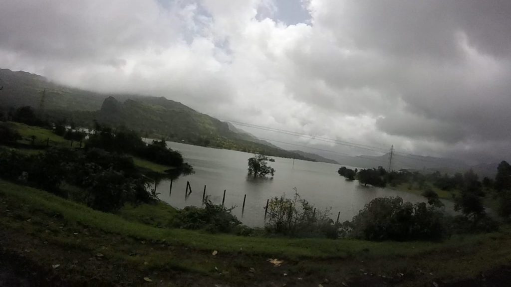
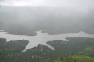
View of Mulshi lake from Tamhini Ghat.
- Raigad trek: Shivaji’s capital fort is on a small Ghat away from the Tamhini Ghat. The route diverges from the town of Nizampur, and reaches the base village of Pachad, from where you either trek using the trail or take a cable car.
- Waterfalls feeding the Mulshi lake. There are several waterfalls on the way, all draining into the Mulshi lake.
- Mulshi lake: There are several viewpoints, lake side sit-outs and resorts around the lake which serves as a catchment area for water to Pune city.
- Lavasa city: One can continue on the road beyond Mulshi lake, reach the village of Paud and then take the diversion away from Pune that leads to the valley city of Lavasa.
- Sahara city: Also known as Amby valley city, it can be reached from a road that starts from Paud and goes around the Mulshi river to the bank away from the Tamhini highway.
- Varandha Ghat (Raigad district to Pune district): This would have been my favourite, but for Malshej. There are several tall and wide waterfalls along this route that always sticks to the view of a lake on one side. The route starts at Mahad, peaks at Varandha village and descends to the plateau at the village of Bhor. Best things to do around Varandha Ghat are:
- Waterfalls: Waterfalls are all around this route. You can take your pick for a refreshing bath.
- Raireshwar trek: This is a fort where Shivaji took the oath of Swaraj / Freedom and vowed to protect his Maratha land from intruders. Raireshwar also has a unique reverse waterfall. A waterfall that is thrown right back to the top of the hill due to the wind.
- Ambenali Ghat (Raigad district to Satara discrict): This Ghat starts from the village of Poladpur and peaks at the popular hill station Mahabaleshwar, the town of strawberry cultivation.
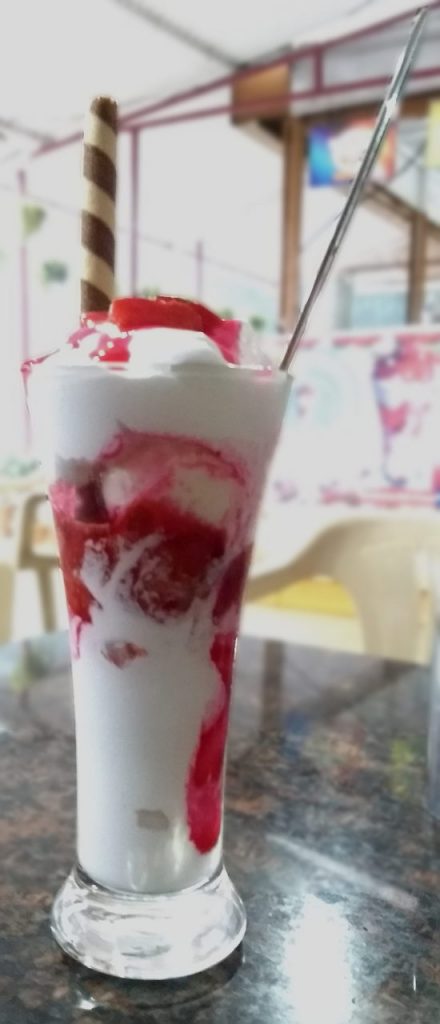
The famous strawberry cream delicacy at Mahabaleshwar. This region grows strawberries and even exports them.
Here are two interesting things to do on Ambenali Ghat:
- Pratapgad fort: is historic for Shivaji’s fight against the Mughal mercenary Afzal Khan. It also offers breathtaking view from its fort walls.
- Mahabaleshwar: is a city known for its strawberry farms, strawberry cream dessert, view points and Mapro (Maharashtra Agro Products Ltd) factory outlet for fruit syrups, squashes and chocolates.
From Mahabaleshwar, the Ambenali Ghat splits into three routes, each with its own name. - Old Mahabaleshwar temple complex: There are four chief temples in old Mahabaleshwar temple complex: The two Shiva temples of Mahabaleshwar and Atibaleshwar, and the Krishna river source temple, that worships the starting point of the Krishna river, and a Panch Ganga temple that worships Satara district’s 5 originating rivers: Krishna, Koyana, Gayatri, Savitri and Venna.
- Wai Ghat (Pune district to Satara district): Wai Ghat is a Ghat that connects the town of Wai to Mahabaleshwar via Panchagani. This is one of the three Ghats leading towards Deccan side, while the afore-mentioned Ambenali Ghat leads to Konkan. Interesting visits on the Wai Ghat are:
- Panchagani: is a town where 5 hills have a flat table-like surface. One of them, the Table Top, is popular among tourists for roaming around and for horse rides.
- Mapro Garden: is a factory outlet half-way between Panchagani and Wai, where you can get fruit syrups, squashes and chocolates. Sampling is free.
- Lingmala waterfall: is a tall plunge waterfall on a small trail off the Panchgani – Mahabaleshwar road
- Venna lake: is a lake formed by damming the Venna river. It is right at the entrance of Mahabaleshwar when entering from Panchagani side. Pedal boating is a leisurely activity on Venna lake.
- Bamnoli Ghat (within Satara district): There are two Ghats leading from Satara city to Mahabaleshwar. The less featured of the two Ghats is the Medha Ghat. It passes through the town of Medha and ascends a Ghat to reach Mahabaleshwar. There is nothing super significant about this Ghat except that the roads are wide. It is a better route to take when your aim is to directly reach Mahabaleshwar from Satara without any sight-seeing along the way. Locals who commute from Mahabaleshwar to Satara on a daily basis use this route because it is faster. However, as a traveller, you should forget about Medha Ghat and use the more adventurous Bamnoli Ghat. The road is narrower, the public transport fewer and the entire area is much less populated that the other Ghats surrounding Mahabaleshwar.
-
- A view of the Tapola lake, created by the Koyana river backwaters, from the Tapola Ghat near Mahabaleshwar.
-
- Vajrai waterfall as seen from Kaas plateau
There are some amazing scenes to see on the Bamnoli Ghat.
- Tapola lake: is a star shaped lake formed by the backwaters of Koyana river. There is a jaw-dropping view of Tapola lake from high up in the Bamnoli Ghat, before you reach the valley of Tapola. At Tapola lake, you can try boating or simply gazing at the moutains and waterfalls around.
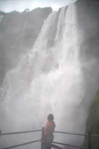
- Vajrai waterfall: is one of the most beautiful waterfalls in India. The fall plunges 250 metres forming two cascades along the way. The fall drops from the heights of Kaas plateau (discussed next) and reaches it way to the depths of the Urmodi river in the valley.
- Kaas plateau: is Maharashtra’s own valley of flowers. While not the place to be during monsoon, Kaas plateau’s uniqueness is during September – October (coinciding with its elder cousin in Uttarakhand!), when the grassland around the whole plateau is covered in multi-coloured flowers.
-
- Kumbharli Ghat (Ratnagiri district to Satara district): This Ghat starts in Ratnagiri district’s Chiplun city and ends just outside Karad city, where the Krishna and Koyana rivers meet. The Ghat is gorgeous during monsoon, with several waterfalls along the way.
-
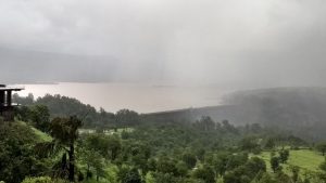
- View of Koyna dam from our camping location. It is the most important dam in Maharashtra and is part of the green revolution project.
-
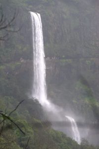
- Ozarde waterfall on the way from Koyna to Kumbharli.
But there are a couple of destinations not to be missed when you are travelling around Kumbharli Ghat.
- Sawatsada waterfall: Though not in Kumbharli Ghat, this tall waterfall is just north of Chiplun city. So if you are in Chiplun, this waterfall is not to be missed. It is formed as the Vashisht river plunges from the Sahyadris and makes its way to the Arabian sea near Guhaghar.
- Koyana Nagar and Koyana dam: Towards the middle of Kumbharli Ghat, at its highest point, a branch road leads to Koyana Nagar. This township exists for the purpose of running the Koyana dam, one of India’s largest dams and part of independent India’s Green Revolution project. There are several resorts in the town.
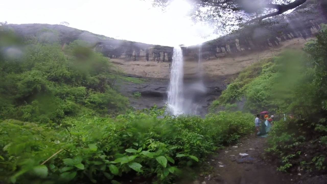
- Ozarde waterfall: One of the several waterfalls that feeds the Koyana dam is the massive Ozarde waterfall, about 10 km from Koyana Nagar town. The massive amount of water that pours at Ozarde is spell-binding. To reach the base of the waterfall, one should visit the nature park that has the trail to the falls.
-
- Amba Ghat (Ratnagiri district to Kolhapur / Satara district): This Ghat is not touristy, so it is an excellent place for some quite treks or just to take a refreshing drive. The Ghat is simply for connectivity and there is nothing marked for tourists. However, there are wonderful vistas of open grasslands, small waterfalls and several windmills along the way. The Amba Ghat starts at the village of Sakharpa near Rajapur in Ratnagiri district. The other end is at a junction town named Malkapur. From Malkapur, it is possible to go either to Kolhapur city or Satara district’s Karad city.
- Anuskura Ghat (Ratnagiri district to Kolhapur district): is a secluded Ghat that connects Rajapur to Kolhapur city. Like Amba, this Ghat too is not touristy and is used by the locals of the two cities and by the villages along the way. There is one standout destination in this Ghat. The Barki waterfall is on a small trail from the highway inside a forested area.
- Gaganbawada Ghat (Sindhudurg district to Kolhapur district): Buses that connect Pune to Goa via Kolhapur use this route. The Ghat starts at the town of Vaibhavwadi and ends outside Kolhapur city. Along the way is the town of Gaganbawada, which is at the peak of the Ghat. Gaganbawada Ghat’s most popular destination is the Kshetra Mahadev Mandir, a Shiv temple that is on a precipice that drops on three sides around the temple, offering gorgeous views of the Sahyadris and the valley floor fall below.
- Phonda Ghat (Sindhudurg district to Kolhapur district): Phonda Ghat has a beautiful road, but is scarily secluded. Villages are far and few in between and the area around the Ghat is a protected wildlife zone. The Ghat starts at the city of Kankavali and starts ascending at Phonda village. The Ghat road is mostly uninhabited except for scatterings of villages. This is because the forests in Phonda Ghat are part of Radhanagari wildlife sanctuary. The Ghat ends at the town of Radhanagari, right in front of a dam on Bhagawati river, a tributary of Koyana. The forests in Radhanagari are home to several species of bees, hence apiaries are aplenty here.
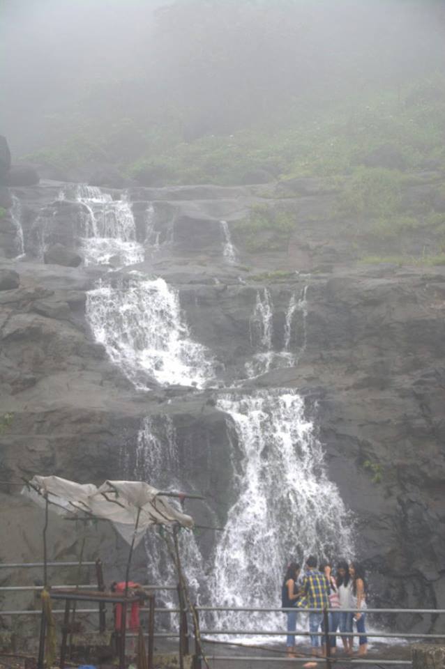
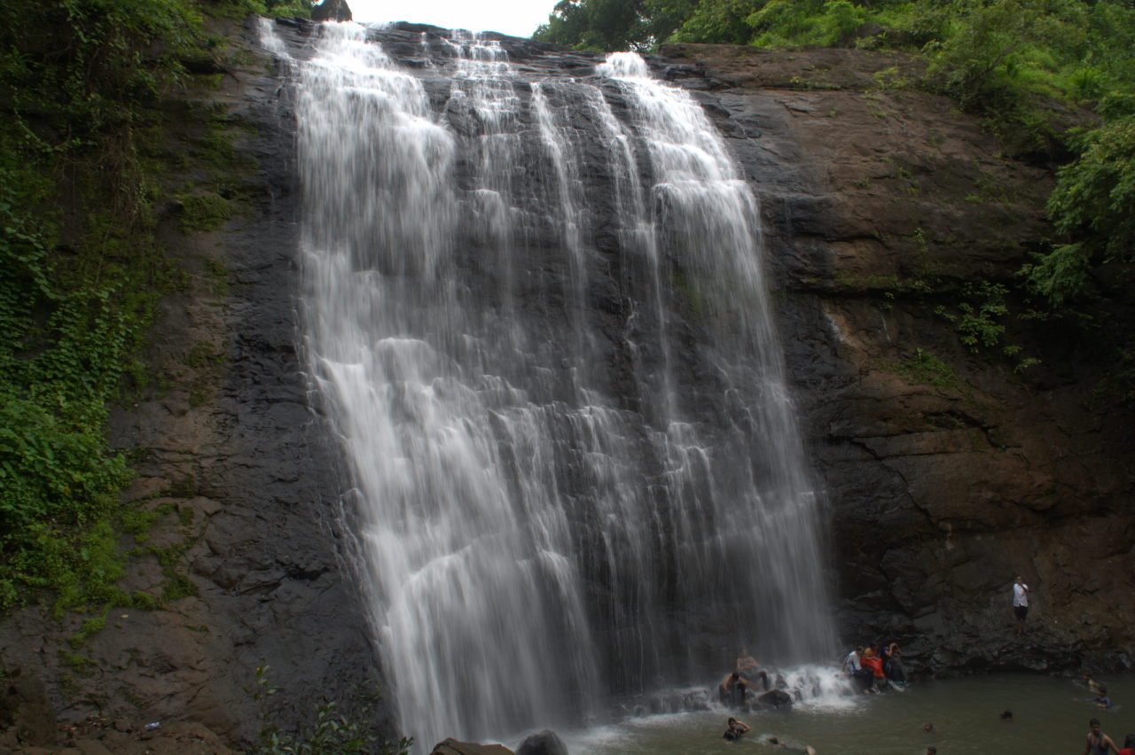
- Amboli Ghat (Sindhudurg district to Kolhapur district): The southern-most Ghat in Maharashtra starts at Sawantwadi, a mere 25km from the Goa border. The road winds its way to the peak of the Ghat at Amboli village, where you can admire the Amboli waterfall. The Ghat finishes at the village of Ajara, less than 100 km from Karnataka’s Sankeshwar town. There is a junction near Amboli village where another road leads to Belagavi.
Amboli Ghat waterfall between Kolhapur and Sawantwadi.


Conclusion
The monsoon magic is a great time to visit western Maharashtra. It is sure to leave you spell-bound. Be ready to pack your bags and your raincoats in July.
Covered all areas with adequate information for tourists.👍
Though I’m sure that you can go on and on writing about Western Maharashtra and the monsoon….☺️
True Rupesh…. There is so much to see. I have retained only the areas that are close to the Ghats and can be visited by vehicles or by a short trail. There are of course so many forts near each of these Ghats. We’ve been there together. But I considered them irrelevant for this post. Editing this post and removing the parts that aren’t truly necessary was ‘heart-breaking’!! 🙂